 Le Pays catalan est constituÃĐ de plusieurs rÃĐgions à forte identitÃĐ gÃĐographiques et humaines : la plaine du Roussillon, les CorbiÃĻres, la CÃīte Vermeille, les AlbÃĻres, le Vallespir, le Conflent, la Cerdagne, le Capcir, sans oublier le FenouillÃĻdes situÃĐ aux limites du Pays occitan. Le guide donne accÃĻs au littoral mÃĐditerranÃĐen, aux ÃĐtangs cÃītiers, aux vallÃĐes pyrÃĐnÃĐennes et aux hauts sommets. Il y en a pour tous les goÃŧts, en 20 balades essentielles rÃĐunies dans un ouvrage à petit prix. IdÃĐal pour les sÃĐjours courts. * 48 pages
* Format pratique : 12 x 21 cm
* Introduction gÃĐnÃĐrale avec prÃĐsentation du territoire (plusieurs thÃĻmes dÃĐveloppÃĐs qui enrichissent la connaissance des sites traversÃĐs)
* 20 itinÃĐraires de 1h30 Ã 5h30 pour une pratique familiale et sportive
* Cartographie sur fond IGN au 1 : 25 000 pour se repÃĐrer facilement
* DÃĐtail des centres d’intÃĐrêts
* Renseignements pratiques pour randonner en toute sÃĐcuritÃĐ
* Adresses utiles.  Kartenbeispiel Kartenbeispiel
|
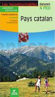
PAYS CATALAN - balades et randonnÃĐes WanderfÞhrer - (franzÃķsisch) Chamina - Frankreich
EAN / ISBN: 9782844662156
Preis: EUR 12.90
|
|


