| << Spanien: Wanderkarten - ICGC (ICC) - Institut Cartogrà fic i Geològic de Catalunya |
||
|
||

Zuletzt angesehene Artikel:
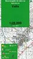
 | Valls (Blatt 36) 1:25.000 - Wanderkarte Katalonien (Spanien) - Col·lecció Capitals Comarcals - Institut Cartogrà fic de Catalunya |
 | Fahrradkarte Berlin Nord 1:60.000 wasserfest - reiÃfest- Grünes Herz |
 | 1032 DIESSENHOFEN 1:25.000 - Feuerthalen - Thayngen - Stein a. Rh. - Topographische Landeskarte der Schweiz - swisstopo |
 | N-34-113-C/D Raciaz Amtliche topographische Landkarte Polen 1:50.000 N-34-113-C/D Raciaz - Mapa Topograficzna Polski Glowny Geodeta Kraju |
 | Vogelzug - Westliche Hemisphäre Laminierte PLANO-Karte (Format: 59 x 91 cm) - gerollt im Plastikrohr Bird Migration - Western Hemisphere flat map - laminated National Geographic |
 | 3542 Groà Kreutz Sonderausgabe mit Wanderwegen - Topographische Wanderkarte Brandenburg 1:25.000 ProjektNord |
 | L7540 Vilsbiburg (geplottete Ausgabe) Topographische Karte Bayern 1:50.000 Bayerisches Landesvermessungsamt |
 | USA physisch PLANO-Karte 1:5.65 Mio. (Format: 91 x 60 cm) - gerollt im Plastikrohr USA physical flat map National Geographic |
 | 140 Mittleres Sasauland - Fahrradkarte Tschechien 1:70.000 Strednà Posázavà - cykloturistická mapa KARTOGRAFIE PRAHA |
| 1836 I Kamøya Amtliche Topographische Karte Norwegen 1:50.000 - Statens Kartverk - Norwegen |
 | Kalabrien Italiens Stiefelspitze vom Pollino bis zum Aspromonte. 57 Touren. Mit GPS-Tracks - von Dorothee Sänger, Michael Gahr, Benno Zimmermann - Bergverlag Rother |