| << Portugal: Amtliche topografische Landkarten des Instituto Geográfico do Exército (IGeoE) 1:25.000 (Serie M888) |
||
|
||

Zuletzt angesehene Artikel:
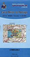
 | 40 Viana do Castelo - Topographische Landkarte Portugal 1:25.000 Carta Militar de Portugal - Série M888 Instituto Geográfico do Exército (IGeoE) - Portugal |
 | NL 33-02-27 West (4227-West) Zeltweg Ãsterreichische Karte 1:25.000 mit Wegmarkierungen (topographische Wanderkarte - UTM) - BEV - Ãsterreich - VergröÃerung (ÃK25V) |
| Secymin Niemieki Topographische Karte 1:25.000 Messtischblatt des Deutschen Reiches - PreuÃische Landesaufnahme / Reichsamt für Landesaufnahme - Faksimile ProjektNord |
 | 50 IV Ameixial Topographische Karte Portugal 1:50.000 Carta Militar de Portugal Instituto Geográfico do Exército (IGeoE) - Portugal |
| 13101 Stallupönen Topographische Karte 1:25.000 Messtischblatt des Deutschen Reiches - PreuÃische Landesaufnahme / Reichsamt für Landesaufnahme - Faksimile ProjektNord |
 | 465-4 BURBÃGUENA Amtliche topographische Landkarte 1:25.000 Spanien (M.T.N.) 465-4 Mapa Topográfico Nacional de Espana (MTN25) Instituto Geográfico Nacional - CNIG Spanien |
 | 348-2 Talveila Amtliche topographische Landkarte 1:25.000 Spanien (M.T.N.) 348-2 Mapa Topográfico Nacional de Espana (MTN25) Instituto Geográfico Nacional - CNIG Spanien |
 | 1096-II / 1097-I (Tenerife) Las Nieves Amtliche topographische Landkarte 1:25.000 Spanien (M.T.N.) 1096-II Mapa Topográfico Nacional de Espana (MTN25) Instituto Geográfico Nacional - CNIG Spanien |
 | Schlesische Beskiden 1:50.000 Touristische Landkarte BESKID SLASKIE - mapa turystyczna / tourist map / carte touristique Wydawnictwo Pietka - Polen |
 | Krakau-Tschenstochauer Jura (Südteil) Laminierte touristische Landkarte 1:52.000 Jura Krakowsko-Czestochowska csecz poludniowa ExpressMap Polen |
 | 95-4 TOURO Amtliche topographische Landkarte 1:25.000 Spanien (M.T.N.) 95-4 Mapa Topográfico Nacional de Espana (MTN25) Instituto Geográfico Nacional - CNIG Spanien |
 | 1244 02 Sarvijoki Topographische Karte 1:20.000 (Maastokartta / Peruskartta / Grundkarta) Maanmittauslaitos / Lantmäteriverket Finnland - ProjektNord |
 | 693-1 CAMPORROBLES Amtliche topographische Landkarte 1:25.000 Spanien (M.T.N.) 693-1 Mapa Topográfico Nacional de Espana (MTN25) Instituto Geográfico Nacional - CNIG Spanien |
 | 843-1 TOBARRA Amtliche topographische Landkarte 1:25.000 Spanien (M.T.N.) 843-1 Mapa Topográfico Nacional de Espana (MTN25) Instituto Geográfico Nacional - CNIG Spanien |
 | 795-4 Villalonga Amtliche topographische Landkarte 1:25.000 Spanien (M.T.N.) 795-4 Mapa Topográfico Nacional de Espana (MTN25) Instituto Geográfico Nacional - CNIG Spanien |
 | 789-3 EL BALLESTERO Amtliche topographische Landkarte 1:25.000 Spanien (M.T.N.) 789-3 Mapa Topográfico Nacional de Espana (MTN25) Instituto Geográfico Nacional - CNIG Spanien |
 | 182 (34-09) Ribera de Cardós Amtliche topographische Landkarte 1:50.000 Spanien (M.T.N.) 182 182 Ribera de Cardós - Mapa Topográfico Nacional de Espana (MTN50) Instituto Geográfico Nacional - CNIG Spanien |
 | 981-2 FUENTE DE LA CORCHA Amtliche topographische Landkarte 1:25.000 Spanien (M.T.N.) 981-2 Mapa Topográfico Nacional de Espana (MTN25) Instituto Geográfico Nacional - CNIG Spanien |
 | 2231 07 Lyly Topographische Karte 1:20.000 (Maastokartta / Peruskartta / Grundkarta) Maanmittauslaitos / Lantmäteriverket Finnland - ProjektNord |
 | Erimanthos (Blatt 8.61) Topografische Bergwanderkarte Peloponnes - Griechenland 1:25.000- Peloponnese - Anavasi - Griechenland Ερυμανθος - Mt. Erimanthos - ΠΕΖΟΠΟΡΙΚΟΣ ΧΑΡΤΗΣ - Hiking Map |