| << Portugal: Amtliche topografische Landkarten des Instituto Geográfico do Exército (IGeoE) 1:25.000 (Serie M888) |
||
|
||

Zuletzt angesehene Artikel:
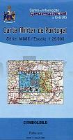
 | 82 - Topographische Landkarte Portugal 1:25.000 Carta Militar de Portugal - Série M888 Instituto Geográfico do Exército (IGeoE) - Portugal |
 | NJ 37-3 Erzincan Amtliche Topographische Karte der Türkei 1:250.000 NJ 37-3 Erzincan - Müşterek Harekat Haritası HGK |
 | Fichtelgebirge Rad- und Wanderkarte mit Ausflugszielen, Einkehr- & Freizeittipps, wetterfest, reissfest, abwischbar, GPS-genau. 1:50000 - von - Freytag-Berndt und ARTARIA PUBLICPRESS |
| 1991 Bischofstein Topographische Karte 1:25.000 Messtischblatt des Deutschen Reiches - PreuÃische Landesaufnahme / Reichsamt für Landesaufnahme - Faksimile ProjektNord |
| 4055 Kanig Topographische Karte 1:25.000 Messtischblatt des Deutschen Reiches - PreuÃische Landesaufnahme / Reichsamt für Landesaufnahme - Faksimile ProjektNord |
 | Gudbrandsdalsleden cycling guide: The St. Olav Way from Oslo to Trondheim - Cycling guide for the pilgrims´ way to Noidaros in Norway - In the footsteps of Saint Olav Radwanderführer für den Pilgerweg nach Nidaros - von Gea van Veen (englisch) Via Gaia |
| Bernsdorf Topographische Karte 1:25.000 Messtischblatt des Deutschen Reiches - PreuÃische Landesaufnahme / Reichsamt für Landesaufnahme - Faksimile ProjektNord |
 | 0131 CISTIERNA Topographische Landkarte 1:50.000 Spanien (Grundlage MTN50) Instituto Geográfico Nacional - CNIG Spanien - ProjektNord |
| 2229 Berkenthin - Gestern und Heute - Historische Ãberlagerung 1953-1956 Topographische Landkarte 1:25.000 im Vergleich - Landesvermessungsamt Schleswig-Holstein / ProjektNord |
 | 0678-1 SANTIAGO DEL CAMPO Topographische Landkarte 1:25.000 Spanien (Grundlage MTN25) Instituto Geográfico Nacional - CNIG Spanien - ProjektNord |
| Podhale - Tatra - Arwa - Zips Touristische Landkarte 1:50.000 Touristische Landkarte, Wanderkarte - Polen - wasserfest Podhale Tatry Orawa Spisz mapa wodoodporna Compass - Polen |
 | 0253-2 EL PLA DE SANT TIRS Topographische Landkarte 1:25.000 Spanien (Grundlage MTN25) Instituto Geográfico Nacional - CNIG Spanien - ProjektNord |
 | E-Bike-Region Stuttgart Leporello Radtourenkarte mit Ausflugszielen, Einkehr- & Freizeittipps, StraÃennamen, E-Bike-Lade- und Verleihstationen, wetterfest, reiÃfest, abwischbar, GPS-genau. 1:50000 - von - Freytag-Berndt und ARTARIA PUBLICPRESS |
 | 0022-1 FENE Topographische Landkarte 1:25.000 Spanien (Grundlage MTN25) Instituto Geográfico Nacional - CNIG Spanien - ProjektNord |
 | Jomfruland - Risør - Seekarte Norwegische Küste 1:50.000 - (Blatt 6) Den Norske Kyst Sjøkart - Hovedkart (sjø) Statens Kartverk Sjø - Norwegen |
 | 0684-3 LAS NAVILLAS Topographische Landkarte 1:25.000 Spanien (Grundlage MTN25) Instituto Geográfico Nacional - CNIG Spanien - ProjektNord |
 | 0115-2 OLAGUE Topographische Landkarte 1:25.000 Spanien (Grundlage MTN25) Instituto Geográfico Nacional - CNIG Spanien - ProjektNord |
 | 0571-3 SANTA MAGDALENA DE PULPIS Topographische Landkarte 1:25.000 Spanien (Grundlage MTN25) Instituto Geográfico Nacional - CNIG Spanien - ProjektNord |
 | 1039-3 CASABERMEJA Topographische Landkarte 1:25.000 Spanien (Grundlage MTN25) Instituto Geográfico Nacional - CNIG Spanien - ProjektNord |
| 2426 Hamburg - Wandsbek - Gestern und Heute - Historische Ãberlagerung 1932-1950 Topographische Landkarte 1:25.000 im Vergleich - Landesvermessungsamt Schleswig-Holstein / ProjektNord |