| << Portugal: Amtliche topografische Landkarten des Instituto Geográfico do Exército (IGeoE) 1:25.000 (Serie M888) |
||
|
||

Zuletzt angesehene Artikel:
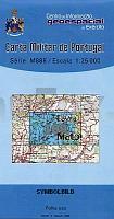
 | 109 - Topographische Landkarte Portugal 1:25.000 Carta Militar de Portugal - Série M888 Instituto Geográfico do Exército (IGeoE) - Portugal |
 | 128 Rybnik - Freistadt - Pless - Karte des Deutschen Reiches 1:100.000 (KDR 100 GB) - GroÃblatt Reichsamt für Landesaufnahme / PreuÃische Landesaufnahme ProjektNord |
 | UK 50-54 Chiemsee - Chiemgauer Alpen - Traunstein - Wasserburg a. Inn - Haag i.OB. - Simssee - Kaiserwinkl Wanderkarte Bayern 1:50.000 mit Wanderwegen und Radwanderwegen, GPS-Gitter - Landesamt für Digitalisierung, Breitband und Vermessung (Landesvermessungsamt Bayern) |
 | 69-3 SANTA COMBA Amtliche topographische Landkarte 1:25.000 Spanien (M.T.N.) 69-3 Mapa Topográfico Nacional de Espana (MTN25) Instituto Geográfico Nacional - CNIG Spanien |
 | 294-2 BAS Amtliche topographische Landkarte 1:25.000 Spanien (M.T.N.) 294-2 Mapa Topográfico Nacional de Espana (MTN25) Instituto Geográfico Nacional - CNIG Spanien |
 | 4566 Gr. Bargen Topographische Karte 1:25.000 Messtischblatt des Deutschen Reiches - PreuÃische Landesaufnahme / Reichsamt für Landesaufnahme - Faksimile ProjektNord |
 | 401-3 VALLELADO Amtliche topographische Landkarte 1:25.000 Spanien (M.T.N.) 401-3 Mapa Topográfico Nacional de Espana (MTN25) Instituto Geográfico Nacional - CNIG Spanien |
 | 4811 07 HIRVASPÃÃT Topographische Karte 1:20.000 (Maastokartta / Peruskartta / Grundkarta) Maanmittauslaitos / Lantmäteriverket Finnland - ProjektNord |
 | 105-4 PRIORO Amtliche topographische Landkarte 1:25.000 Spanien (M.T.N.) 105-4 Mapa Topográfico Nacional de Espana (MTN25) Instituto Geográfico Nacional - CNIG Spanien |
| N-33-105-C/D Trzcianka Amtliche topographische Landkarte Polen 1:50.000 N-33-105-C/D Trzcianka - Mapa Topograficzna Polski Glowny Geodeta Kraju |
 | 2014 07 Snappertuna Topographische Karte 1:20.000 (Maastokartta / Peruskartta / Grundkarta) Maanmittauslaitos / Lantmäteriverket Finnland - ProjektNord |
 | 739-2 CASA DE LOS ÃRBOLES Amtliche topographische Landkarte 1:25.000 Spanien (M.T.N.) 739-2 Mapa Topográfico Nacional de Espana (MTN25) Instituto Geográfico Nacional - CNIG Spanien |
 | 0326-3 MONZÃN Topographische Landkarte 1:25.000 Spanien (Grundlage MTN25) Instituto Geográfico Nacional - CNIG Spanien - ProjektNord |
| N-34-142-C/D Huszlew Amtliche topographische Landkarte Polen 1:50.000 N-34-142-C/D Huszlew - Mapa Topograficzna Polski Glowny Geodeta Kraju |
 | 187-3 MASIDE Amtliche topographische Landkarte 1:25.000 Spanien (M.T.N.) 187-3 Mapa Topográfico Nacional de Espana (MTN25) Instituto Geográfico Nacional - CNIG Spanien |
 | 1014 02 Järsö Topographische Karte 1:20.000 (Maastokartta / Peruskartta / Grundkarta) Maanmittauslaitos / Lantmäteriverket Finnland - ProjektNord |
 | 53-4 (26-10) POLA DE LAVIANA Amtliche topographische Landkarte 1:25.000 Spanien (M.T.N.) 53-4 Mapa Topográfico Nacional de Espana (MTN25) Instituto Geográfico Nacional - CNIG Spanien |
 | 1012 10 Flaka Topographische Karte 1:20.000 (Maastokartta / Peruskartta / Grundkarta) Maanmittauslaitos / Lantmäteriverket Finnland - ProjektNord |
 | 0138 NANCLARES DE LA OCA/LANGRAIZ OKA Topographische Landkarte 1:50.000 Spanien (Grundlage MTN50) Instituto Geográfico Nacional - CNIG Spanien - ProjektNord |
 | 0438-4 VILLARREAL DE HUERVA Topographische Landkarte 1:25.000 Spanien (Grundlage MTN25) Instituto Geográfico Nacional - CNIG Spanien - ProjektNord |