| << Portugal: Amtliche topografische Landkarten des Instituto Geográfico do Exército (IGeoE) 1:25.000 (Serie M888) |
||
|
||

Zuletzt angesehene Artikel:
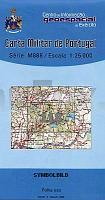
 | 118 - Topographische Landkarte Portugal 1:25.000 Carta Militar de Portugal - Série M888 Instituto Geográfico do Exército (IGeoE) - Portugal |
 | 558-1 NAVALAGAMELLA Amtliche topographische Landkarte 1:25.000 Spanien (M.T.N.) 558-1 Mapa Topográfico Nacional de Espana (MTN25) Instituto Geográfico Nacional - CNIG Spanien |
 | 2131 11 Janakkala Topographische Karte 1:20.000 (Maastokartta / Peruskartta / Grundkarta) Maanmittauslaitos / Lantmäteriverket Finnland - ProjektNord |
 | Die Viarhôna vom Genfer See bis zum Mittelmeer per Fahrrad 1:110.000 Fahrradkarte La Viarhona du Leman à la Mediterannée à vélo by bike IGN Frankreich |
 | Ravna Gora (Blatt 16) 1:25.000 Bergwanderkarte und Bergsteigerkarte - Serie Kroatien kontinental Ravna Gora - Serija Kontinentalna Hrvatska - Mountaineering and Hiking map - Croatian Mountain Rescue Service Kroatischer Bergrettungsdienst - Kroatien |
 | 3214 06 Hankas. Topographische Karte 1:20.000 (Maastokartta / Peruskartta / Grundkarta) Maanmittauslaitos / Lantmäteriverket Finnland - ProjektNord |
 | 3413 08 Itämäki Topographische Karte 1:20.000 (Maastokartta / Peruskartta / Grundkarta) Maanmittauslaitos / Lantmäteriverket Finnland - ProjektNord |
 | 503-3 LAS VEGUILLAS Amtliche topographische Landkarte 1:25.000 Spanien (M.T.N.) 503-3 Mapa Topográfico Nacional de Espana (MTN25) Instituto Geográfico Nacional - CNIG Spanien |
 | 0320-3 TARAZONA Topographische Landkarte 1:25.000 Spanien (Grundlage MTN25) Instituto Geográfico Nacional - CNIG Spanien - ProjektNord |
 | Terre del Nebbiolo 1:25.000 - Wanderkarte (Blatt 127) - Cossato - Gattinara - Ghemme - Maggiora - Topographische Wanderkarte Piemont und Lombardei - Italien Carta dei sentieri delle Terre del Nebbiolo, zona di Cossato, Gattinara, Ghemme, Maggiora Geo4 Map - Italien |
 | 0394-1 CANET DE MAR Topographische Landkarte 1:25.000 Spanien (Grundlage MTN25) Instituto Geográfico Nacional - CNIG Spanien - ProjektNord |
 | 533-2 COLLADO VILLALBA Amtliche topographische Landkarte 1:25.000 Spanien (M.T.N.) 533-2 Mapa Topográfico Nacional de Espana (MTN25) Instituto Geográfico Nacional - CNIG Spanien |
 | 3021 09 Pernå Topographische Karte 1:20.000 (Maastokartta / Peruskartta / Grundkarta) Maanmittauslaitos / Lantmäteriverket Finnland - ProjektNord |
 | 85-3 VILLASANTE Amtliche topographische Landkarte 1:25.000 Spanien (M.T.N.) 85-3 Mapa Topográfico Nacional de Espana (MTN25) Instituto Geográfico Nacional - CNIG Spanien |
 | 1009-III Santa Fé Amtliche topographische Landkarte 1:25.000 Spanien (M.T.N.) 1009-III Mapa Topográfico Nacional de Espana (MTN25) Instituto Geográfico Nacional - CNIG Spanien |
 | 0704-1 CÃCERES Topographische Landkarte 1:25.000 Spanien (Grundlage MTN25) Instituto Geográfico Nacional - CNIG Spanien - ProjektNord |
 | N-33-116-A/B Strzelce Krajenskie Amtliche topographische Landkarte Polen 1:50.000 N-33-116-A/B Strzelce Krajenskie - Mapa Topograficzna Polski Glowny Geodeta Kraju |
| Montsec d`Ares (Blatt 60) 1:25.000 Congost de Mont-rebei, Pas de Terradets, Ãger - Wanderkarte Katalonien (Spanien) - Col·lecció Unitats Geogrà fiques - Institut Cartogrà fic de Catalunya |
 | 0752-3 LA NAVA DE SANTIAGO Topographische Landkarte 1:25.000 Spanien (Grundlage MTN25) Instituto Geográfico Nacional - CNIG Spanien - ProjektNord |
 | 0609 VILLAR DE OLALLA Topographische Landkarte 1:50.000 Spanien (Grundlage MTN50) Instituto Geográfico Nacional - CNIG Spanien - ProjektNord |