| << Portugal: Amtliche topografische Landkarten des Instituto Geográfico do Exército (IGeoE) 1:25.000 (Serie M888) |
||
|
||

Zuletzt angesehene Artikel:
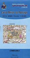
 | 237 - Topographische Landkarte Portugal 1:25.000 Carta Militar de Portugal - Série M888 Instituto Geográfico do Exército (IGeoE) - Portugal |
 | 0639-2 VIVER Topographische Landkarte 1:25.000 Spanien (Grundlage MTN25) Instituto Geográfico Nacional - CNIG Spanien - ProjektNord |
 | 0892-3 FORTUNA Topographische Landkarte 1:25.000 Spanien (Grundlage MTN25) Instituto Geográfico Nacional - CNIG Spanien - ProjektNord |
 | 0998-2 LEPE Topographische Landkarte 1:25.000 Spanien (Grundlage MTN25) Instituto Geográfico Nacional - CNIG Spanien - ProjektNord |
 | 0619 SON PARC Topographische Landkarte 1:50.000 Spanien (Grundlage MTN50) Instituto Geográfico Nacional - CNIG Spanien - ProjektNord |
 | 1885 Wusen Topographische Karte 1:25.000 Messtischblatt des Deutschen Reiches - PreuÃische Landesaufnahme / Reichsamt für Landesaufnahme - Faksimile ProjektNord |
| NM 33-11-25 Ost (4325-Ost) Bad Hall Ãsterreichische Karte 1:25.000 mit Wegmarkierungen (topographische Wanderkarte - UTM) - BEV - Ãsterreich - VergröÃerung (ÃK25V) |
| N-33-115/116 Gorzow Wielkopolski (Landsberg an der Warthe) Plot aus der Kartengrundlage der amtliche topographische Karte Polen 1:100.000 ProjektNord |
 | 0767-1 ALATOZ Topographische Landkarte 1:25.000 Spanien (Grundlage MTN25) Instituto Geográfico Nacional - CNIG Spanien - ProjektNord |
 | 0424-3 CARBELLINO Topographische Landkarte 1:25.000 Spanien (Grundlage MTN25) Instituto Geográfico Nacional - CNIG Spanien - ProjektNord |
 | SIERRAS BLANCA Y CANUCHA (Andalusien - Spanien) 1:20.000 - Topographische Wanderkarte Sierras de Marbella, Istán, Monda y Ojén - (spanisch / englisch / französisch / deutsch) - Editorial Piolet |
| 5258 Polaun Topographische Karte 1:25.000 Messtischblatt des Deutschen Reiches - PreuÃische Landesaufnahme / Reichsamt für Landesaufnahme - Faksimile ProjektNord |
| 1760 Lassehne Topographische Karte 1:25.000 Messtischblatt des Deutschen Reiches - PreuÃische Landesaufnahme / Reichsamt für Landesaufnahme - Faksimile ProjektNord |
| 1929 Ahrensbök - Gestern und Heute - Historische Ãberlagerung 1878-1880 Topographische Landkarte 1:25.000 im Vergleich - Landesvermessungsamt Schleswig-Holstein / ProjektNord |
| 3274 Broniewice Topographische Karte 1:25.000 Messtischblatt des Deutschen Reiches - PreuÃische Landesaufnahme / Reichsamt für Landesaufnahme - Faksimile ProjektNord |
 | Bandar Abbas & Hormozgan Province (Blatt 453) 1:1.43 Mio. Landkarte Englisch und Persisch نقشه استان هرمزگان Gitashenasi - Iran |
 | 0766-1 MIRALCAMPO Topographische Landkarte 1:25.000 Spanien (Grundlage MTN25) Instituto Geográfico Nacional - CNIG Spanien - ProjektNord |
| Birzai (65-69/65-69) Topografische Karte Litauen 1:50.000 Lietuvos Respublikos Topografinis Zemelapis 1:50.000 - Nacionaline Zemes Tarnyba - Litauen |
 | 0887-2 ORCERA Topographische Landkarte 1:25.000 Spanien (Grundlage MTN25) Instituto Geográfico Nacional - CNIG Spanien - ProjektNord |
 | 0596-4 MORALEJA Topographische Landkarte 1:25.000 Spanien (Grundlage MTN25) Instituto Geográfico Nacional - CNIG Spanien - ProjektNord |