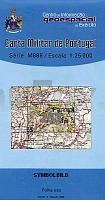
| << Portugal: Amtliche topografische Landkarten des Instituto Geográfico do Exército (IGeoE) 1:25.000 (Serie M888) |
||
|
||

Zuletzt angesehene Artikel:
 | 253 - Topographische Landkarte Portugal 1:25.000 Carta Militar de Portugal - Série M888 Instituto Geográfico do Exército (IGeoE) - Portugal |
 | Mosel-Radweg, Perl - Koblenz Leporello Radtourenkarte mit Ausflugszielen, Einkehr- & Freizeittipps, wetterfest, reiÃfest, abwischbar, GPS-genau. 1:50000 - von - Freytag-Berndt und ARTARIA Publicpress |
 | 2224 Barmstedt - Gestern und Heute - Historische Ãberlagerung 1953-1956 Topographische Landkarte 1:25.000 im Vergleich - Landesvermessungsamt Schleswig-Holstein / ProjektNord |
 | Palau und La-Maddalena-Archipel (30) Topographische Wanderkarte Sardinien 1:30.000 (deu./engl./frz./ital.) Carta turistica di Palau e Arcipelago della Maddalena Edizioni Abies |
 | 0701-4 VALENCIA DE ALCÃNTARA Topographische Landkarte 1:25.000 Spanien (Grundlage MTN25) Instituto Geográfico Nacional - CNIG Spanien - ProjektNord |
 | 0032-3 LLANES Topographische Landkarte 1:25.000 Spanien (Grundlage MTN25) Instituto Geográfico Nacional - CNIG Spanien - ProjektNord |
 | 3818 Herford (geplottete Ausgabe) Amtliche topographische Karte 1:25.000 Landesvermessungsamt Nordrhein-Westfalen |
 | 0661 VILLAREJO DE FUENTES Topographische Landkarte 1:50.000 Spanien (Grundlage MTN50) Instituto Geográfico Nacional - CNIG Spanien - ProjektNord |
| 2053 Kolzow Topographische Karte 1:25.000 Messtischblatt des Deutschen Reiches - PreuÃische Landesaufnahme / Reichsamt für Landesaufnahme - Faksimile ProjektNord |
| 1185 Palmnicken Topographische Karte 1:25.000 Messtischblatt des Deutschen Reiches - PreuÃische Landesaufnahme / Reichsamt für Landesaufnahme - Faksimile ProjektNord |
 | Mönchgut-Granitz, Putbus - Binz Rad- und Wanderkarte mit Ausflugszielen, Einkehr- & Freizeittipps, wetterfest, reiÃfest, abwischbar, GPS-genau. 1:50000 - von - Freytag-Berndt und ARTARIA PUBLICPRESS |
 | Lahntal-Radweg, Netphen-Lahnhof - Lahnstein Leporello Radtourenkarte mit Ausflugszielen, Einkehr- & Freizeittipps, wetterfest, reissfest, abwischbar, GPS-genau. 1:50000 - von - Freytag-Berndt und ARTARIA Publicpress |
 | 4315 Benninghausen (geplottete Ausgabe) Amtliche topographische Karte 1:25.000 Landesvermessungsamt Nordrhein-Westfalen |
| 1832 Kellenhusen - Gestern und Heute - Historische Ãberlagerung 1953-1956 Topographische Landkarte 1:25.000 im Vergleich - Landesvermessungsamt Schleswig-Holstein / ProjektNord |
 | 68 - Topographische Landkarte Portugal 1:25.000 Carta Militar de Portugal - Série M888 Instituto Geográfico do Exército (IGeoE) - Portugal |
 | 8 FARO Topographische Karte Portugal 1:250.000 Carta Militar de Portugal Instituto Geográfico do Exército (IGeoE) - Portugal |
 | 1010-2 PURULLENA Topographische Landkarte 1:25.000 Spanien (Grundlage MTN25) Instituto Geográfico Nacional - CNIG Spanien - ProjektNord |
 | 762-3 LAS PACHECAS Amtliche topographische Landkarte 1:25.000 Spanien (M.T.N.) 762-3 Mapa Topográfico Nacional de Espana (MTN25) Instituto Geográfico Nacional - CNIG Spanien |
| N-34-66-C/D Lidzbark Warminski Amtliche topographische Landkarte Polen 1:50.000 N-34-66-C/D Lidzbark Warminski - Mapa Topograficzna Polski Glowny Geodeta Kraju |
 | 0967 BAENA Topographische Landkarte 1:50.000 Spanien (Grundlage MTN50) Instituto Geográfico Nacional - CNIG Spanien - ProjektNord |