| << Portugal: Amtliche topografische Landkarten des Instituto Geográfico do Exército (IGeoE) 1:25.000 (Serie M888) |
||
|
||

Zuletzt angesehene Artikel:
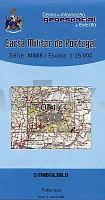
 | 278 Oleiros - Topographische Landkarte Portugal 1:25.000 Carta Militar de Portugal - Série M888 Instituto Geográfico do Exército (IGeoE) - Portugal |
 | 3312 08 Korppinen Topographische Karte 1:20.000 (Maastokartta / Peruskartta / Grundkarta) Maanmittauslaitos / Lantmäteriverket Finnland - ProjektNord |
 | 500-2 DEHESA DE VILLAR DEL R. Amtliche topographische Landkarte 1:25.000 Spanien (M.T.N.) 500-2 Mapa Topográfico Nacional de Espana (MTN25) Instituto Geográfico Nacional - CNIG Spanien |
 | 0644 POLLENÃA Topographische Landkarte 1:50.000 Spanien (Grundlage MTN50) Instituto Geográfico Nacional - CNIG Spanien - ProjektNord |
 | 4123 05 Koitsanlahti Topographische Karte 1:20.000 (Maastokartta / Peruskartta / Grundkarta) Maanmittauslaitos / Lantmäteriverket Finnland - ProjektNord |
 | 104 Breslau - Schweidnitz - Karte des Deutschen Reiches 1:100.000 (KDR 100 GB) - GroÃblatt Reichsamt für Landesaufnahme / PreuÃische Landesaufnahme ProjektNord |
 | Bilogora (Blatt 3) Topographische Wanderkarte 1:25.000 - Serie Kroatien kontinental Bilogora - Serija Kontinentalna Hrvatska - Mountaineering and Hiking map - Croatian Mountain Rescue Service Kroatischer Bergrettungsdienst - Kroatien |
 | 711-2 LAS GUADALERZAS Amtliche topographische Landkarte 1:25.000 Spanien (M.T.N.) 711-2 Mapa Topográfico Nacional de Espana (MTN25) Instituto Geográfico Nacional - CNIG Spanien |
 | Bodetal - Selketal Rad- und Wanderkarte mit Ausflugszielen, Einkehr- & Freizeittipps und Stadtplänen, wetterfest, reissfest, abwischbar, GPS-genau. 1:50000 - von - Freytag-Berndt und ARTARIA PUBLICPRESS |
 | UK 50-20 Naturpark Oberpfälzer Wald Schwandorf, Burglengenfeld, Oberpfälzer Seenland - Wanderkarte Bayern 1:50.000 mit Wanderwegen und Radwanderwegen, GPS-Gitter - Freizeit kompakt - Landesamt für Digitalisierung, Breitband und Vermessung (Landesvermessungsamt Bayern) |
 | Oblast Ternopil 1:250.000 Landkarte, StraÃenkarte - Ukraine Ternopilska oblast / Тернопільська область Kartografija - ukrmap Ukraine |
 | 4521 09 Kuolio Topographische Karte 1:20.000 (Maastokartta / Peruskartta / Grundkarta) Maanmittauslaitos / Lantmäteriverket Finnland - ProjektNord |
 | 3932 02 Patoniva Topographische Karte 1:20.000 (Maastokartta / Peruskartta / Grundkarta) Maanmittauslaitos / Lantmäteriverket Finnland - ProjektNord |
 | 124-4 SAMOS Amtliche topographische Landkarte 1:25.000 Spanien (M.T.N.) 124-4 Mapa Topográfico Nacional de Espana (MTN25) Instituto Geográfico Nacional - CNIG Spanien |
 | 2231 09 Kotiniemi Topographische Karte 1:20.000 (Maastokartta / Peruskartta / Grundkarta) Maanmittauslaitos / Lantmäteriverket Finnland - ProjektNord |
 | 1005-3 OSUNA Amtliche topographische Landkarte 1:25.000 Spanien (M.T.N.) 1005-3 Mapa Topográfico Nacional de Espana (MTN25) Instituto Geográfico Nacional - CNIG Spanien |
 | 678-4 PIE DE VILLA Amtliche topographische Landkarte 1:25.000 Spanien (M.T.N.) 678-4 Mapa Topográfico Nacional de Espana (MTN25) Instituto Geográfico Nacional - CNIG Spanien |
 | 2041 07 Veikkola Topographische Karte 1:20.000 (Maastokartta / Peruskartta / Grundkarta) Maanmittauslaitos / Lantmäteriverket Finnland - ProjektNord |
 | 48-3 (15-10) CASTRO DE REI Amtliche topographische Landkarte 1:25.000 Spanien (M.T.N.) 48-3 Mapa Topográfico Nacional de Espana (MTN25) Instituto Geográfico Nacional - CNIG Spanien |
 | 3132 01 Tuohikotti Topographische Karte 1:20.000 (Maastokartta / Peruskartta / Grundkarta) Maanmittauslaitos / Lantmäteriverket Finnland - ProjektNord |