| << Portugal: Amtliche topografische Landkarten des Instituto Geográfico do Exército (IGeoE) 1:25.000 (Serie M888) |
||
|
||

Zuletzt angesehene Artikel:
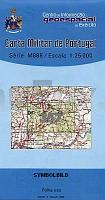
 | 357 - Topographische Landkarte Portugal 1:25.000 Carta Militar de Portugal - Série M888 Instituto Geográfico do Exército (IGeoE) - Portugal |
 | Moselsteig, Perl - Koblenz Leporello Wanderkarte mit Ausflugszielen, Einkehr- & Freizeittipps, Entfernungen, Etappen, Höhenprofil, wetterfest, reiÃfest, abwischbar, GPS-genau. 1:35000 - von - Freytag-Berndt und ARTARIA Publicpress |
 | 0467-4 ARIÃO Topographische Landkarte 1:25.000 Spanien (Grundlage MTN25) Instituto Geográfico Nacional - CNIG Spanien - ProjektNord |
 | N-33-83-A/B Koczala Amtliche topographische Landkarte Polen 1:50.000 N-33-83-A/B Koczala - Mapa Topograficzna Polski Glowny Geodeta Kraju |
 | 0152-1 VILAGARCÃA Topographische Landkarte 1:25.000 Spanien (Grundlage MTN25) Instituto Geográfico Nacional - CNIG Spanien - ProjektNord |
 | 0083-1 MOLLEDO Topographische Landkarte 1:25.000 Spanien (Grundlage MTN25) Instituto Geográfico Nacional - CNIG Spanien - ProjektNord |
 | 5620 Ortenberg - Wanderkarte mit Wanderwegen (geplottete Ausgabe) Topographische Landkarte Hessen 1:25.000 - ProjektNord (geplottete Ausgabe) |
 | 0692 Nidden Topographische Karte 1:25.000 Messtischblatt des Deutschen Reiches - PreuÃische Landesaufnahme / Reichsamt für Landesaufnahme - Faksimile ProjektNord |
 | 0519-4 BORDÃN Topographische Landkarte 1:25.000 Spanien (Grundlage MTN25) Instituto Geográfico Nacional - CNIG Spanien - ProjektNord |
 | 5504 Arlberg - Lech - St. Anton am Arlberg - Verwallgruppe Landkarte *** SCHNÃPPCHEN *** Wanderkarte, Radwanderkarte, Freizeitkarte - Freytag & Berndt |
 | S:t Olavsleden - Pilgerreise von Küste zu Küste Wanderführer (schwedischsprachig) S:t Olavsleden, pilgrimsfärd från hav till hav - en guide Vildmarksbiblioteket Schweden |
 | 0702-1 CASILLAS Topographische Landkarte 1:25.000 Spanien (Grundlage MTN25) Instituto Geográfico Nacional - CNIG Spanien - ProjektNord |
 | 0614 SARRIÃN Topographische Landkarte 1:50.000 Spanien (Grundlage MTN50) Instituto Geográfico Nacional - CNIG Spanien - ProjektNord |
 | 0228-1 A VEIGA Topographische Landkarte 1:25.000 Spanien (Grundlage MTN25) Instituto Geográfico Nacional - CNIG Spanien - ProjektNord |
 | Nationaler Touren-Atlas Ungarn (Blaue Landestour - Teil 3) Rockenbauer Pál - Dél Dunántúli Kéktúra Wanderatlas Ungarn (ungarisch) Országos Kéktúra - National blue trail III. tourist guide (Ãrott-kö-Szekszárd) - Cartographia |