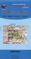
| << Portugal: Amtliche topografische Landkarten des Instituto Geográfico do Exército (IGeoE) 1:25.000 (Serie M888) |
||
|
||

Zuletzt angesehene Artikel:
 | 392 - Topographische Landkarte Portugal 1:25.000 Carta Militar de Portugal - Série M888 Instituto Geográfico do Exército (IGeoE) - Portugal |
 | 684-2 MENASALBAS Amtliche topographische Landkarte 1:25.000 Spanien (M.T.N.) 684-2 Mapa Topográfico Nacional de Espana (MTN25) Instituto Geográfico Nacional - CNIG Spanien |
 | Ãmter Stolpen, Radeberg und Lausitz, 1754 (Nr. 4) - historische Landkarte - Nachdruck KURFÃRSTENTUM SACHSEN - MEISSNISCHER KREIS. - von Peter (der Jüngere) Schenk - Plano gerollt - Verlag Rockstuhl |
 | 6536 Sulzbach-Rosenberg Süd Topographische Landkarte Bayern 1:25.000 - Normalausgabe - ProjektNord (geplottete Ausgabe) - Grundlage amtliche Topographische Karte Bayern DTK25 |
 | 0893 Kallningken Topographische Karte 1:25.000 Messtischblatt des Deutschen Reiches - PreuÃische Landesaufnahme / Reichsamt für Landesaufnahme - Faksimile ProjektNord |
 | 467-2 MASES DE RADIGUERO Amtliche topographische Landkarte 1:25.000 Spanien (M.T.N.) 467-2 Mapa Topográfico Nacional de Espana (MTN25) Instituto Geográfico Nacional - CNIG Spanien |
| 4772 Trembatschau Topographische Karte 1:25.000 Messtischblatt des Deutschen Reiches - PreuÃische Landesaufnahme / Reichsamt für Landesaufnahme - Faksimile ProjektNord |
 | 1012 08 Mariehamn Topographische Karte 1:20.000 (Maastokartta / Peruskartta / Grundkarta) Maanmittauslaitos / Lantmäteriverket Finnland - ProjektNord |
| Dzietrzniki Topographische Karte 1:25.000 Messtischblatt des Deutschen Reiches - PreuÃische Landesaufnahme / Reichsamt für Landesaufnahme - Faksimile ProjektNord |
 | 0554-2 PIEDRAHÃTA Topographische Landkarte 1:25.000 Spanien (Grundlage MTN25) Instituto Geográfico Nacional - CNIG Spanien - ProjektNord |
| 2030 Bad Schwartau - Gestern und Heute - Historische Ãberlagerung 1953-1956 Topographische Landkarte 1:25.000 im Vergleich - Landesvermessungsamt Schleswig-Holstein / ProjektNord |
 | N621 Hoilola Topographische Karte 1:50.000 EUREF-FIN (Maastokarttat) Maanmittauslaitos / Lantmäteriverket Finnland - ProjektNord |
 | 2215-III-Sà Topographische Karte Dänemark 1:25.000 Topografisk kort Danmark (DTK/Kort25) 2215-III-Sà ProjektNord - Kort & Matrikelstyrelsen / Geodætisk Institut |
 | 2123 08 Pirkkala Topographische Karte 1:20.000 (Maastokartta / Peruskartta / Grundkarta) Maanmittauslaitos / Lantmäteriverket Finnland - ProjektNord |
 | 2311 04 MALKAMÃKI Topographische Karte 1:20.000 (Maastokartta / Peruskartta / Grundkarta) Maanmittauslaitos / Lantmäteriverket Finnland - ProjektNord |
| M-34-47-A/B Krasnystaw Amtliche topographische Landkarte Polen 1:50.000 M-34-47-A/B Krasnystaw - Mapa Topograficzna Polski Glowny Geodeta Kraju |
 | 672-4 (80-52) ARTà (Mallorca) Amtliche topographische Landkarte 1:25.000 Spanien (M.T.N.) 672-4 Mapa Topográfico Nacional de Espana (MTN25) Instituto Geográfico Nacional - CNIG Spanien |
 | 25-2 PRESNO Amtliche topographische Landkarte 1:25.000 Spanien (M.T.N.) 25-2 Mapa Topográfico Nacional de Espana (MTN25) Instituto Geográfico Nacional - CNIG Spanien |
| 3363 Klodzisko Topographische Karte 1:25.000 Messtischblatt des Deutschen Reiches - PreuÃische Landesaufnahme / Reichsamt für Landesaufnahme - Faksimile ProjektNord |
 | 352-3 BERATÃN Amtliche topographische Landkarte 1:25.000 Spanien (M.T.N.) 352-3 Mapa Topográfico Nacional de Espana (MTN25) Instituto Geográfico Nacional - CNIG Spanien |