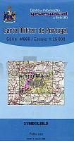
| << Portugal: Amtliche topografische Landkarten des Instituto Geográfico do Exército (IGeoE) 1:25.000 (Serie M888) |
||
|
||

Zuletzt angesehene Artikel:
 | 401 - Topographische Landkarte Portugal 1:25.000 Carta Militar de Portugal - Série M888 Instituto Geográfico do Exército (IGeoE) - Portugal |
 | 944-2 TORRES CABRERA Amtliche topographische Landkarte 1:25.000 Spanien (M.T.N.) 944-2 Mapa Topográfico Nacional de Espana (MTN25) Instituto Geográfico Nacional - CNIG Spanien |
 | 2672 Wiskitno Topographische Karte 1:25.000 Messtischblatt des Deutschen Reiches - PreuÃische Landesaufnahme / Reichsamt für Landesaufnahme - Faksimile ProjektNord |
 | 381-2 TRASOBARES Amtliche topographische Landkarte 1:25.000 Spanien (M.T.N.) 381-2 Mapa Topográfico Nacional de Espana (MTN25) Instituto Geográfico Nacional - CNIG Spanien |
 | 488 Alvito - Topographische Landkarte Portugal 1:25.000 Carta Militar de Portugal - Série M888 Instituto Geográfico do Exército (IGeoE) - Portugal |
 | 214-2 RIALP Amtliche topographische Landkarte 1:25.000 Spanien (M.T.N.) 214-2 Mapa Topográfico Nacional de Espana (MTN25) Instituto Geográfico Nacional - CNIG Spanien |
| 3575 Siedlimowo Topographische Karte 1:25.000 Messtischblatt des Deutschen Reiches - PreuÃische Landesaufnahme / Reichsamt für Landesaufnahme - Faksimile ProjektNord |
| 5369 Arnsdorf Topographische Karte 1:25.000 Messtischblatt des Deutschen Reiches - PreuÃische Landesaufnahme / Reichsamt für Landesaufnahme - Faksimile ProjektNord |
 | 416-2 CASTELLDANS Amtliche topographische Landkarte 1:25.000 Spanien (M.T.N.) 416-2 Mapa Topográfico Nacional de Espana (MTN25) Instituto Geográfico Nacional - CNIG Spanien |
 | 0980-1 SANLÃCAR DE GUADIANA Topographische Landkarte 1:25.000 Spanien (Grundlage MTN25) Instituto Geográfico Nacional - CNIG Spanien - ProjektNord |
 | 1081 YAIZA Topographische Landkarte 1:50.000 Spanien (Grundlage MTN50) Instituto Geográfico Nacional - CNIG Spanien - ProjektNord |
 | 0847-1 LA TORRE DE LES MAÃANES/TORREMANZANAS Topographische Landkarte 1:25.000 Spanien (Grundlage MTN25) Instituto Geográfico Nacional - CNIG Spanien - ProjektNord |
 | 970-4 PEDRO MARTÃNEZ Amtliche topographische Landkarte 1:25.000 Spanien (M.T.N.) 970-4 Mapa Topográfico Nacional de Espana (MTN25) Instituto Geográfico Nacional - CNIG Spanien |
 | 0436-1 ARIZA Topographische Landkarte 1:25.000 Spanien (Grundlage MTN25) Instituto Geográfico Nacional - CNIG Spanien - ProjektNord |
 | 0858 EL VISO Topographische Landkarte 1:50.000 Spanien (Grundlage MTN50) Instituto Geográfico Nacional - CNIG Spanien - ProjektNord |
 | 0439-3 HERRERA DE LOS NAVARROS Topographische Landkarte 1:25.000 Spanien (Grundlage MTN25) Instituto Geográfico Nacional - CNIG Spanien - ProjektNord |
| 3866 Czempin Topographische Karte 1:25.000 Messtischblatt des Deutschen Reiches - PreuÃische Landesaufnahme / Reichsamt für Landesaufnahme - Faksimile ProjektNord |
 | C5914 Wiesbaden Topographische Landkarte Hessen 1:100.000 - ProjektNord - Kartographie: Hessisches Landesamt für Bodenmanagement und Geoinformation (Landesvermessungsamt Hessen) |
 | 3911 12 OUTAKOSKI Topographische Karte 1:20.000 (Maastokartta / Peruskartta / Grundkarta) Maanmittauslaitos / Lantmäteriverket Finnland - ProjektNord |
 | Siebengebirge - Wanderkarte 1:25.000 Wanderkarte Naturpark Siebengebirge mit aktuellen Wegeplan im Naturschutzgebiet Siebengebirge - mr-kartographie - grünes herz |