| << Portugal: Amtliche topografische Landkarten des Instituto Geográfico do Exército (IGeoE) 1:25.000 (Serie M888) |
||
|
||

Zuletzt angesehene Artikel:
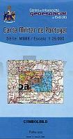
 | 431 Lisboa Topographische Landkarte Portugal 1:25.000 Carta Militar de Portugal - Série M888 Instituto Geográfico do Exército (IGeoE) - Portugal |
 | Niederlande Gesamt - StraÃenkarte 1:300.000 Wegenkaart Nederland totaal - ANWB - Niederlande |
 | Hanko - Jussarö - Bromarv, veneilykartta Wassersportkarte / Bootskarte 1:60.000 Karttakeskus Hanko Jussarö Bromarv, veneilykartta Karttakeskus - Finnland |
 | Nationalpark Tara 1:50.000 - Serbien Topographische Wanderkarte Национални парк Тара (Србија) ProjektNord |
 | Ofotfjorden - Seekarte Norwegische Küste 1:50.000 - (Blatt 141) Den Norske Kyst Sjøkart - Hovedkart (sjø) Statens Kartverk Sjø - Norwegen |
 | Bergen - Sognesjøen (Serie 11) Bootsportkarten 1:50.000 Bootsportkarten 1:50.000 - Nordeca Norwegen 11 Bergen - Sognesjøen Båtsportkart |
 | Hintere Sächsische Schweiz - Blatt 1 - Schrammsteine, Affensteine, Zschirnsteine Wanderkarte und Radwanderkarte 1:15.000 Sachsen Kartographie (Blatt 91) |
 | Hastiere-sur-Meuse NGI 1:25.000 - 111 km Radtouren Touristische Landkarte und Radtourenkarte, Wanderkarte Belgien Hastière-sur-Meuse - 111 km fietsroutes |
| 43/56 Sudzha - Krasnopolie - Amtliche topographische Landkarte 1:100.000 der Ukraine Kiewskaja Wojenno-Kartografitscheskaja Fabrika Ukraine |
 | Eifel, Maare und Vulkane Rad- und Wanderkarte mit Ausflugszielen, Einkehr- & Freizeittipps, wetterfest, reissfest, abwischbar, GPS-genau. 1:50000 - von - Freytag-Berndt und ARTARIA Publicpress |
 | Nordsee - Mittelmeer - Abschnitt: Flandern Bergen op Zoom - Eben-Emael 252 km Wandel-Gids Belgien (flämisch) Noordzee Middellandse Zee GR5 - Deel Vlaanderen: Van Bergen op Zoom tot Eben-Emael GRSentiers - Grote Routepaden |
 | 78 Topographische Landkarte Wanderkarte und Fahrradkarte Portugal 1:25.000 078 Mapa topográfico - Mapa de caminhadas - Portugal 1:25.000 ProjektNord |
 | 57E LEENDE Topographische Karte der Niederlande 1:25.000 (Plotausgabe) 57E LEENDE Topografische Kaart van Nederland Kadaster - ProjektNord |
 | Normandie 1:350.000 Touristische StraÃenkarte Frankreich (Blatt 615) Normandie - carte touristique et routière Michelin |
 | Ytre Sognefjorden - Seekarte Norwegische Küste 1:50.000 - (Blatt 121) Den Norske Kyst Sjøkart - Hovedkart (sjø) Statens Kartverk Sjø - Norwegen |
 | 71 Topographische Landkarte Wanderkarte und Fahrradkarte Portugal 1:25.000 071 Mapa topográfico - Mapa de caminhadas - Portugal 1:25.000 ProjektNord |
 | 57 Topographische Landkarte Wanderkarte und Fahrradkarte Portugal 1:25.000 057 Mapa topográfico - Mapa de caminhadas - Portugal 1:25.000 ProjektNord |
 | Mit dem Wohnmobil nach Schleswig-Holstein (Band 4) Nordseeküste, Holsteinische Schweiz, Lauenburgische Seen, Ostseefjord Schlei, Fehmann, Ostseeküste. Tipps, Tricks, Touren, Tolle Strände. Alle Plätze mit präzisen GPS-Daten - von Rainer Klee - Womo |
 | Historische Karte: Provinz WESTPREUSSEN im Deutschen Reich - um 1905 - gerollt Carl Flemmings Generalkarte, No. 4. Regierungsbezirke Danzig und Marienweder. Handtke, Friedrich Verlag Rockstuhl |
 | 30 Germil (Ponte da Barca) Topographische Landkarte Wanderkarte und Fahrradkarte Portugal 1:25.000 030 Mapa topográfico - Mapa de caminhadas - Portugal 1:25.000 ProjektNord |