| << Portugal: Amtliche topografische Landkarten des Instituto Geográfico do Exército (IGeoE) 1:25.000 (Serie M888) |
||
|
||

Zuletzt angesehene Artikel:
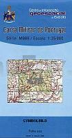
 | 470 - Topographische Landkarte Portugal 1:25.000 Carta Militar de Portugal - Série M888 Instituto Geográfico do Exército (IGeoE) - Portugal |
 | Tucheler Heide - Kaschubei - Kociewie 1:75.000 / 1:165.000 Landkarte/ touristischer Landkarte Bory Tucholskie, Kaszuby, Kociewie ExpressMap - Polen |
 | 0815 ROBLEDO Topographische Landkarte 1:50.000 Spanien (Grundlage MTN50) Instituto Geográfico Nacional - CNIG Spanien - ProjektNord |
 | Pembrokeshire West Wales Fahrradkarte 1:126.720 Cycling maps - country lanes & byways (waterproof) Pembrokeshire West Wales cycling map Goldeneye Publications - GroÃbritannien |
 | 95-3 SAN MARCOS Amtliche topographische Landkarte 1:25.000 Spanien (M.T.N.) 95-3 Mapa Topográfico Nacional de Espana (MTN25) Instituto Geográfico Nacional - CNIG Spanien |
 | Wladimir - Wladimirer Oblast Stadtatlas und StraÃenatlas 1:25.000 / 1:200.000 Wladimir - Wladimirskaja Oblast Rus Co. Ltd. - Russland |
 | Prespa - Mt. Varnous - Mt. Vitsi - Mt. Voras - Topografische Bergwanderkarte Westmakedonien - Griechenland 1:50.000 (Blatt 6.2) Anavasi - Griechenland |
 | 736-1 LOS CORTIJOS Amtliche topographische Landkarte 1:25.000 Spanien (M.T.N.) 736-1 Mapa Topográfico Nacional de Espana (MTN25) Instituto Geográfico Nacional - CNIG Spanien |
 | Amt BORNA, 1758 (Nr. 6) - historische Landkarte - Nachdruck KURFÃRSTENTUM SACHSEN - LEIPZIGER KREIS - von Peter (der Jüngere) Schenk - Plano gerollt - Verlag Rockstuhl |
 | Oberländische Seenplatte (Eylauer Seengebiet) Topographische Wanderkarte Polen 1:50.000 Pojezierze Iławskie mapa topograficzno-turystyczna (GPS) - WZKART Polen |
 | 968-2 FUENSANTA DE MARTOS Amtliche topographische Landkarte 1:25.000 Spanien (M.T.N.) 968-2 Mapa Topográfico Nacional de Espana (MTN25) Instituto Geográfico Nacional - CNIG Spanien |
 | 2263 Kollatz Topographische Karte 1:25.000 Messtischblatt des Deutschen Reiches - PreuÃische Landesaufnahme / Reichsamt für Landesaufnahme - Faksimile ProjektNord |
 | S414 Veitsiluoto Topographische Karte 1:50.000 EUREF-FIN (Maastokarttat) Maanmittauslaitos / Lantmäteriverket Finnland - ProjektNord |
| 1825 Nortorf - Gestern und Heute - Historische Ãberlagerung 1878-1880 Topographische Landkarte 1:25.000 im Vergleich - Landesvermessungsamt Schleswig-Holstein / ProjektNord |
 | 3908 Ahaus (geplottete Ausgabe) Amtliche topographische Karte 1:25.000 Landesvermessungsamt Nordrhein-Westfalen |
 | 0701 VALENCIA DE ALCÃNTARA Topographische Landkarte 1:50.000 Spanien (Grundlage MTN50) Instituto Geográfico Nacional - CNIG Spanien - ProjektNord |
 | N533 Kesälahti Topographische Karte 1:50.000 EUREF-FIN (Maastokarttat) Maanmittauslaitos / Lantmäteriverket Finnland - ProjektNord |
 | 0682-2 LA NAVA DE RICOMALILLO Topographische Landkarte 1:25.000 Spanien (Grundlage MTN25) Instituto Geográfico Nacional - CNIG Spanien - ProjektNord |
 | 324-2 SESA Amtliche topographische Landkarte 1:25.000 Spanien (M.T.N.) 324-2 Mapa Topográfico Nacional de Espana (MTN25) Instituto Geográfico Nacional - CNIG Spanien |
| 5377 Pawonkau Topographische Karte 1:25.000 Messtischblatt des Deutschen Reiches - PreuÃische Landesaufnahme / Reichsamt für Landesaufnahme - Faksimile ProjektNord |