| << Portugal: Amtliche topografische Landkarten des Instituto Geográfico do Exército (IGeoE) 1:25.000 (Serie M888) |
||
|
||

Zuletzt angesehene Artikel:
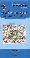
 | 511 - Topographische Landkarte Portugal 1:25.000 Carta Militar de Portugal - Série M888 Instituto Geográfico do Exército (IGeoE) - Portugal |
 | 1824 Gnutz - Gestern und Heute - Historische Ãberlagerung 1932-1950 Topographische Landkarte 1:25.000 im Vergleich - Landesvermessungsamt Schleswig-Holstein / ProjektNord |
 | 6113 Bad Kreuznach - Wanderkarte mit Wanderwegen (geplottete Ausgabe) ProjektNord - Grundlage Amtliche topographische Karte Landesamt für Vermessung und Geobasisinformation Rheinland-Pfalz |
 | 4008 Gescher (geplottete Ausgabe) Amtliche topographische Karte 1:25.000 Landesvermessungsamt Nordrhein-Westfalen |
 | Stadt- und Landgemeinde Opole Lubelskie Touristische Natur-Landkarte 1:100.000 (Blatt 359) POWIAT OPOLE LUBELSKIE mapa przyrodniczo-turystyczna Cartomedia |
 | L3320 Nienburg (Weser) (geplottete Ausgabe) Topographische Karte 1:50.000 Kartografie Landesvermessungsamt Niedersachsen - ProjektNord |
 | 84-4 ESPINOSA DE LOS MONTEROS Amtliche topographische Landkarte 1:25.000 Spanien (M.T.N.) 84-4 Mapa Topográfico Nacional de Espana (MTN25) Instituto Geográfico Nacional - CNIG Spanien |
| M-34-3-A/B Zgierz Amtliche topographische Landkarte Polen 1:50.000 M-34-3-A/B Zgierz - Mapa Topograficzna Polski Glowny Geodeta Kraju |
 | 2318-I-Nà Skagen Topographische Karte Dänemark 1:25.000 Topografisk kort Danmark (DTK/Kort25) 2318-I-Nà ProjektNord - Kort & Matrikelstyrelsen / Geodætisk Institut |
 | NL 32-03-20 (2220) Elbigenalp Ãsterreichische Karte 1:50.000 mit Wegmarkierungen (topographische Wanderkarte - UTM) - BEV - Ãsterreich |
 | 777-2 MÃRIDA Amtliche topographische Landkarte 1:25.000 Spanien (M.T.N.) 777-2 Mapa Topográfico Nacional de Espana (MTN25) Instituto Geográfico Nacional - CNIG Spanien |
 | Landschaftsschutzpark Weitsee - Wanderkarte 1:50.000 Touristische Wanderkarte/Stadtplan WDZYDZKI PARK KRAJOBRAZOWY + plany Kościerzyny i Wdzydz. Cartomedia - Sygnatura Polen |
 | 4522 HofgeiÃmar - Wanderkarte mit Wanderwegen (geplottete Ausgabe) Topographische Landkarte Hessen 1:25.000 - ProjektNord (geplottete Ausgabe) |
 | Hochsolling Wanderkarte mit Ausflugszielen, Einkehr- & Freizeittipps, wetterfest, reiÃfest, abwischbar, GPS-genau. 1:25000 - von - Freytag-Berndt und ARTARIA PUBLICPRESS |
 | NM 33-12-15 (5315) Zistersdorf Ãsterreichische Karte 1:50.000 mit Wegmarkierungen (topographische Wanderkarte - UTM) - BEV - Ãsterreich |
 | 25-141 Kelc Topographische Karte 1:25.000 der Tschechischen Republik Zakladnà mapa Ceská republika - Cesky urad zememericky a katastralni - ProjektNord |
 | Spanien Kartenset 1:500.000 (15 Karten) Landkarten 1:500.000 StraÃenkarte Spanien - CNIG Centro Nacional de Información Geográfico |
 | Saybusch - Kleine Beskiden Stadtplan/Landkarte 1:10.000/1:30.000 Żywiec Beskid Mały mapa PLAN Galileos - Polen |
| Passow (kopia) Topographische Karte 1:25.000 Messtischblatt des Deutschen Reiches - PreuÃische Landesaufnahme / Reichsamt für Landesaufnahme - Faksimile ProjektNord |
 | MN05 Postavaru - Piatra Mare - Baiului 1:45.000/1:50.000 Topographische Wanderkarte - Bergwanderkarte (englisch / rumänisch) Harta de drumeţie / Hiking Map - POSTĂVARU - PIATRA MARE şi BAIULUI Muntii Nostri - Schubert & Franzke - Rumänien |