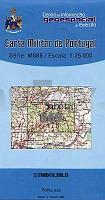
| << Portugal: Amtliche topografische Landkarten des Instituto Geográfico do Exército (IGeoE) 1:25.000 (Serie M888) |
||
|
||

Zuletzt angesehene Artikel:
 | 569 Saboia (Odemira) Topographische Landkarte Portugal 1:25.000 Carta Militar de Portugal - Série M888 Instituto Geográfico do Exército (IGeoE) - Portugal |
 | 0713-4 ALCÃZAR DE SAN JUAN Topographische Landkarte 1:25.000 Spanien (Grundlage MTN25) Instituto Geográfico Nacional - CNIG Spanien - ProjektNord |
 | Münsterland, Coesfeld - Münster - Warendorf Radkarte mit Ausflugszielen, Einkehr- & Freizeittipps, wetterfest, reissfest, abwischbar, GPS-genau. 1:100000 - von - Freytag-Berndt und ARTARIA Publicpress |
 | 553 Odemira Topographische Landkarte Portugal 1:25.000 Carta Militar de Portugal - Série M888 Instituto Geográfico do Exército (IGeoE) - Portugal |
 | 7041 Münster Topographische Landkarte Bayern 1:25.000 - Normalausgabe - ProjektNord (geplottete Ausgabe) - Grundlage amtliche Topographische Karte Bayern DTK25 |
 | 1088-4_1089-3 SANTA CRUZ DE TENERIFE Topographische Landkarte 1:25.000 Spanien (Grundlage MTN25) Instituto Geográfico Nacional - CNIG Spanien - ProjektNord |
 | Lindau - Wangen, Westliches Allgäu, Oberstaufen - Friedrichshafen Rad- und Wanderkarte mit Ausflugszielen, Einkehr- & Freizeittipps, wetterfest, reissfest, abwischbar, GPS-genau. 1:50000 - von - Freytag-Berndt und ARTARIA PUBLICPRESS |
 | Russland und WeiÃrussland (Blatt 10) - Von Moskau bis Brest - StraÃenkarte 1:700.000 Россия Белоруссия - От Москвы до Бреста Merkurij |
 | 18H SV GRANINGE 1:50.000 *** SCHNÃPPCHEN *** Topographische Wanderkarte Schweden (Terrängkarta/Gröna Kartan) - Kartförlaget - Lantmäteriet Landkarte Schweden |
 | 302 Proenca-A-Nova - Topographische Landkarte Portugal 1:25.000 Carta Militar de Portugal - Série M888 Instituto Geográfico do Exército (IGeoE) - Portugal |
 | 196-1 CALZADILLA DE LOS HERMANILLOS Amtliche topographische Landkarte 1:25.000 Spanien (M.T.N.) 196-1 Mapa Topográfico Nacional de Espana (MTN25) Instituto Geográfico Nacional - CNIG Spanien |
 | Karpathos - Saria (Blatt 10.50) Topografische Wanderkarte griechische Inseln - Ãgäis - 1:43.000 Κάρπαθος - Σαρία - Hiking Map Anavasi - Griechenland |
 | 593 Bensafrim (Lagos) Topographische Landkarte Wanderkarte und Fahrradkarte Portugal 1:25.000 593 Mapa topográfico - Mapa de caminhadas - Portugal 1:25.000 ProjektNord |
 | 692-1 CAMPILLO DE ALTOBUEY Amtliche topographische Landkarte 1:25.000 Spanien (M.T.N.) 692-1 Mapa Topográfico Nacional de Espana (MTN25) Instituto Geográfico Nacional - CNIG Spanien |
 | Schlesischen Beskiden - Kleine Beskiden 1:52.500 Laminierte touristische Landkarte - Panoramakarte Beskid Śląski i Mały ExpressMap - Polen |
 | 2344 09+12 Karsikas Topographische Karte 1:20.000 (Maastokartta / Peruskartta / Grundkarta) Maanmittauslaitos / Lantmäteriverket Finnland - ProjektNord |
 | 0965-1 CAÃADA DEL RABADÃN Topographische Landkarte 1:25.000 Spanien (Grundlage MTN25) Instituto Geográfico Nacional - CNIG Spanien - ProjektNord |
 | Kultur-Trekking im Zentralen Hohen Atlas (Marokko) - Touristische Landkarte 1:100.000 - Marokko Herbert Popp, Brahim El Fasskaoui & Mohamed Aït Hamza - Verlag Naturwissenschaftliche Gesellschaft Bayreuth |
 | 960-3 VALVERDE DEL CAMINO Amtliche topographische Landkarte 1:25.000 Spanien (M.T.N.) 960-3 Mapa Topográfico Nacional de Espana (MTN25) Instituto Geográfico Nacional - CNIG Spanien |
 | 5835 Stadtsteinach Topographische Landkarte Bayern 1:25.000 - Normalausgabe - ProjektNord (geplottete Ausgabe) - Grundlage amtliche Topographische Karte Bayern DTK25 |