Wurde Ihre Bestellung bestätigt? Wenn nicht - gab es evtl. ein SERVER-Problem! Bitte kontaktieren Sie uns! +++ Buchhändler-Anfragen erwünscht +++
Warenkorb
Artikel: 0 - € 0.00
Zur Kasse
Widerruf
Impressum Kontakt
Versandkosten
AGB
Bildansicht
Partnerprogramm
Links
Aktuelle Infos
Erweitertes Sortiment
Europa-Übersichtskarte
Novitäten von ProjektNord
Geschenkgutscheine
Individuelle Landkarten
Poster, Wandkarten, Reliefkarten
Globen
Landkarten-Puzzles
Europa - allgemein
Welt - allgemein
Außereuropäische Länder
Albanien
Andorra
Baltikum
Bosnien-Herzegowina
Bulgarien
Belgien
Benelux
Dänemark
Deutschland
Estland
Finnland
Frankreich
Griechenland
Großbritannien
Irland
Island
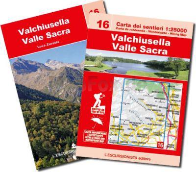
Italien
Kosovo
Kroatien
Lettland
Liechtenstein
Litauen
Luxemburg
Malta
Mittelmeer und Mittelmeer-Inseln
Moldawien
Montenegro
Niederlande
Nordmazedonien
Norwegen
Österreich
Polen
Portugal
Rumänien
Russland
Schweden
Schweiz
Serbien
Skandinavien
Slowakei
Slowenien
Spanien
Tschechien
Türkei
Ukraine
Ungarn
Weißrussland (Belarus)
Zypern
Verlage
Digitale Landkarten auf CD-ROM / DVD, SD-Karte
Reisen allgemein
Astronomische Karten und Bücher
NonBooks und Zubehör
Schnäppchen - Restposten - Mängelexemplare
Top-Destinationen
Extra-Sortiment
Wanderwege - Routen - Fernradwege
Literatur über Landkarten, Vermessung, Entdeckungen
Historische Landkarten
Schnäppchen
Gesamtübersicht
Startseite