| << Norwegen: Bootsportkarten Norwegen 1:50.000 Nordeca / UGLAND |
  | |
Zuletzt angesehene Artikel:
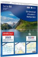
![]() | Strømstad (Hvaler) - Mefjorden (Serie 02) Bootsportkarten 1:50.000 Bootsportkarten 1:50.000 - Nordeca Norwegen 02 Strømstad (Hvaler) - Mefjorden Båtsportkart |
![]() | Lomscha Topographische Karte 1:25.000 Messtischblatt des Deutschen Reiches - Preußische Landesaufnahme / Reichsamt für Landesaufnahme - Faksimile ProjektNord |
![]() | 2863 Ruschendorf Topographische Karte 1:25.000 Messtischblatt des Deutschen Reiches - Preußische Landesaufnahme / Reichsamt für Landesaufnahme - Faksimile ProjektNord |
![]() | 500-3 VILLAR DE CIERVO Amtliche topographische Landkarte 1:25.000 Spanien (M.T.N.) 500-3 Mapa Topográfico Nacional de Espana (MTN25) Instituto Geográfico Nacional - CNIG Spanien |
![]() | 3269 Mietschisko Topographische Karte 1:25.000 Messtischblatt des Deutschen Reiches - Preußische Landesaufnahme / Reichsamt für Landesaufnahme - Faksimile ProjektNord |
![]() | Goworowo Topographische Karte 1:25.000 Messtischblatt des Deutschen Reiches - Preußische Landesaufnahme / Reichsamt für Landesaufnahme - Faksimile ProjektNord |
![]() | 3656 Sternberg Topographische Karte 1:25.000 Messtischblatt des Deutschen Reiches - Preußische Landesaufnahme / Reichsamt für Landesaufnahme - Faksimile ProjektNord |
![]() | 2861 Zatten Topographische Karte 1:25.000 Messtischblatt des Deutschen Reiches - Preußische Landesaufnahme / Reichsamt für Landesaufnahme - Faksimile ProjektNord |
![]() | Radzikowo Topographische Karte 1:25.000 Messtischblatt des Deutschen Reiches - Preußische Landesaufnahme / Reichsamt für Landesaufnahme - Faksimile ProjektNord |
![]() | 444 Topographische Landkarte Wanderkarte und Fahrradkarte Portugal 1:25.000 444 Mapa topográfico - Mapa de caminhadas - Portugal 1:25.000 ProjektNord |
![]() | 823-3 Benitachell - Elpoble Nou de Benitatxell Amtliche topographische Landkarte 1:25.000 Spanien (M.T.N.) 823-3 Mapa Topográfico Nacional de Espana (MTN25) Instituto Geográfico Nacional - CNIG Spanien |
![]() | 1118 Neukirchen - Gestern und Heute - Historische Überlagerung 1878-1880 Topographische Landkarte 1:25.000 im Vergleich - Landesvermessungsamt Schleswig-Holstein / ProjektNord |
![]() | 5866 Mittelwalde Topographische Karte 1:25.000 Messtischblatt des Deutschen Reiches - Preußische Landesaufnahme / Reichsamt für Landesaufnahme - Faksimile ProjektNord |
![]() | 2561 Gr. Lübbesee Topographische Karte 1:25.000 Messtischblatt des Deutschen Reiches - Preußische Landesaufnahme / Reichsamt für Landesaufnahme - Faksimile ProjektNord |
![]() | 919-1 EL REAL DE LA JARA Amtliche topographische Landkarte 1:25.000 Spanien (M.T.N.) 919-1 Mapa Topográfico Nacional de Espana (MTN25) Instituto Geográfico Nacional - CNIG Spanien |
![]() | 915-4 JIMONETE Amtliche topographische Landkarte 1:25.000 Spanien (M.T.N.) 915-4 Mapa Topográfico Nacional de Espana (MTN25) Instituto Geográfico Nacional - CNIG Spanien |
![]() | 113 I (45-13) Ozaeta Amtliche topographische Landkarte 1:25.000 Spanien (M.T.N.) 113 Mapa Topográfico Nacional de Espana (MTN25) Instituto Geográfico Nacional - CNIG Spanien |
![]() | 514 Topographische Landkarte Wanderkarte und Fahrradkarte Portugal 1:25.000 514 Mapa topográfico - Mapa de caminhadas - Portugal 1:25.000 ProjektNord |
![]() | 271-1 GORDONCILLO Amtliche topographische Landkarte 1:25.000 Spanien (M.T.N.) 271-1 Mapa Topográfico Nacional de Espana (MTN25) Instituto Geográfico Nacional - CNIG Spanien |
![]() | 388-II Bell-lloc d´Urgel (64-29) Amtliche topographische Landkarte 1:25.000 Spanien (M.T.N.) 388-II Mapa Topográfico Nacional de Espana (MTN25) Instituto Geográfico Nacional - CNIG Spanien |


