| << Spitzbergen: Topographische Karten vom Nordisk Polarinstitut |
||
|
||

Zuletzt angesehene Artikel:
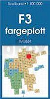
 | F3 Duvefjorden Spitzbergen / Svalbard / Spitsbergen - Topographische Karte 1:100.000 Norsk Polarinstitutt |
 | Provence - Alpen - Côte d`Azur 1:300.000 - laminierte Landkarte comfort!map Provence - Alpes - Cote d´Azur ExpressMap |
 | Hinterhermsdorf und die Schleusen Wanderkarte 1:10.000 - Rolf Böhm Verlag |
 | Pawlowski-Possad Stadtplan 1:18.000 / 1:36.000 - Russland Павловский Посад GKS - Globalnij Kartografitscheskij Servis Russland |
 | El Maestrat Comarca històrica - Wanderkarte 1:85.000 El Tossal Cartographies - Valencia - Spanien El Maestrat - Comarca històrica |
 | Blatt 5: Norwegen Nord 1:500.000 - Straßenkarte - Vägkartor - Bil- og turistkart - Calazo Förlag Norwegen Bil- og turistkart Nord-Norge |
 | 45G VEGHEL Topographische Karte der Niederlande 1:25.000 (Plotausgabe) 45G VEGHEL Topografische Kaart van Nederland Kadaster - ProjektNord |
 | Wilde Wege Dolomiten 45 Touren. Mit GPS-Tracks - von Mark Zahel - Bergverlag Rother |
 | Nationalpark Ojców 1:20.000 Touristische Wanderkarte Ojcowski Park Narodowy Compass - Polen |
 | 174.33 Amtliche topographische Karte 1:25.000 Polen |
 | New York 1:75.000 - laminierter Stadtplan comfort!map ExpressMap |
 | Greece: Ski Touring with Sea View (englisch) by Christian Mayer - Anavasi Editions Griechenland |
 | Lake District Nord - Wanderkarte 1:40.000 (wasser- und reißfest) Ultramap XT40 Lake District north - hiking map (durable, tear-resistent and 100% waterproof) HARVEY MAPS - Großbritannien |
 | 3000 Ibones - Balaitous - Infiernos - Gran Facha - Vignemale - Garmo Negro 1:25.000 Wanderkarte Spanien - ALPINA |
| Utena (80-84/50-54) Topografische Karte Litauen 1:50.000 Lietuvos Respublikos Topografinis Zemelapis 1:50.000 - Nacionaline Zemes Tarnyba - Litauen |
 | Schweden 1:750.000 Doppelkarte Nord + Süd - Hallwag |
 | The Islands of Croatia - 30 Walking Routes on 14 Adriatic islands Wanderführer (englisch) Cicerone Großbritannien |
 | Sierra de Cazorla, Segura y las Villas Sierra de Castril - Topographische Wanderkarte 1:40:000 + Begleitheft mit Tourenbeschreibungen (englisch) Sierra de Cazorla, Segura y las Villas Sierra de Castril - Hiking Map Editorial Penibética - Spanien |
 | Landkreis Koscian-Kosten Touristische Landkarte 1:50.000 Wanderkarte, Radwanderkarte, Freizeitkarte, Kanurouten Powiat kościański mapa TopMapa Pietruska & Mierkiewicz |
 | Tallin (Reval) Stadtplan 1:30.000 Tallinn Linnaplaan Jana Seta |