| << Spitzbergen: Topographische Karten vom Nordisk Polarinstitut |
  | |
|
||
Zuletzt angesehene Artikel:
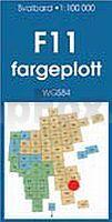
![]() | F11 Deltabreen Spitzbergen / Svalbard / Spitsbergen - Topographische Karte 1:100.000 Norsk Polarinstitutt |
![]() | Die Davert Topographische Wanderkarte Nordrhein-Westfalen mit Wanderwegen und Radwegen 1:25.000 - ProjektNord |
![]() | Val d` Orcia - Topographische Wanderkarte 1:25.000 (Blatt 515) Carta Sentieri della Provincia di Siena - Edizioni Multigraphic - Italien |
![]() | Alto Sil 1:50.000 - Wanderkarte Cordillera Cantábrica - Calecha Ediciones - Spanien |
![]() | 167 Chelmsford - Harlow & Bishop`s Stortford - Wanderkarte Großbritannien 1:50.000 Active Laminiert LANDRANGER MAP - Ordnance Survey |
![]() | O09 Ammersee mit Penzing - Inning a. Ammersee - Geltendorf - Windach - Utting am Ammersee ATK25 Topographische Karte 1:25.000 (Atkis) Bayern Landesvermessungsamt Bayern - Wanderkarte |
![]() | 2538OT Ste-Eulalie-d´Olt - Haute Vallée du Lot - Mt d´Aubrac GPS Topographische Wanderkarte Frankreich 1:25.000 TOP 25 IGN - (GPS) |
![]() | 2039SB Cahors (Ouest) - Labastide-Marnhac - Montcuq GPS Amtliche Topographische Wanderkarte Frankreich 1:25.000 - série bleue (IGN) |
![]() | Vendée de la mer au bocage - à vélo Radwanderführer (französisch) - OUEST France - Frankreich OUEST France |
![]() | Nicaragua - Honduras - El Salvador 1:650.000 Landkarte Reise-Know-How Verlag - world mapping project |
![]() | Tatra-Nationalpark Tourisitsche Wanderkarte 1:33.000 Landkarte Tatrzański Park Narodowy mapa turystyczna Demart - Polen |
![]() | 6329 Baudenbach Topographische Landkarte Bayern 1:25.000 - Normalausgabe - ProjektNord (geplottete Ausgabe) - Grundlage amtliche Topographische Karte Bayern DTK25 |
![]() | 5203 (NL 33-03-03) Neusiedl am See Topographische Wanderkarte 1:50.000 mit Wegmarkierungen - Österreich - Kartographie BEV - ProjektNord |
![]() | 14-141 Rokytnice v Orlickych horach Topographische Karte 1:25.000 der Tschechischen Republik Zakladní mapa Ceská republika - Cesky urad zememericky a katastralni - ProjektNord |
![]() | Parco Regionale Storico di Monte Sole - Medie valli del Reno e del Setta (Blatt 04bo) - Touristische Wanderkarte 1:25.000 Carta escursionistica Regione Emilia-Romagna / Club Alpino Italiano - Italien |
![]() | Stanislau / Iwano-Frankowsk Stadtplan 1:14.000 Ivano-Frankivs`k Kartografija - ukrmap Ukraine |
![]() | 2738 Putlitz Topographische Karte 1:25.000 Landesvermessungsamt Brandenburg (gefaltet) |
![]() | Istrien 1 - Pula mit Wanderwegen und Radwegen - Wanderkarte - Fahrradkarte 1:35.000 Kroatien - ProjektNord |


