| << Spitzbergen: Topographische Karten vom Nordisk Polarinstitut |
||
|
||

Zuletzt angesehene Artikel:
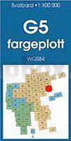
 | G5 Isdomen Spitzbergen / Svalbard / Spitsbergen - Topographische Karte 1:100.000 Norsk Polarinstitutt |
 | Südwestliche Oberpfalz - Neumarkt (Blatt 177) 1:50.000 wasserfest - Rad- und Wanderkarte - PhoneMaps - Freytag & Berndt |
 | Oblast Kirowohrad / Kirowograd 1:250.000 Landkarte, Straßenkarte mit administrativen Grenzen - Ukraine Kirowohradska oblast / Кіровоградська область Kartografija - ukrmap Ukraine |
 | N11 München-Nord - Dachau, Oberschleißheim, Garching b.München, Karlsfeld, Unterschleißheim, Eching ATK25 Topographische Karte 1:25.000 (Atkis) Bayern Landesvermessungsamt Bayern - Wanderkarte |
 | Mexico Country Guide Reiseführer englisch - Lonely Planet Publications |
 | Isère: 90 itinéraires VTT MTB-Führer (französisch) Guide VTOPO Frankreich |
 | BAIX GAIÀ - Ruta dels Castells i Pic de la Mola Wanderkarte 1:20.000 - Editorial Piolet - Spanien |
 | Lowther Hills walking guide Wanderführer Schottland - Cicerone Großbritannien (englisch) |
 | V52 Topographische Karte 1:100.000 EUREF-FIN Maanmittauslaitos / Lantmäteriverket Finnland - ProjektNord |
 | Freizeitkarte Mecklenburgische Kleinseeplatte Mit Ortsregister. Maßstab 1:100.000 - grünes herz |
 | Azoren (Nr. 5917) Wanderführer. 90 Touren - KOMPASS |
 | Stettiner Haff - Ueckermünde - Usedoms Süden Mit Stettin - von Ute Kissling - via reise |
 | Republik Karatschai-Tscherkessien 1:200.000 Topographische Landkarte Karachevo-Tscherkesskaja Respublika Russland |
 | Kleine Fatra - Martinske hole 1:50.000 (Blatt 5019) Wanderkarte Malá Fatra - Martinské hole TatraPlan - Slowakei |
 | Der neue Saar-Hunsrück-Steig Wandern Band 1 + 2 im SET mit Karte von Ulrike Poller und Wolfgang Todt - Idee Media |
 | Las Marches du Velay... à pied - Réf. P43D Topographischer Wanderführer - FFRP (Fédération française de randonnée pédestre) Frankreich |
 | 2175 Occippel Topographische Karte 1:25.000 Messtischblatt des Deutschen Reiches - Preußische Landesaufnahme / Reichsamt für Landesaufnahme - Faksimile ProjektNord |
 | Pfalz mit Kindern von Hannah Mehrfert - pmv Peter Meyer Verlag |
 | Mumbai - Bombay CityTrip Reiseführer von Rainer Krack - Reise-Know-How |
| 5537 Gefell Topographische Karte Thüringen 1:25.000 Landesvermessungsamt Thüringen |