 Detaillierte topographische Wanderkarte der Slowakei. Höhenlinien im 20 m-Abstand. Die Karte ist GPS-tauglich. Sie enthält die markierten Wanderwege mit Angabe der Gehzeiten in beiden Richtungen. Außerdem sind Langlaufloipen und Radwanderwege. Legende (auch deutschsprachig) ist sehr umfangreich und zum Wandern zweckdienlich.
Die Karte wird in einer Kunststoffhülle geliefert.  Kartenbeispiel aus der Serie Kartenbeispiel aus der Serie
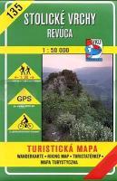
Kartenausschnitt
|
135 Stolicke Vrchy Wanderkarte Slowakei 1:50.000 - VKU
EAN / ISBN: 9788081442186
Preis: EUR 11.90
|
| 
