| << Spanien: Wanderkarten - ICGC (ICC) - Institut Cartogrà fic i Geològic de Catalunya |
  | |
|
||
Zuletzt angesehene Artikel:
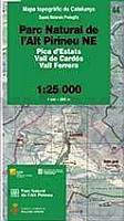
![]() | Parc Natural de l`Alt Pirineu NE (Blatt 44) 1:25.000 Pica d`Estats, Vall de Cardos, Vall Ferrera - Wanderkarte Spanien - ICC - Institut Cartogrà fic de Catalunya |
![]() | 27/28/36 IEPER / WARANDEHOEK-PROVEN / LE BIZET NGI 1:50.000 Topographische Karte Belgien |
![]() | AREA 9: Tierra del Fuego y Antartica - Regionale Landkarte 1:400.000 / 1:5 Mio. 9 Mapa TurÃstico: Tierra del Fuego y Antártica Mapas Compass Chile |
![]() | Marin County / San Rafael / Novato / Sausalito / Mill Valley Stadtplan 1:28.000 (Kalifornien - USA) Marin County / San Rafael / Novato / Sausalito / Mill Valley street map GM Johnson |
![]() | 0084 ESPINOSA DE LOS MONTEROS Topographische Landkarte 1:50.000 Spanien (Grundlage MTN50) Instituto Geográfico Nacional - CNIG Spanien - ProjektNord |
![]() | 066 Edinburgh, Penicuik & North Berwick - Wanderkarte Großbritannien 1:50.000 Active Laminiert LANDRANGER MAP - Ordnance Survey |
![]() | Moors - Tors Wanderführer - Northern Eye Books Top 10 Walks Series, Peak District Classic walks on the upland moors of the Peak District |
![]() | 2711SB Craonne - Beaurieux GPS Amtliche Topographische Wanderkarte Frankreich 1:25.000 - série bleue (IGN) |
![]() | 047 N Kongsvinger NORD 1:50.000 - Amtliche Topographische Landkarte Norwegen - Startens Kartverk |
![]() | 0200 BURGOS Topographische Landkarte 1:50.000 Spanien (Grundlage MTN50) Instituto Geográfico Nacional - CNIG Spanien - ProjektNord |
![]() | 3119SB Nogent - Foulain GPS Amtliche Topographische Wanderkarte Frankreich 1:25.000 - série bleue (IGN) |
![]() | Ostseeküste - Schleswig-Holstein Reiseführer inkl. Holsteinische Schweiz und Fehmarn Reiseführer Michael-Müller-Verlag - Reiseführer |
![]() | 1106-4 PUERTO RICO Topographische Landkarte 1:25.000 Spanien (Grundlage MTN25) Instituto Geográfico Nacional - CNIG Spanien - ProjektNord |
![]() | 2304SB St-Omer - Aire-sur-la-Lys GPS Amtliche Topographische Wanderkarte Frankreich 1:25.000 - série bleue (IGN) |
![]() | 245 The National Forest - Burton upon Trent & Swadlincote - Wanderkarte Großbritannien 1:25.000 EXPLORER MAP - Ordnance Survey |
![]() | 1845SB Boulogne-sur-Gesse - Trie-sur-Baïse GPS Amtliche Topographische Wanderkarte Frankreich 1:25.000 - série bleue (IGN) |
![]() | 2614SB La Ferté-Gaucher - Montmirail GPS Amtliche Topographische Wanderkarte Frankreich 1:25.000 - série bleue (IGN) |
![]() | 089 West Cumbria, Cockermouth & Wast Water - Wanderkarte Großbritannien 1:50.000 Active Laminiert LANDRANGER MAP - Ordnance Survey |
![]() | 6: Ammarnäs - Hemavan-Lill-Björkvattnet 1:75.000 - Outdoorkarte / Fjällkarte - wasserfest Norstedts - Schweden |
![]() | 0870-1 RASPAY Topographische Landkarte 1:25.000 Spanien (Grundlage MTN25) Instituto Geográfico Nacional - CNIG Spanien - ProjektNord |


