| << Finnland: Gewässerkarten, Wassersportkarten << Genimap / Karttakeskus Finnland |
  | |
Zuletzt angesehene Artikel:
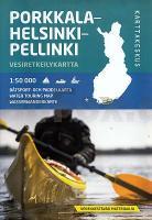
![]() | Helsinki - Porkkala - Pellinki Kanukarte / Wassersportkarte Wassersportkarte / Bootskarte 1:50.000 Karttakeskus Helsinki - Porkkala - Pellinki, veneily ja melontakartta Karttakeskus - Finnland |
![]() | Blatt 7B: Sant`Anna di Vinadio - Ceresole Reale 1:50.000 - Wanderkarte - Sentiero Italia Piemonte CAI - 4land / Idea Montagna Carta itineraria del Sentiero Italia tratto piemontese, da Sant`Anna di Vinadio a Ceresole Reale 4land / Idea Montagna |
![]() | Brasilien 1:4 Mio. Landkarte Brésil IGN |
![]() | Skåneleden SL 1: Kust till kust Wanderkarte 1:50.000 wasserfest - Region Skåne - Schweden |
![]() | Cabo Froward 1:100.000 Trekkingkarte Cabo Froward Trekking Map Viachile Editores - Chile |
![]() | 179 Cheltenham - Gloucester & Stroud - Wanderkarte Großbritannien 1:25.000 EXPLORER MAP - Ordnance Survey |
![]() | 2136ET ROCAMADOUR - PADIRAC - VALLEE DE LA DORDOGNE - Topographische Wanderkarte Frankreich 1:25.000 TOP 25 IGN - (GPS) |
![]() | Gauteng (Central) Straßenatlas 1:20.000 (Spiralo) Gauteng central street guide MapStudio Südafrika |
![]() | 18/1-2 HAMONT - VELDHOVEN NGI 1:25.000 Topographische Landkarte Belgien |
![]() | 1925SB Preuilly-sur-Claise / le Grand-Pressigny GPS Amtliche Topographische Wanderkarte Frankreich 1:25.000 - série bleue (IGN) |
![]() | 1641SB Roquefort - Cazaubon - GPS Amtliche Topographische Wanderkarte Frankreich 1:25.000 - série bleue (IGN) |
![]() | 2035SB Terrasson-Lavilledieu - Montignac - Grotte de Lascaux GPS Amtliche Topographische Wanderkarte Frankreich 1:25.000 - série bleue (IGN) |
![]() | Tatopani (Annapurna-Region) Trekkingkarte 1:50.000 (NA515) Himalayan MapHouse - Nepal Treks around Pokhara - Tatopani (Hot Spring) Trek |
![]() | 2149 Usedom Amtliche Topographische Karte 1:25.000 Landesvermessungsamt Mecklenburg-Vorpommern |
![]() | 10 La Via dei Campioni 1:25.000 - Rifugio Cascina Foi - Lerma - Rad- und Wanderkarte - Ingenia Editori - Italien Carta cicloescursionistica del tratto compreso tra Rifugio Cascina Foi e Lerma sulla Via dei Campioni |
![]() | 2403SB Bailleul - Steenvoorde GPS Amtliche Topographische Wanderkarte Frankreich 1:25.000 - série bleue (IGN) |
![]() | 2738SB Le Bleymard - la Bastide-Puylaurent - GPS Amtliche Topographische Wanderkarte Frankreich 1:25.000 - série bleue (IGN) |
![]() | Japanese Alpine News Vol. 14 - The Japanese Alpine Club |
![]() | Siegen 1966 (Blatt 62) Historischer Bildstadtplan Bollmann-Bildkarten-Verlag |
![]() | 4340 Pouch Topographische Karte 1:25.000 Landesamt für Vermessung und Geoinformation Sachsen-Anhalt (Landesvermessungsamt) |


