Willkommen bei MapFox
+++ Buchhändleranfragen willkommen! Tel. 0431-666 75 99 +++
Warenkorb
Artikel: 0 - € 0.00
Zur Kasse
Impressum Kontakt Versandkosten AGB
Kanada - USA - Mexiko Straßenatlas 100th Anniversary 2024 Rand McNally
2024 Midsize Easy to Read Road Atlas - 100th Anniversary Collector`s Edition
<< Rand Mc.Nally
 
Cover

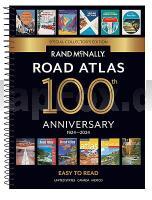
Beginning with it`s predecessor, the Auto Chum in 1924, the Rand McNally Road Atlas has been the essential, trusted tool for road travelers for 100 years. Celebrating its centennial anniversary, this 2024 Special Collector`s Edition features a trip down memory lane - a nostalgic look back at 100 years of roadside culture, cars, and the highway system that shaped the open road, as well as showcasing Road Atlas covers throughout the years. This spiral-bound midsized atlas contains updated, easy-to-read, large print maps of the U.S., Canada, and Mexico, plus detailed maps of over 50 North American cities, in a convenient travel size that fits in a glove box. Spiral, stay-flat binding allows the book to lay open easily. Other Features: Tell Rand! As much as we work to keep our atlases up to date, conditions change quickly and new construction projects begin frequently. If you know of something we haven`t captured in our atlas, let us know at randmcnally.com/tellrand. Mileage chart showing distances between 77 cities and national parks with driving times map. Road construction and conditions phone numbers and websites. Tourism websites and phone numbers for every U.S. state and Canadian province on map pages. Spiral Bound.

Kartenbeispiel

Kanada - USA - Mexiko Straßenatlas 100th Anniversary 2024 Rand McNally
2024 Midsize Easy to Read Road Atlas - 100th Anniversary Collector`s Edition
EAN / ISBN: 9780528026935
Preis: EUR 29.90

Bestellartikel: versandfertig in ca. 1-3 Wochen. Dieser Artikel wird speziell für Sie bestellt. Keine Rücknahme!
Produkt EUR Anzahl Bestellen
Kanada - USA - Mexiko Straßenatlas 100th Anniversary 2024 Rand McNally
2024 Midsize Easy to Read Road Atlas - 100th Anniversary Collector`s Edition
29.90
Versandkostenfrei in Deutschland ab 30,- Bestellwert

incl. MwSt.

Stichworte, die bei der Suche nützlich sein könnten:
USA - Canada Straßenatlas - U.S.A - USA Straßenatlas - Kanada - Mexiko - Canada - Mexico - Mexiko Straßenatlas - Kanada - Rand Mc.Nally - Rand McNally - Thomas Guide - USA Stadtpläne - Amerikanische Stadtpläne - Vereinigte Staaten von Amerika Stadtpläne - US Stadtpläne - US city maps - US city plans

Zuletzt angesehene Artikel:

CoverKanada - USA - Mexiko Straßenatlas 100th Anniversary 2024 Rand McNally
2024 Midsize Easy to Read Road Atlas - 100th Anniversary Collector`s Edition

Noch kein Cover vorhanden251.4 Amtliche topographische Karte 1:50.000 Polen

Noch kein Cover vorhanden472.41 Amtliche topographische Karte 1:25.000 Polen

Noch kein Cover vorhanden235.44 Czarna Bialystocka Amtliche topographische Karte 1:25.000 Polen

Noch kein Cover vorhandenDunedin / Mosgiel & Oamaru 1:35.000 / 1:275.000 - Minimap 9 Straßenkarte mit Stadtplänen Neuseeland - Kiwimaps Ltd - Neuseeland

CoverBasso Appennino Parmense ovest - Val Ceno, Parco dello Stirone, Parco del Taro, Parco Boschi di Carrega 1:25.000 (Foglio 6) Wander- und Mountainbikekarte - Provincia di Parma - Italien - CAI Parma
Carta escursionistica e per mountain bike di Val Ceno, Parco dello Stirone, Parco del Taro, Parco Boschi di Carrega CAI Parma

Cover101 Skandinavien Geheimtipps und Top-Ziele. Ulrich Quack, Andrea Lammerting, Dirk Kruse-Etzbach u. a. - Iwanowski Reiseführer

Cover03-243 Topographische Karte 1:25.000 der Tschechischen Republik
Zakladní mapa Ceská republika Cesky urad zememericky a katastralni - ProjektNord

CoverAktiv-Reiseführer Fischland-Darß-Zingst Radfahren, Surfen, Wandern, Paddeln, Kanu fahren, Skaten sowie Pflanzen, Tiere und Fossilien bestimmen u.v.m - von Karolin Küntzel und Sandra Pixberg - Steffen Verlag

Cover149 Hereford & Leominster - Bromyard & Ledbury - Wanderkarte Großbritannien 1:50.000 Active Laminiert LANDRANGER MAP - Ordnance Survey

Noch kein Cover vorhanden541.11 Amtliche topographische Karte 1:25.000 Polen

CoverMit dem Wohnmobil nach Ungarn (Band 34) Die Anleitung für einen Erlebnisurlaub. Tipps, Tricks, Touren, Tolle Plätze. Alle Plätze mit präzisen GPS-Daten - von Peter Simm und Silvia Sussmann - Womo

Noch kein Cover vorhanden214.33 Gizycko Amtliche topographische Karte 1:25.000 Polen

CoverLa presqu`île du Rhuys - Golfe du Morbihan - Topocarte 1:50.000 - Réf. TC561 Topographische Wanderkarte - FFRP (Fédération française de randonnée pédestre) Frankreich

Noch kein Cover vorhanden7141 Straubing Topographische Landkarte Bayern 1:25.000 (Normalausgabe - Atkis) Landesvermessungsamt Bayern

Noch kein Cover vorhanden146.42 Amtliche topographische Karte 1:25.000 Polen

Cover02-242 Topographische Karte 1:25.000 der Tschechischen Republik
Zakladní mapa Ceská republika Cesky urad zememericky a katastralni - ProjektNord

Noch kein Cover vorhanden076 S Breheimen SØR 1:50.000 - Amtliche Topographische Landkarte Norwegen - Startens Kartverk

CoverTucheler Heide Touristische Landkarte 1:75.000 Landkarte
Bory Tucholskie mapa turystyczna Demart - Polen

Cover22-112 Topographische Karte 1:25.000 der Tschechischen Republik
Zakladní mapa Ceská republika Cesky urad zememericky a katastralni - ProjektNord