Willkommen bei MapFox
Wurde Ihre Bestellung bestätigt? Wenn nicht - gab es evtl. ein SERVER-Problem! Bitte kontaktieren Sie uns! +++ Buchhändler-Anfragen erwünscht +++
Warenkorb
Artikel: 0 - € 0.00
Zur Kasse
Impressum Kontakt Versandkosten AGB
Alaska Road & Recreation Atlas 1:316.800-1:1.267.200 - Benchmark Atlas USA
<< USA: Wanderkarten, Nationalpark-Karten
<< Benchmark
 
Cover

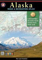
Alaska truly is the Last Frontier. No other publication can display this rugged scenery and recreation potential with more precision than Benchmark’s Alaska Road & Recreation Atlas. The Landscape Maps reveal landforms with amazing realism and detail, clearly showing how the state’s vast network of roads, waterways, and recreation landmarks fit into the landscape. A complete Recreation Guide lists a myriad of outdoor activities. Arranged by category and boasting unequalled insight and detail, it is the ideal planning tool from a simple scouting trip to an extended exploration. Benchmark field-checkers drove several thousand miles to make sure the Alaska Road & Recreation Atlas is the most accurate, comprehensive, and reliable map product ever published for the 49th State.

Kartenausschnitt

Kartenbeispiel

Alaska Road & Recreation Atlas 1:316.800-1:1.267.200 - Benchmark Atlas USA
EAN / ISBN: 9780929591148
Preis: EUR 26.95

Bestellartikel: versandfertig in ca. 1-3 Wochen. Dieser Artikel wird speziell für Sie bestellt. Keine Rücknahme!
Produkt EUR Anzahl Bestellen
Alaska Road & Recreation Atlas 1:316.800-1:1.267.200 - Benchmark Atlas USA 26.95
Versandkostenfrei in Deutschland ab 30,- Bestellwert

incl. MwSt.

Stichworte, die bei der Suche nützlich sein könnten:
Alaska Straßenatlas - USA Wanderkarten - USA Landkarten - USA Nationalparks - USA National Parks - USA maps - Vereinigte Staaten Landkarten - USA Nationalpark-Karten - Benchmark - Benchmark Recreation maps - Benchmark Road Maps - Benchmark Roadatlases - Benchmark Atlanten - USA Atlanten - USA Recreation Atlases - Bundesstaatenkarten USA - Amerikanische Bundesstaaten - Vereinigte Staaten von Amerika Landkarte - US maps - US states maps

Zuletzt angesehene Artikel:

CoverAlaska Road & Recreation Atlas 1:316.800-1:1.267.200 - Benchmark Atlas USA

CoverSETAU SAGÈTH Wanderkarte 1:30.000 - Editorial Piolet - Spanien

CoverPhilippinen Landkarte 1:900.000 freytag & berndt

CoverHeiligenhafen Topographische Wanderkarte mit Wanderwegen und Radwegen 1:25.000 Schleswig-Holstein - ProjektNord

CoverPeak District NP pocket map Pocket map - National Parks UK and Collins Maps

CoverL6508 St. Wendel Topographische Karte 1:50.000 - Landesvermessungsamt Saarland

CoverSudan und Südsudan Geographische Straßenkarte 1:2.5 Mio.
Sudan and South-Sudan GiziMap

Cover3647 Wildau Topographische Karte 1:25.000 Landesvermessungsamt Brandenburg (gefaltet)

Noch kein Cover vorhandenCF09 Topographische Landkarte Neuseeland 1:50.000 Land Information New Zealand

Cover358 Lochgilphead & Knapdale North - laminierte Wanderkarte Großbritannien 1:25.000 EXPLORER MAP - Ordnance Survey

CoverRwanda Travel Guide Reiseführer (englisch) Bradt Publications

CoverMazedonien 1:250.000 Straßenkarte
MACEDONIA ROAD MAP GiziMap

Noch kein Cover vorhanden444.4 Amtliche topographische Karte 1:50.000 Polen

Cover309 Stranraer & The Rhins - Wanderkarte Großbritannien 1:25.000 EXPLORER MAP - Ordnance Survey

CoverArta (Blatt 187) Präfektur Landkarte 1:150.000 Orama - Griechenland
Άρτα

CoverEuropa-Radweg Eiserner Vorhang Ostseeküste Von Riga nach Lübeck - Esterbauer

Cover423 Elgin - Forres & Lossiemouth - Wanderkarte Großbritannien 1:25.000 EXPLORER MAP - Ordnance Survey

Cover35 Eutin - Malente - Varendorfsche Karte 1789-1792 Topographisch Militärische Charte des Herzogtums Holstein - Reproduktion 1:25.000

Noch kein Cover vorhanden4740 Liebertwolkwitz-Rötha (26) - Geologische Karte 1:25.000 (GK25) Grundlage Vollbornsche Äquidistantenkarte Sächsisches Landesamt für Umwelt, Landwirtschaft und Geologie

Cover217 Skiathos 1:15.000 Landkarte Griechische Inseln - Road Editions - Griechenland