Willkommen bei MapFox
Wurde Ihre Bestellung bestätigt? Wenn nicht - gab es evtl. ein SERVER-Problem! Bitte kontaktieren Sie uns! +++ Buchhändler-Anfragen erwünscht +++
Warenkorb
Artikel: 0 - € 0.00
Zur Kasse
Impressum Kontakt Versandkosten AGB
Texas Road & Recreation Atlas 1:253.440-1:1.267.200 - Benchmark Atlas USA
<< USA: Wanderkarten, Nationalpark-Karten
<< Benchmark
 
Cover

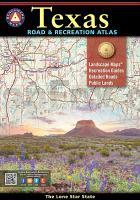
The vast openness of Texas is the source of everything that makes it unique. No other publication can display this dense, expansive landscape and its recreation potential with more precision than Benchmark’s Texas Road & Recreation Atlas. The field-checked Landscape Maps reveal back-roads & land-forms with amazing realism and detail, clearly showing how the state’s network of roads and local recreation landmarks fit into the countryside. A Recreation Guide provides regional maps and lists a variety of outdoor activities. Arranged by category, it is the ideal planning tool for any adventure, from a simple day-trip to an extended exploration. Benchmark field-checkers, cartographers, and editors have spent over two years making the Texas Road & Recreation Atlas the most accurate, comprehensive, and reliable map product ever published for The Lone Star State.

Texas Road & Recreation Atlas 1:253.440-1:1.267.200 - Benchmark Atlas USA
EAN / ISBN: 9780929591155
Preis: EUR 29.95

Bestellartikel: versandfertig in ca. 1-3 Wochen. Dieser Artikel wird speziell für Sie bestellt. Keine Rücknahme!
Produkt EUR Anzahl Bestellen
Texas Road & Recreation Atlas 1:253.440-1:1.267.200 - Benchmark Atlas USA 29.95
Versandkostenfrei in Deutschland ab 30,- Bestellwert

incl. MwSt.

Stichworte, die bei der Suche nützlich sein könnten:
Texas Landkarte - Texas map - Texas Straßenatlas - USA Wanderkarten - USA Landkarten - USA Nationalparks - USA National Parks - USA maps - Vereinigte Staaten Landkarten - USA Nationalpark-Karten - Benchmark - Benchmark Recreation maps - Benchmark Road Maps - Benchmark Roadatlases - Benchmark Atlanten - USA Atlanten - USA Recreation Atlases - Bundesstaatenkarten USA - Amerikanische Bundesstaaten - Vereinigte Staaten von Amerika Landkarte - US maps - US states maps

Zuletzt angesehene Artikel:

CoverTexas Road & Recreation Atlas 1:253.440-1:1.267.200 - Benchmark Atlas USA

CoverMitten durchs Mittelland Zu Fuss vom Bodensee zum Genfersee - Rotpunktverlag

CoverKosovo Travel Guide Reiseführer (englisch) Bradt Publications

Cover50 Walks in West-Yorkshire Wanderführer - AA Automobile Association / OS Ordnance Survey - Großbritannien

CoverTour del Monte Rosa 1:25.000 - Topographischer Wanderführer - Geo4 Map - Italien
Atlante cartografico del Tour del Monte Rosa.

CoverOrkney pocket map 1:10.000 Pocket map - National Parks UK and Collins Maps

CoverCami de Reencuentro - Alt Urgell - Andorra - Ariège Wanderführer Pyrenäen Spanien (spanisch) ALPINA

CoverAustralien 1:3.5 Mio. Auto- + Freizeitkarte
Australia Australie freytag & berndt

CoverSan Rafael Swell, Utah (Blatt: 712) Landkarte Trails Illustrated Map National Geographic - USA

CoverDuMont direkt Fuerteventura von Lipps, Susanne

CoverStefan Loose Travel Handbücher Schottland von Eickhoff, Matthias

CoverSuriname von Philip Briggs - Bradt Travel Guides

CoverCosta Brava & Barcelona Sunflower-Wanderführer - englisch - kostenlose Updates - car tours & walks

CoverGebrauchsanweisung für Katalonien - von Michael Ebmeyer - Piper Verlag

CoverGermany, Austria? - Best Trip Reiseführer Lonely Planet (engl.)

Noch kein Cover vorhanden252.33 Amtliche topographische Karte 1:25.000 Polen

CoverFläming 1:75.000 (Blatt RK-BRA07) Bikeline Radkarte Deutschland - Esterbauer

CoverGenusswandern mit der Münchner S-Bahn Wanderführer - von Eduard Soeffker - Bergverlag Rother

CoverSächsische Schweiz 1:30.000 Wanderkarte - GeoMap

CoverAustralien + Städte - Straßenkarte 1:4.5 Mio. Country Map
Australia + cities HEMA maps Australien