| << Schottland << Großbritannien: Wanderführer + Kletterführer |
||
|
||
Zuletzt angesehene Artikel:
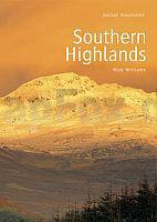
 | Southern Highlands Walking / Hiking Guide - Areas covered: Ben Lawers and Glen Lyon Fife and Kinross to Crieff and Callander, The Trossachs to the Mamlorn Hills, Loch Lomond and the Arrochar Alps to Inveraray, Hills of Crianlarich and Tyndrum - Nick Williams - POCKET MOUNTAINS LTD |
 | Neuseeland Travel & Touring Map + 10 Stadtpläne - Minimap (Blatt 18) 1:1.5 Mio / 1:20.000 Landkarte New Zealand Travel & Touring Map + 10 Central City and Town Maps - Minimap 18 Kiwimaps Ltd - Neuseeland |
 | 24 Veluwe zuid - Fahrradkarte 1:66.666 Veluwe zuid fietskaart Veluwe zuid - ANWB fietskaart 24 - ANWB - Niederlande |
 | 619 Son Parc - Menorca Amtliche topographische Landkarte 1:50.000 Spanien (M.T.N.) 619 Mapa Topográfico Nacional de Espana (MTN50) Instituto Geográfico Nacional - CNIG Spanien |
 | 823-I Javea / Xabia Amtliche topographische Landkarte 1:25.000 Spanien (M.T.N.) 823-I Mapa Topográfico Nacional de Espana (MTN25) Instituto Geográfico Nacional - CNIG Spanien |
 | Deutsche Ostsee (West) - Großraumkarte 1:250.000 - POSTER Topographische Landkarte ca. 90 x 80 cm Bundesamt für Kartographie und Geodäsie - ProjektNord |
 | Polen: Straßenkarte mit Touristischen Sehenswürdigkeiten 1:685.000 - Touristische Landkarte Polska Atrakcje Turystyczne mapa samochochodowa-turystyczna ExpressMap Polen |
 | 6 Feteira (Faial südwest - Azoren) - Topographische Karte Portugal 1:25.000 Carta Militar de Portugal - Série M889 - 1/25 000 (Acores) - Instituto Geográfico do Exército (IGeoE) - Portugal |
 | 1632 Großenbrode - Gestern und Heute - Historische Überlagerung 1932-1950 Topographische Landkarte 1:25.000 im Vergleich - Landesvermessungsamt Schleswig-Holstein / ProjektNord |
| 1323 Satrup - Gestern und Heute - Historische Überlagerung 1878-1880 Topographische Landkarte 1:25.000 im Vergleich - Landesvermessungsamt Schleswig-Holstein / ProjektNord |
 | 526-3 SERRADILLA DEL ARROYO Amtliche topographische Landkarte 1:25.000 Spanien (M.T.N.) 526-3 Mapa Topográfico Nacional de Espana (MTN25) Instituto Geográfico Nacional - CNIG Spanien |
| Wnory Topographische Karte 1:25.000 Messtischblatt des Deutschen Reiches - Preußische Landesaufnahme / Reichsamt für Landesaufnahme - Faksimile ProjektNord |
 | P424 Lestijärvi Topographische Karte 1:50.000 EUREF-FIN (Maastokarttat) Maanmittauslaitos / Lantmäteriverket Finnland - ProjektNord |
 | Maaspad (Wanderführer niederländisch) 1:50.000 wandelen naar de Noordzee in het stroomgebied van de Maas - von Nico Gerrits - Buijten en Schipperheijn |
 | 479 Peñaranda de Bracamonte Amtliche topographische Landkarte 1:50.000 Spanien (M.T.N.) 479 Mapa Topográfico Nacional de Espana (MTN50) Instituto Geográfico Nacional - CNIG Spanien |