 The 3rd Edition of Exploring Ireland`s Wild Atlantic Way is essential reading for anyone planning to visit the Atlantic coast of Ireland.
Whether looking for ideas for weekend adventures or visiting from abroad you will find everything you need within this guide. This book`s focus is on the outdoors - on getting out into the fresh air, the wind, the sun and the rain - and experiencing the incredible natural beauty found everywhere along the coast.
Written entirely by humans, no AI used! The authors spent years researching this book, it is the fruit of a lifetime of trips and time living on the Wild Atlantic Way.
Printed less than 20km from the Wild Atlantic Way by Walsh Colour Print in Castleisland, County Kerry.  Kartenausschnitt Kartenausschnitt
Kartenbeispiel
|
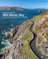
Exploring Ireland`s Wild Atlantic Way (3rd) A travel guide to the west coast of Ireland
EAN / ISBN: 9781068591204
Preis: EUR 34.90
|
|


