Willkommen bei MapFox
Wurde Ihre Bestellung bestätigt? Wenn nicht - gab es evtl. ein SERVER-Problem! Bitte kontaktieren Sie uns! +++ Buchhändler-Anfragen erwünscht +++
Warenkorb
Artikel: 0 - € 0.00
Zur Kasse
Impressum Kontakt Versandkosten AGB
USA - Pazifikküste 1:1 Mio. Von Vancouver bis San Diego - Landkarte
USA Pacific coast - From Vancouver to San Diego ITMB International Travel Maps (engl.)
<< USA
<< ITMB - International Travel Maps
 
Cover

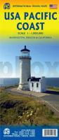
The entire Pacific Coast of America from Vancouver to San Diego. This map highlights regions of the entire stretch of Interstate 5 (I-5), from the Canadian border to the Mexican border, as well as other arterial highways, such as Hwy 99, the famous Hwy 101, and Interstate 395. Detailed road and touristic information covers all of Washington, Oregon, and California, along with most of Idaho and Nevada. Along the West Coast are some of the most famous cities of America, Vancouver, Seattle, Tacoma, Portland, Eugene, San Francisco, Sacramento, Los Angeles, Anaheim, and San Diego. This map is truly a must-have for travelers exploring America`s fascinating Pacific Coast.

Kartenausschnitt

Kartenbeispiel

USA - Pazifikküste 1:1 Mio. Von Vancouver bis San Diego - Landkarte
USA Pacific coast - From Vancouver to San Diego ITMB International Travel Maps (engl.)
EAN / ISBN: 9781771298605
Preis: EUR 12.90

sofort versandfertig Dieser Artikel ist im Normalfall sofort lieferbar.
Produkt EUR Anzahl Bestellen
USA - Pazifikküste 1:1 Mio. Von Vancouver bis San Diego - Landkarte
USA Pacific coast - From Vancouver to San Diego ITMB International Travel Maps (engl.)
12.90
Versandkostenfrei in Deutschland ab 30,- Bestellwert

incl. MwSt.

Stichworte, die bei der Suche nützlich sein könnten:
USA Westküste - United States of America - USA - Vereinigte Staaten von Amerika - USA Pazifikküste - Vereinigte Staaten von Amerika - United States - USA - U.S.A. - ITMB - ITM - International Travel Maps - ITMB Internationale Landkarten - ITB-Karten - ITMB-Karten - International Travel Maps and Books

Zuletzt angesehene Artikel:

CoverUSA - Pazifikküste 1:1 Mio. Von Vancouver bis San Diego - Landkarte
USA Pacific coast - From Vancouver to San Diego ITMB International Travel Maps (engl.)

Cover781-3 GARLITOS Amtliche topographische Landkarte 1:25.000 Spanien (M.T.N.)
781-3 Mapa Topográfico Nacional de Espana (MTN25) Instituto Geográfico Nacional - CNIG Spanien

Cover181 Kals - Matrei - Heiligenblut - Lienz 1:50.000 - Wanderkarte / Radwanderkarte / Wintersportkarte Österreich - GPS - Freytag & Berndt

Cover0214-3 SARROCA DE BELLERA Topographische Landkarte 1:25.000 Spanien (Grundlage MTN25) Instituto Geográfico Nacional - CNIG Spanien - ProjektNord

Cover191 - Topographische Landkarte Portugal 1:25.000 Carta Militar de Portugal - Série M888 Instituto Geográfico do Exército (IGeoE) - Portugal

Cover0512-3 HENCHE Topographische Landkarte 1:25.000 Spanien (Grundlage MTN25) Instituto Geográfico Nacional - CNIG Spanien - ProjektNord

Cover0615-2 LLUCENA/LUCENA DEL CID Topographische Landkarte 1:25.000 Spanien (Grundlage MTN25) Instituto Geográfico Nacional - CNIG Spanien - ProjektNord

Cover570-2 CATÍ Amtliche topographische Landkarte 1:25.000 Spanien (M.T.N.)
570-2 Mapa Topográfico Nacional de Espana (MTN25) Instituto Geográfico Nacional - CNIG Spanien

Cover0763-1 LA BERRUGA Topographische Landkarte 1:25.000 Spanien (Grundlage MTN25) Instituto Geográfico Nacional - CNIG Spanien - ProjektNord

CoverKrynica und Umgebung Landkarte 1:50.000 Wanderkarte / Landkarte
Okolice Krynicy mapa Rewasz - Polen

CoverGERA & Thüringer Vogtland Reiseführer: Weiße Elster Weg, Thüringer Lutherweg, Zeulenrodaer Talsperrenweg, Weidatalweg, Hohenwarte Stausee Weg - von Sabine Flöry und Jörg Schaar - REISE-KARHU

Cover204-3 ALBERITE Amtliche topographische Landkarte 1:25.000 Spanien (M.T.N.)
204-3 Mapa Topográfico Nacional de Espana (MTN25) Instituto Geográfico Nacional - CNIG Spanien

Cover0668-1 SONEJA Topographische Landkarte 1:25.000 Spanien (Grundlage MTN25) Instituto Geográfico Nacional - CNIG Spanien - ProjektNord

Noch kein Cover vorhanden1912SB Elbeuf - Bourgtheroulde-Infreville GPS Amtliche Topographische Wanderkarte Frankreich 1:25.000 - série bleue (IGN)

Noch kein Cover vorhandenN-33-72-A/B Stezyca Amtliche topographische Landkarte Polen 1:50.000
N-33-72-A/B Stezyca - Mapa Topograficzna Polski Glowny Geodeta Kraju

Cover0832-3 SÍJUELA Topographische Landkarte 1:25.000 Spanien (Grundlage MTN25) Instituto Geográfico Nacional - CNIG Spanien - ProjektNord

Cover0503 LAS VEGUILLAS Topographische Landkarte 1:50.000 Spanien (Grundlage MTN50) Instituto Geográfico Nacional - CNIG Spanien - ProjektNord

Cover0744-3 ALCALÁ DEL JÚCAR Topographische Landkarte 1:25.000 Spanien (Grundlage MTN25) Instituto Geográfico Nacional - CNIG Spanien - ProjektNord

CoverHerzogtum Gotha 1858 - Historische Landkarte Nachdruck Planokarte - gerollt von Bär, Joseph - Verlag Rockstuhl

Noch kein Cover vorhandenRaseiniai (45-49/45-49) Topografische Karte Litauen 1:50.000
Lietuvos Respublikos Topografinis Zemelapis 1:50.000 - Nacionaline Zemes Tarnyba - Litauen