Willkommen bei MapFox
Wurde Ihre Bestellung bestätigt? Wenn nicht - gab es evtl. ein SERVER-Problem! Bitte kontaktieren Sie uns! +++ Buchhändler-Anfragen erwünscht +++
Warenkorb
Artikel: 0 - € 0.00
Zur Kasse
Widerruf Impressum Kontakt Versandkosten AGB
Colorado Trail - Collegiate Loop 1:75.000 (Blatt 1203) Trails Illustrated Map Guide Colorado - National Parks USA - National Geographic
<< USA: Wanderkarten, Nationalpark-Karten
<< National Geographic
 
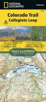
Cover

The Colorado Trail, Collegiate Loop Topographic Map Guide has been designed as the perfect traveling companion when navigating the Collegiate Loop section of The Colorado Trail. In 2012, the 83-mile Collegiate West route was added to The Colorado Trail as an alternate route to the Collegiate East section, creating the approximately 163-mile Collegiate Loop.

The Collegiate Loop Topographic Map Guide starts at the top end of the loop near Twin Lakes Reservoir. The trail tracks south along the eastern slope of Sawatch Range under the watchful gaze of several 14ers (fourteen-thousand foot peaks) until it joins the Continental Divide Trail near Monarch. The trail then turns north along the west side of the Sawatch Range as it crisscrosses the continental divide until finally finishing the loop back at Twin Lakes Reservoir. Each page is centered on the trail and overlaps with adjacent pages so there is little chance of getting lost. Along the bottom of each page is a trail profile that shows the distance between passes, camping areas, and trail access points. The map and trail profile provide a step by step visual guide to hiking the trail, mile by rugged mile.

Expertly researched and created in partnership with local land management agencies including The Colorado Trail Foundation, this map guide provides detailed topographic maps, interesting history, a 15 day itinerary, and a resupply location chart shows distances, and services available at each resupply point.

More convenient and easier to use than folded maps, but just as compact and lightweight, National Geographic`s Topographic Map Guide booklets are printed on "Backcountry Tough" waterproof, tear-resistant paper with stainless steel staples. A full UTM grid is printed on the map to aid with GPS navigation.

Kartenausschnitt

Kartenbeispiel

Colorado Trail - Collegiate Loop 1:75.000 (Blatt 1203) Trails Illustrated Map Guide Colorado - National Parks USA - National Geographic
EAN / ISBN: 9781566957229
Preis: EUR 16.95

Bestellartikel: versandfertig in ca. 1-3 Wochen. Dieser Artikel wird speziell für Sie bestellt. Keine Rücknahme!
Produkt EUR Anzahl Bestellen
Colorado Trail - Collegiate Loop 1:75.000 (Blatt 1203) Trails Illustrated Map Guide Colorado - National Parks USA - National Geographic 16.95
Versandkostenfrei in Deutschland ab 30,- Bestellwert

incl. MwSt.

Stichworte, die bei der Suche nützlich sein könnten:
Alpine Tunnel - Mount Princeton Hot Springs - Collegiate Loop - Cottonwood Pass - Colorado Trail - Clear Creek Reservoir - Twin Lakes Reservoir - Monarch Pass - USA Wanderkarten - USA Landkarten - USA Nationalparks - USA National Parks - USA maps - Vereinigte Staaten Landkarten - USA Nationalpark-Karten - National Geographic - National Geographic Landkarten

Zuletzt angesehene Artikel:

CoverColorado Trail - Collegiate Loop 1:75.000 (Blatt 1203) Trails Illustrated Map Guide Colorado - National Parks USA - National Geographic

CoverMARCO POLO Regionalkarte England Süd / Wales 1:350.000 2-Karten-Set

CoverMARCO POLO Länderkarte Neuseeland 1:1 Mio.

CoverBudapest (wasserfest) Stadtplan 1:30.000 Comfort - Cartographia Ungarn

Noch kein Cover vorhanden112.4 Amtliche topographische Karte 1:50.000 Polen

CoverWhangarei & Bay Of Islands Minimap 34 Kiwimaps Ltd - Neuseeland

CoverR 7 Luxemburg und Umgebung GPS 1:20.000 mit Wanderwegen - Wanderkarte Luxemburg

CoverNationalparkroute USA - Kalifornien Routenreiseführer - von Marion Landwehr - Conbook Medien

Noch kein Cover vorhanden3448-SW Topographische Karte 1:10.000 - Landesvermessungsamt Brandenburg

CoverRothaargebirge - Kahler Asten - Winterberg Topographische Wanderkarte mit Wanderwegen 1:50.000 - ProjektNord

CoverJakobsweg von der Rhön an die Donau - von Simon, Martin - Stein, Conrad, Verlag

CoverVins d`Armagnac 1:200.000 Armagnac Culture & Environnement - IGN Frankreich

CoverErlebnisurlaub mit Kindern Mallorca 40 Touren und Ausflüge - Bergverlag Rother

CoverUkraine - Moldawien Autokarte 1:1 Mio. Freytag & Berndt

Cover77 WEXFORD Wanderkarte Irland 1:50.000 DISCOVERY MAP - Ordnance Survey

Cover35 MARCO POLO Freizeitkarte Rhein, Neckar 1:100.000 wasserfest, reißfest

CoverMestre - Maghera Stadtplan 1:14.000
Mestre - Maghera - Pianta della Citta L.A.C. GlobalMap Italien

Noch kein Cover vorhanden1734SB Ribérac - Chalais GPS Amtliche Topographische Wanderkarte Frankreich 1:25.000 - série bleue (IGN)

CoverWhistler 1:50.000 / 1:250.000 - Landkarte - ITMB International Travel Reference Maps (engl.)

CoverEuropa 1:3.6 Mio. Landkarte Hallwag