 Kartenset mit zwei Wanderkarten:
Grand Teton National Park
Karte des Grand Teton National Park in Wyoming (USA). Mit touristischen Informationen sowie Routenvorschlägen. Mit GPS-Angaben und UTM-Gitter.
Die Landkarte enthält unter anderem: Jedediah Smith Wilderness National Elk Refuge Die Karte ist reiss- und wasserfest.
Yellowstone National Park:
Detaillierte Wanderkarte mit Wanderwegen. Enthält den Continental Divide Trail und viele für den Besucher des Yosemite Nationalparks relevante Informationen und Tipps. Die Karte besteht aus wasserfestem und reißfestem Material. GPS-kompatibel.  Kartenausschnitt Kartenausschnitt
Kartenbeispiel
|
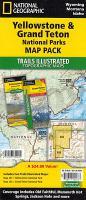
Yellowstone / Grand Teton National Parks (201, 202) 1:31.680 / 1:80.000/ 1:126.720 Landkarten-Set (2 Karten) - Trails Illustrated Maps - National Parks USA National Geographic
EAN / ISBN: 9781597754002
Preis: EUR 25.95
|
| 


