Willkommen bei MapFox
Wurde Ihre Bestellung bestätigt? Wenn nicht - gab es evtl. ein SERVER-Problem! Bitte kontaktieren Sie uns! +++ Buchhändler-Anfragen erwünscht +++
Warenkorb
Artikel: 0 - € 0.00
Zur Kasse
Widerruf Impressum Kontakt Versandkosten AGB
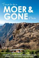
Things to do in Moer & Gone Places A guide to over 100 South Africa´s outdoor secrets - Activities - Accomodation - Amenities - Sights - MapStudio Südafrika
<< Afrika allgemein und länderübergreifend
<< MapStudio Südafrika
 
Cover

Things to do in Moer and Gone Places is a guide `to get away from it all` with over 100 places within South Africa, Zimbabwe, Botswana, Namibia, Lesotho, Swaziland and Mozambique.

The book covers all levels of accommodation, from a rustic cabin in the woods, to a 4-star self-catering lodge in the African bush. Each entry features a short description of the destination and the accommodation, and the range of activities available in the surrounding areas.

Take time out to relax and enjoy these remote places where you can do a thousand things, from outdoor activities and eco-experiences to eating, drinking and exploring these off-the-beaten-track places, and what to watch out for.

GPS coordinates and handy locator maps help you to get there easily.

Fantastic full-colour photographs of the accommodation and surrounds, including action and leisure sports.

Finding a remote holiday adventure is one page away!

Content Include:
- Hiking
- Cycling
- Fishing
- Swimming
- Birding
- Wildlife viewing
- Horse riding
- Cultural experiences
- Tasting local food and drink
- 4×4 trips? plus many more

An important information panel features driving directions with locator map and GPS coordinates, access, security, cell reception, Wi-Fi availability, website and contact details.

Things to do in Moer & Gone Places A guide to over 100 South Africa´s outdoor secrets - Activities - Accomodation - Amenities - Sights - MapStudio Südafrika
EAN / ISBN: 9781770269668
Preis: EUR 34.90

Bestellartikel: versandfertig in ca. 3-7 Tagen. Dieser Artikel wird speziell für Sie bestellt. Keine Rücknahme!
Produkt EUR Anzahl Bestellen
Things to do in Moer & Gone Places A guide to over 100 South Africa´s outdoor secrets - Activities - Accomodation - Amenities - Sights - MapStudio Südafrika 34.90
Versandkostenfrei in Deutschland

incl. MwSt.

Stichworte, die bei der Suche nützlich sein könnten:
South Africa Guide - Südliches Afrika Reiseführer - Southern Africa Guide - Afrika - Africa - MapStudio - Map Studio - Südafrika Landkarten - Südliches Afrika Landkarten - Südafrika Straßenatlanten - Südafrika Autoatlanten - Südafrika Autoatlas - Südafrika Straßenatlas - Lesotho - Swasiland - Botswana - Malawi - Sambia - Zambia - Mosambik - Mozambique - Afrika Landkarten

Zuletzt angesehene Artikel:

CoverThings to do in Moer & Gone Places A guide to over 100 South Africa´s outdoor secrets - Activities - Accomodation - Amenities - Sights - MapStudio Südafrika

Cover25 Wassersportkarte Spree-Dahme-Gewässer GPS Topographische Freizeitkarte Wassersport 1:50.000 Landesvermessung und Geobasisinformation Brandenburg

CoverBlatt 9B: Alpe Devero - Como 1:50.000 - Wanderkarte - Sentiero Italia Piemonte-Lombardia CAI - 4land / Idea Montagna
Carta itineraria del Sentiero Italia tratto Piemonte-Lombardia, da Alpe Devero/Formazza a Como 4land / Idea Montagna

CoverNeufchateau NGI 1:30.000 Touristische Mountainbikekarte Belgien mit 5 MTB-Touren

CoverSkarvheimen - Aurlandsdalen Wanderkarte Norwegen 1:50.000 (Blatt 2661) - Nordeca / UGLAND / Statens Kartverk Norwegen

CoverAltai Gebirge (Russland) topographische Landkarte 1:200.000 Altai Mountains Russia - Kazakhstan 1:200.000 - Central Asia - WEST COL PRODUCTIONS

CoverPilisgebirge und Visegrader Gebirge Atlas 1:40.000 Wanderatlas Ungarn (ungarisch) - Cartographia
Pilis - Visegrádi hegység

CoverOstallgäu, Pfaffenwinkel, Außerfern 1:70.000 (Nr. 3344) Fahrradkarte. GPS-genau. 1:70.000 (wasserfest) KOMPASS-Karten

CoverKyffhäuserkreis mit Geopark 1:50.000 Wanderkarte + Radwanderkarte Thüringen KKV - Kartographische Kommunale Verlagsgesellschaft

CoverLoonse Route GR564: Lommel - Huy 167 km Wandel-Gids Belgien (flämisch)
De Loonse route GR564 - von Lommel naar Huy GRSentiers - Grote Routepaden

CoverWallonie / Ardennen NGI Touristische Landkarte Belgien NGI Belgien

Cover018 Sound of Harris - North Uist - Taransay & St Kilda - Wanderkarte Großbritannien 1:50.000 LANDRANGER MAP - Ordnance Survey

CoverPordenone Provinzialautokarte - Straßenkarte 1:100.000 - Italien
Pordenone - Carta stradale della Provincia L.A.C. GlobalMap Italien

CoverPoelberg - Meikensbossen wandelnetwerk Wanderkarte 1:12.000 - Belgien Wandelnetwerk Westflandern

CoverTirana - Stadtplan 1:10.000 - freytag & berndt City Pocket, Innenstadtplan, wasserfest und reißfest - Freytag-Berndt und ARTARIA

Noch kein Cover vorhanden5149 Kurort Bad Gottleuba Amtliche Topographische Landkarte 1:25.000 (Präsentationsgrafik) - Landesvermessungsamt Sachsen

CoverC8326 Kempten im Allgäu Topographische Karte 1:100.000 - ProjektNord - Kartographie Bayrisches Landesvermessungsamt

CoverTrient Provinzialautokarte - Straßenkarte 1:150.000 - Italien
Trento - Carta stradale della Provincia - Italia L.A.C. GlobalMap Italien

CoverBlatt 5B: Rivisondoli - Amatrice 1:50.000 - Wanderkarte - Sentiero Italia CAI - Abruzzo-Lazio - 4land / Idea Montagna
Carta itineraria del Sentiero Italia tratto Abruzzo-Lazio, da Rivisondoli ad Amatrice 4land / Idea Montagna

CoverHochrhöner 1:35.000 Hikeline Fernwanderweg Wandern durch die Kuppenrhön und die Lange Rhön - Fernwanderweg, 11 Etappen - von Konrad Lechner - Esterbauer
