| << Großbritannien: Wanderkarten, Radwanderkarten und MTB-Karten << Geographers A-Z |
||
|
||
Zuletzt angesehene Artikel:
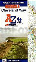
 | Cleveland Way A-Z Adventure Atlas Map 1:25.000 Wanderkarte Geographers` A-Z Großbritannien |
 | Republik Arzach 1:300.000 Straßenkarte Republic of Artsakh & Stepanakert Collage Ltd. |
 | Neretvatal (Blatt 31) Topographische Wanderkarte 1:25.000 - Serija Dinarske Alpe Dolina Neretve - Serija Dinarske Alpe - Mountaineering and Hiking map - Croatian Mountain Rescue Service Kroatischer Bergrettungsdienst - Kroatien |
 | 117 Chester & Wrexham - Ellesmere Port - Wanderkarte Großbritannien 1:50.000 LANDRANGER MAP - Ordnance Survey |
 | Ullsfjorden og Lyngen - Seekarte Norwegische Küste 1:50.000 - (Blatt 90) Den Norske Kyst Sjøkart - Hovedkart (sjø) Statens Kartverk Sjø - Norwegen |
 | Dolina Chocholowska (Tatra) Touristenkarte 1:25.000 - Serie Tatra-Ecken DOLINA CHOCHOŁOWSKA - Tatrzańskie zakątki PLAN Galileos - Polen |
 | 61/3-4 OUREN NGI 1:20.000 Topographische Landkarte Belgien |
 | Florenz regionale Straßenkarte Italien 1:100.000 - (Blatt 225) Carta Stradale Provinciale Firenze con Piante e Gli Stradari di Firenze, Fiesole, Bagno a Ripoli, Calenzano, Sesto Fiorentino, Campi Bisenzio, Osmannoro, Scandicci |
 | 254T INTERLAKEN - Jungfrauregion - OB.Thunersee - Brienzersee 1:50.000 Topographische Wanderkarte SAW der Schweiz - swisstopo |
| CG09 Topographische Landkarte Neuseeland 1:50.000 Land Information New Zealand |
 | 107 Umeå 1:50.000 (wasserfest) Topographische Wanderkarte - Sverigeserien Topo50 - Schweden Kartförlaget |
 | UK 50-9 Naturpark Steigerwald - südlicher Teil: Aischgrund - Bad Windsheim - Erlangen - Fürth - Kitzingen Wanderkarte Bayern 1:50.000 mit Wanderwegen und Radwanderwegen, GPS-Gitter - Landesamt für Digitalisierung, Breitband und Vermessung (Landesvermessungsamt Bayern) |
| CF06 Topographische Landkarte Neuseeland 1:50.000 Land Information New Zealand |
 | 1276 VAL BREGAGLIA 1:25.000 - Soglio - Pass da Sett/Septimerpass - Maloja - Topographische Landeskarte der Schweiz - swisstopo |
 | Aserbaidschan Ost und West + Ardabil 1:600.000 - Iranische Provinz Landkarte (Nr. 206) نقشه استان آذربايجان شرقي و غربی و اردبيل - Azarbayejan (East & west & Ardabil (Persian & English) Gitashenasi - Iran |
| Samnanger-, Bjørna- og Ytre Hardangerfjorden - Seekarte Norwegische Küste 1:50.000 - (Blatt 22) Den Norske Kyst Sjøkart - Hovedkart (sjø) Statens Kartverk Sjø - Norwegen |
| Långnäs - Sottunga Hafenkarte 162 - 1:25.000 Långnäs - Sottunga Satamakartta 162 - 1:25.000 Finnland |
 | L4342 Jessen (Elster) Topographische Karte 1:50.000 Landesamt für Vermessung und Geoinformation Sachsen-Anhalt (Landesvermessungsamt) |
 | 1332 BRISSAGO 1:25.000 - Cannobio - Gerra (Gambarogno) - Indemini - Topographische Landeskarte der Schweiz - swisstopo |
 | L1114 Westerland (Sylt) Topographische Landkarte 1:50.000 Landesvermessungsamt Schleswig-Holstein |