 This updated Bradt Outer Hebrides Guidebook is the only up-to-date guide to focus solely on Scotland’s Western Isles: the islands of Lewis, Harris, St Kilda, Berneray, North Uist, Benbecula, South Uist, Eriskay, Barra and Vatersay. Informed and intimate, this guidebook is ideal for people who travel with curious minds to discover places of great cultural, historical and wildlife interest. The Outer Hebrides is an archipelago of 15 inhabited islands and more than 50 others that are free of human footprint. It is perfect for a staycation where you can get off the beaten track, switching off from the modern world. Huge variations in landscape are found across the islands - from Lewisian gneiss, which dates back almost three billion years, to rugged Harris with its magnificent, almost unbroken sands running down its western flanks, and the undulating flatness and jagged sea lochs of the Uists. Here Gaelic is increasingly spoken (driven both by a strong sense of regional identity but also, unexpectedly, boosted by commitment from many incomers). Ancient monuments abound, from enigmatic 2,000-year-old brochs to Tobha Mor, the earliest Christian site on the Outer Hebrides. Here too are the Standing Stones of Callanish (where a vibrant new visitor centre opens in 2025) and the Uig peninsula (where the ?Lewis Chessmen’ were uncovered nearly 200 years ago). Nature-lovers can watch stunning seabird colonies, birds of prey, seals and red deer - or become absorbed in the machair, grassy coastal zones that are transformed into glorious carpets of wildflowers in late spring and summer. Walkers have an impressive choice of routes, while cyclists can enjoy the new Hebridean Way cycle trail. Alongside providing all the practical details you could ever need, experienced journalist Mark Rowe contextualises your visit with detailed and enlightening background information - from geography and geology to art and architecture, via extensive coverage of wildlife.  Kartenbeispiel Kartenbeispiel
|
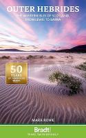
Outer Hebrides - Western Isles of Scotland Bradt travel guides (Paperback)
EAN / ISBN: 9781804692615
Preis: EUR 25.95
|
| 


