Willkommen bei MapFox
Wurde Ihre Bestellung bestätigt? Wenn nicht - gab es evtl. ein SERVER-Problem! Bitte kontaktieren Sie uns! +++ Buchhändler-Anfragen erwünscht +++
Warenkorb
Artikel: 0 - € 0.00
Zur Kasse
Widerruf Impressum Kontakt Versandkosten AGB
Cycling in Northumbria 21 hand-picked rides - von Hennessy, Huw - Bradt Guides
<< Großbritannien: Radwanderführer
<< Bradt Publications
 
Cover

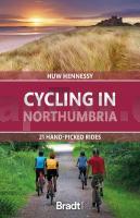
Bradt´s new cycling guide to Northumbria offers 21 routes covering County Durham, Tyne & Wear and Northumberland. Each ride includes comprehensive directions plus contextual features on history, wildlife and culture. Each links to OS Explorer maps (and, where relevant, National Cycle Network routes), while QR codes connect with downloadable GPX maps via the komoot app, enabling navigation by smartphone. With a dedicated bike-hire section (so you have an alternative if your bicycle isn´t suitable for a particular ride) and accommodation suggestions, this book is an indispensable travel companion for two-wheeled adventures. Northeast England is among the UK´s most dramatic and unspoilt regions, boasting long, sandy beaches, upland moors and forests. Its history is rich too, with Celtic, Viking and Roman sites in this battleground for successive border wars between the English and Scots. Majestic castles such as Bamburgh stand guard along its windswept coastline, while Holy Island´s Lindisfarne Castle once provided a haven to Christianity´s earliest missionaries and Alnwick Castle served as Hogwarts School in two Harry Potter films. Today, the region is becoming increasingly popular for cyclists, particularly off-road mountain biking, but is still a ?sleeping giant´ for its potential. Collectively totalling 355 miles, rides range from 9-26 miles and are typically suitable for half-day outings. Most are aimed at beginners and leisure cyclists, with several longer or more adventurous routes (including mountain-bike trails) for those craving greater challenge. Many are loop circuits, making travel hassle-free. Several follow established cycle routes, including the Cathedrals Cycle Route, Coast & Castles, Hadrian´s Cycleway (which broadly follows Hadrian´s Wall) and Pennine Cycleway, and can be linked for longer excursions. So whether you fancy exploring Northumberland National Park via six loop routes, bouncing around roller-coaster tracks in Kielder Forest, freewheeling from Antony Gormley´s Angel of the North statue to Newcastle´s rejuvenated riverfront, or enjoying wildlife by bike, Northumbria is a superb cycling destination with something for everyone - making Bradt´s Cycling in Northumbria brim with inspiration for cyclists of all ages and energy levels.

Cycling in Northumbria 21 hand-picked rides - von Hennessy, Huw - Bradt Guides
EAN / ISBN: 9781804690956
Preis: EUR 19.90

Bestellartikel: versandfertig in ca. 1-3 Wochen. Dieser Artikel wird speziell für Sie bestellt. Keine Rücknahme!
Produkt EUR Anzahl Bestellen
Cycling in Northumbria 21 hand-picked rides - von Hennessy, Huw - Bradt Guides 19.90
Versandkostenfrei in Deutschland ab 30,- Bestellwert

incl. MwSt.

Stichworte, die bei der Suche nützlich sein könnten:
Großbritannien - Großbritannien Radwanderführer - Großbritannien Fahrradführer - Großbritannien Radführer - Bradt Publications - Bradt Reiseführer

Zuletzt angesehene Artikel:

CoverCycling in Northumbria 21 hand-picked rides - von Hennessy, Huw - Bradt Guides

Cover144 Thetford & Diss - Breckland & Wymondham - Wanderkarte Großbritannien 1:50.000 Active Laminiert LANDRANGER MAP - Ordnance Survey

CoverGöttingen - Oberes Leinetal ADFC-Regionalkarte 1:75.000 BVA Bielefelder Verlag

CoverLunigiana - Golfo della Spezia - Riviera Apuana - Topographische Wanderkarte 1:50.000 (Blatt 702) Carta Turistica e dei Sentieri - Edizioni Multigraphic - Italien

CoverAlpi Apuane della Garfagnana - Topographische Wanderkarte 1:25.000 (Blatt 536) Carta Turistica e dei Sentieri - Edizioni Multigraphic - Italien

Noch kein Cover vorhanden512.32 Amtliche topographische Karte 1:25.000 Polen

CoverBaedeker Reiseführer La Palma, Hierro von Borowski, Birgit u. Bourmer, Achim, Fründt, Hans-Jürgen, Höhne, Wieland

Cover04-321 Topographische Karte 1:25.000 der Tschechischen Republik
Zakladní mapa Ceská republika Cesky urad zememericky a katastralni - ProjektNord

Cover203 Land`s End & Isles of Scilly, St Ives & Lizard Point - Wanderkarte Großbritannien 1:50.000 Active Laminiert LANDRANGER MAP - Ordnance Survey

CoverTedesco - Deutsch (italienische Ausgabe) - Wort für Wort Kauderwelsch-Sprachführer (Band 141) Reise-Know-How Verlag

Noch kein Cover vorhanden145.42 Amtliche topographische Karte 1:25.000 Polen

CoverSchottland, Wanderungen an den Küsten und in den Highlands (Nr. 5990) Wanderführer mit Extra-Tourenkarte, 63 Touren, GPX-Daten zum Download. - von Michael Will KOMPASS-Karten

Noch kein Cover vorhandenRepublik Tatarstan 1:200.000 Topographischer Regionalatlas
Tatarstan Respublika 439 CEWKF - Russland

CoverAppennino Bolognese e Pistoiese - Appennino Toscoemiliano - Topographische Wanderkarte 1:25.000 (Blatt 21) Carta dei Sentieri e Rifugi - Edizioni Multigraphic - Italien

CoverAppalachian Trail: Raven Rock to Swatara Gap (Blatt 1506) Topographic Map Guide - National Parks USA - Pennsylvania - wasserfest National Geographic

Noch kein Cover vorhanden274.14 Amtliche topographische Karte 1:25.000 Polen

Noch kein Cover vorhanden323.41 Amtliche topographische Karte 1:25.000 Polen

Cover32 MARCO POLO Freizeitkarte Odenwald - Rhein 1:100.000 wasserfest, reißfest

CoverTop Touren in Schweden
Toppturer i Sverige Calazo Förlag Schweden

CoverJämtlandsfjäll - Tagestouren ab Sylarna, Storulvån, Blåhammaren Wanderführer (schwedischsprachig)
Jämtlandsfjäll - dagsturer från Sylarna, Storulvån, Blåhammaren Vildmarksbiblioteket Schweden