Willkommen bei MapFox
Wurde Ihre Bestellung bestätigt? Wenn nicht - gab es evtl. ein SERVER-Problem! Bitte kontaktieren Sie uns! +++ Buchhändler-Anfragen erwünscht +++
Warenkorb
Artikel: 0 - € 0.00
Zur Kasse
Impressum Kontakt Versandkosten AGB
Madagascar Travel Guide Reiseführer (englisch) Bradt Publications
<< Madagaskar
<< Bradt Publications
 
Cover

A new, thoroughly updated 12th edition of Bradt`s Madagascar, the leading and most comprehensive guide to this unique island nation, written by Hilary Bradt, who first visited in 1976 and has returned roughly 35 times, and Daniel Austin, who has visited 12 times and continues to travel there annually. Bradt`s Madagascar is by far the most thorough guide to the country in English and is written and updated by established experts whose unparalleled knowledge of Madagascar combines with contributions from over 50 experts in a book which has been the most authoritative guide to the country for three decades. It covers national parks and protected areas and includes itineraries to suit all interests and budgets, plus details of around 1,000 hotels and restaurants.
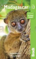
Madagascar is like nowhere else on earth. It is fascinating not only zoologically and botanically, but culturally, linguistically, historically and geologically. This vast island is the fourth largest in the world and also the oldest, which partly explains why it has evolved into an incredible hotspot for biodiversity, with a truly unique flora and fauna that is more than 80% endemic to the island, and with new species being described virtually on a daily basis. Madagascar is also the only place where you can see wild lemurs. Almost a quarter of the world`s 450-or-so primates exist only here.
With Bradt`s Madagascar you can visit tropical rainforest and seek out its incredible flora and fauna; explore otherworldly eroded limestone spires, most famously at Tsingy de Bemaraha National Park - Madagascar`s most striking landscape; discover the beach-fringed islands around Nosy Be with their fabulous scuba diving, snorkelling, kayaking, whale-watching and fishing opportunities; and make the most of a host of adventuring and sporting possibilities, including surfing, windsurfing, kitesurfing, rock climbing, tree climbing, caving, river trips, mountain biking, distance running, quad biking, trekking and hiking. Also covered are the UNESCO World Heritage Site of Ambohimanga; the renowned Avenue des Baobabs, one of the country`s most photographed scenes, and information on the best birdwatching spots: Madagascar has almost 300 avian species, with a high proportion of endemics, including five whole endemic families.

Kartenausschnitt

Madagascar Travel Guide Reiseführer (englisch) Bradt Publications
EAN / ISBN: 9781784776657
Preis: EUR 24.95

Bestellartikel: versandfertig in ca. 3-7 Tagen. Dieser Artikel wird speziell für Sie bestellt. Keine Rücknahme!
Produkt EUR Anzahl Bestellen
Madagascar Travel Guide Reiseführer (englisch) Bradt Publications 24.95
Versandkostenfrei in Deutschland ab 30,- Bestellwert

incl. MwSt.

Stichworte, die bei der Suche nützlich sein könnten:
Madagaskar - Madagascar - Bradt Publications - Bradt Reiseführer - Madagaskar - Madagaskar Radwanderkarten - Madagaskar Fahrradkarten - Madagaskar Landkarten - Madagaskar Radwanderführer - Madagaskar Straßenkarten - Madagaskarkarten - Madagaskar Kartografie - Madagaskar Wanderkarten - Madagaskar Karten - Madagaskar Landkartenverkauf - Madagaskar Atlanten - Madagaskar Reiseführer - Madagaskar Kartographie

Zuletzt angesehene Artikel:

CoverMadagascar Travel Guide Reiseführer (englisch) Bradt Publications

Cover239 ARLBERG 1:50.000 - St. Anton a. A. - Hoher Riffler - Paznauntal - Topographische Landeskarte der Schweiz - swisstopo

CoverN-34-61/62 Tczew Plot aus der Kartengrundlage der amtliche topographische Karte Polen 1:100.000 ProjektNord

CoverRadwandern in der Region Hildesheim Radwanderkarte - 1:50.000 - Bielefelder Verlag

CoverL3724 Hannover Amtliche topographische Karte 1:50.000 Landesvermessungsamt Niedersachsen

CoverThe Yorkshire Dales: North and East - 42 circular walks - Swaledale, Wensleydale, Nidderdale Wanderführer - Cicerone Großbritannien (englisch)

CoverGabrowo - Trjawna - Etar - Usana - Stadtplan 1:11.000
Gabrovo - Tryavna - Etar - Uzana Domino - Bulgarien

CoverRussland und Weißrussland (Blatt 10) - Von Moskau bis Brest - Straßenkarte 1:700.000
Россия Белоруссия - От Москвы до Бреста Merkurij

CoverWanderatlas Rund um Berlin 1:50.000 Hikeline Esterbauer

CoverN16 Altötting - mit Burghausen, Neuötting, Marktl, Burgkirchen a.d.Alz, Emmerting, Winhöring ATK25 Topographische Landkarte 1:25.000 (Atkis) Bayern Landesvermessungsamt Bayern - Wanderkarte

CoverW251 Albstadt Wanderkarte 1:25.000 - Obere Donau (Mitte) - Inzigkofen - Schwäbischer Albverein

CoverIstrien 9 - Umag mit Wanderwegen und Radwegen - Wanderkarte - Fahrradkarte 1:35.000 Kroatien - ProjektNord
Istra 9 - Umag

CoverCykelkartan Blad 1 Sydvästra Skåne Fahrradkarte Schweden 1:90.000 - Norstedts

Cover02-44 Steti Topographische Karte 1:50.000 der Tschechischen Republik
Zakladní mapa Ceská republika - Cesky urad zememericky a katastralni - ProjektNord

Noch kein Cover vorhandenGuernsey County County-Straßenkarte 1:63.000 (Ohio - USA)
Guernsey County county map GIS / Cartography & Publishing Services / GM Johnson

CoverBreslau / Wroclaw Stadtplan damals und heute 1:20.000 Stadtplan (deutschsprachig) Plan / Galileos - Polen PLAN Galileos - Polen

CoverF512 Freizeitkarte Unteres Taubertal - Tauberbischofsheim 1:50.000 - Landesvermessungsamt Baden-Württemberg

CoverFlensburg Süd - Fröruper Berge Topographische Wanderkarte mit Wanderwegen und Radwegen 1:25.000 Schleswig-Holstein - ProjektNord

Noch kein Cover vorhanden412.14 Amtliche topographische Karte 1:25.000 Polen

CoverD10 Hollfeld mit Aufseß - Kasendorf - Königsfeld - Stadelhofen - Thurnau - Wonsees ATK25 Topographische Karte 1:25.000 (Atkis) Bayern Landesvermessungsamt Bayern - Wanderkarte