Willkommen bei MapFox
Wurde Ihre Bestellung bestätigt? Wenn nicht - gab es evtl. ein SERVER-Problem! Bitte kontaktieren Sie uns! +++ Buchhändler-Anfragen erwünscht +++
Warenkorb
Artikel: 0 - € 0.00
Zur Kasse
Impressum Kontakt Versandkosten AGB
Yorkshire: North York Moors Wanderkarte 1:40.000 (wasserfest) - British Mountain Map - HARVEY MAPS
North York Moors
<< Großbritannien: Wanderkarten, Radwanderkarten und MTB-Karten
<< Harvey Maps
 
Cover

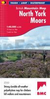
- The North York Moors on one sheet: the only really detailed map to cover this whole area on one sheet
- Includes the popular North Yorkshire Moors Railway and the Lyke Wake Walk
- Printed on polyethylene - durable, tear-resistant and 100% waterproof
- Made in cooperation with the British Mountaineering Council
- Colour shading for easy identification of hills and valleys
- Climbing crags are highlighted and climbing route diagrams included.
- Less than half the weight of a laminated map

Kartenausschnitt

Kartenbeispiel

Yorkshire: North York Moors Wanderkarte 1:40.000 (wasserfest) - British Mountain Map - HARVEY MAPS
North York Moors
EAN / ISBN: 9781851375103
Preis: EUR 28.90

sofort versandfertig Dieser Artikel ist im Normalfall sofort lieferbar.
Produkt EUR Anzahl Bestellen
Yorkshire: North York Moors Wanderkarte 1:40.000 (wasserfest) - British Mountain Map - HARVEY MAPS
North York Moors
28.90
Versandkostenfrei in Deutschland ab 30,- Bestellwert

incl. MwSt.

Stichworte, die bei der Suche nützlich sein könnten:
The Lyke Wake Walk - North York Moors National Park - North York Moors - Scarborough - Yorkshire - North Yorkshire Moors Railway - Großbritannien Wanderkarten - Großbritannien Fahrradkarten - Großbritannien Mountainbike-Karten - Harvey maps - Superwalker - Schottland Wanderkarten - Großbritannien Wanderkarten - Harvay - Harway Maps - Britsh Mountain Maps - BMC - Ultramaps - XT40 - XT25 - Great Britain walking maps - UK hiking maps - Scotland hiking maps - Harveymaps - UK Walking maps - Great Britain walking maps

Zuletzt angesehene Artikel:

CoverYorkshire: North York Moors Wanderkarte 1:40.000 (wasserfest) - British Mountain Map - HARVEY MAPS
North York Moors

CoverMount Everest 1:50.000 - Trekkingkarte Schweizerische Stiftung für Alpine Forschung / Swiss foundation for Alpine Research - Boston Museum of Science

CoverSextner Dolomiten - Dolomiti di Sesto 1:25.000 (Blatt 625) Wanderkarte mit Radtouren. GPS-genau. KOMPASS

CoverItalien Laminierte PLANO-Karte 1:1.76 Mio. (Format: 59 x 87 cm) - gerollt im Plastikrohr
Italy flat map - laminated National Geographic

CoverHistoric Walks in Cheshire A collection of 20 scenic walks - Wanderführer North West England - Cicerone Großbritannien (englisch)

Cover10 MARCO POLO Freizeitkarte Bremen, Oldenburg und Umgebung 1:100.000 wasserfest, reißfest

CoverLofoten, Vesterålen und Senja (Nr. 5982) Wanderführer mit Extra-Tourenkarte, 70 Touren, GPX-Daten zum Download - KOMPASS-Karten

Cover11 Ostwestfalen / Sauerland ADFC-Radtourenkarte 1:150.000 Bielefelder Verlag

Cover3424 Wedemark Topographische Wanderkarte 1:25.000 Niedersachsen mit Wanderwegen - ProjektNord

CoverWorpswede Topographische Wanderkarte mit Wanderwegen und Radwegen 1:25.000 Niedersachsen - ProjektNord

CoverKieler Förde - Fehmarn - Holsteinische Schweiz ADFC-Regionalkarte 1:75.000 BVA Bielefelder Verlag

Noch kein Cover vorhanden91 Mährische Slowakei - Göding Wanderkarte Tschechien 1:50.000 - KCT - Papierausgabe
91 Slovacko - Hodoninsko

Cover106 Erzgebirge - Brüx Fahrradkarte Tschechien 1:60.000
Krusné hory - Mostecko - SHOCart

CoverMayrhofen, Tuxer Tal, Zillergrund (Nr. 037) 1:25.000 - Wanderkarte mit Broschüre KOMPASS

Cover2315-III Hadsten Topographische Karte Dänemark 1:50.000 - Kort & Matrikelstyrelsen ProjektNord

Cover134 Oberpfälzer Wald - Taus Fahrradkarte Tschechien 1:60.000
Ceský les - Domazlicko - SHOCart

Noch kein Cover vorhandenBA35 Whitianga Topographische Landkarte Neuseeland 1:50.000 Land Information New Zealand

CoverWalking on Gran Canaria - 45 day walks incl. 5 days an the GR131 coast-to-coast route Cicerone Wanderführer (englisch)

CoverC4750 Hoyerswerda - Topografische Karte 1:100.000 Normalausgabe mit UTM-Gitter (WGS84) - Landesvermessungsamt Sachsen

CoverBR28 Blenheim Topographische Landkarte Neuseeland 1:50.000 Land Information New Zealand