 Entire route on one map
This is a 48km (30 miles) long distance path which links together three of Scotlands`s Great Trails: the West Highland Way, the Rob Roy Way and the Three Lochs Way.
The Great Trossachs Path is a fantastic walk on its own or can be extended by connecting to one of the other Great Trails. Other waymarked routes within the Great Trossachs Forest are also shown and the map includes a generous amount of the fine broadleaved woodland of the Forest north and south of the Trail.
The Path is suitable for walkers and cyclists.  Kartenausschnitt Kartenausschnitt
Kartenbeispiel
|
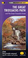
The Great Trossachs Path & The Great Trossachs Forest - XT40 Wanderkarte 1:40.000 waterproof - HARVEY MAPS Schottland
EAN / ISBN: 9781851375400
Preis: EUR 15.90
|
|

