Willkommen bei MapFox
Wurde Ihre Bestellung bestätigt? Wenn nicht - gab es evtl. ein SERVER-Problem! Bitte kontaktieren Sie uns! +++ Buchhändler-Anfragen erwünscht +++
Warenkorb
Artikel: 0 - € 0.00
Zur Kasse
Impressum Kontakt Versandkosten AGB
Short Walks in Lakeland Book 3: West Lakeland Wanderführer Lake District - Cicerone Großbritannien (englisch)
<< Großbritannien: Wanderführer + Kletterführer
<< Cicerone
 
Cover

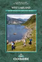
The third and final guidebook book in the Short Walks in Lakeland trilogy, the series also covers walking routes in the South Lake District (book 1) and North Lake District (book 2).

This guide covers 50 walking routes around the Duddon Valley and the coast, Eskdale, Wasdale, Ennerdale and the coast, Lorton Vale, Buttermere and the north-west. The walks described are generally between 4 and 8 miles - enough to pleasantly fill a good half-day, and ideal for day visitors and family walkers.

Priority is given to the lower fells and dales, which include many worthwhile summits. Some of the walks are classics and well used. Others seek out lonely tracks which are still green and a joy to walk. Interesting features are pointed out along the way, whilst the specially drawn maps help with navigation.

The combination of detailed description and clear, easy-to-follow maps and evocative sketches makes this book ideal for anyone who wants to explore West Lakeland.

Kartenausschnitt

Short Walks in Lakeland Book 3: West Lakeland Wanderführer Lake District - Cicerone Großbritannien (englisch)
EAN / ISBN: 9781852843083
Preis: EUR 19.90

Bestellartikel: versandfertig in ca. 3-7 Tagen. Dieser Artikel wird speziell für Sie bestellt. Keine Rücknahme!
Produkt EUR Anzahl Bestellen
Short Walks in Lakeland Book 3: West Lakeland Wanderführer Lake District - Cicerone Großbritannien (englisch) 19.90
Versandkostenfrei in Deutschland ab 30,- Bestellwert

incl. MwSt.

Stichworte, die bei der Suche nützlich sein könnten:
Lake District - Lakeland - Cicerone - Cicerone Radwanderführer - Cicerone Wanderführer - Großbritannien Radwanderführer - Großbritannien Wanderführer - Cicerone Großbritannien - Großbritannien - Großbritannien Wanderführer - Großbritannien Trekkingführer - Großbritannien Klettern - Großbritannien Kletterführer

Zuletzt angesehene Artikel:

CoverShort Walks in Lakeland Book 3: West Lakeland Wanderführer Lake District - Cicerone Großbritannien (englisch)

CoverCape Wrath Trail North XT40- Wanderkarte 1:40.000 Strathcarron to Cape Wrath - Long Distance Walk - waterproof - HARVEY MAPS Großbritannien

CoverWashington State Straßenkarte 1:1.25 Mio. (engl.) GuideMap National Geographic - USA

CoverBreisgau 1:75.000 (Blatt RK-BW09) bikeline-Radkarte Deutschland Esterbauer

CoverArrochar Alps XT40 ultra - Wanderkarte 1:40.000 Harvey Maps Großbritannien

CoverUsedom - mit Wollin und Stettiner Haff - 46 Touren. Mit GPS-Daten - Rother Wanderführer von Manfred Schmid-Myszka - Bergverlag Rother

Noch kein Cover vorhanden314.42 Amtliche topographische Karte 1:25.000 Polen

CoverSüdamerika, politisch 1:8 Mio. Planokarte gerollt (97x128 cm) freytag & berndt

Noch kein Cover vorhanden156.1 Amtliche topographische Karte 1:50.000 Polen

Noch kein Cover vorhanden153.31 Amtliche topographische Karte 1:25.000 Polen

CoverJemen - Golf von Aden Geographische Landkarte
Yemen - Gulf of Aden GiziMap

Cover37 Nationalpark Val Müstair - Wanderkarte Schweiz 1:40.000 wasserfest - Kümmerly & Frey

CoverGanz Brandenburg 76 Ausflüge in die Mark - via reise

Cover31C ALPHEN AAN DEN RIJN Topographische Karte der Niederlande 1:25.000 (Plotausgabe)
31C ALPHEN AAN DEN RIJN Topografische Kaart van Nederland Kadaster - ProjektNord

Noch kein Cover vorhanden335.3 Amtliche topographische Karte 1:50.000 Polen

CoverSamothraki Best of - Landkarte + Führer
Best of Samothraki - Map + Guide Road Editions - Nakas Road Cartography - Griechenland

Cover1206 GUGGISBERG 1:25.000 Topographische Landeskarte der Schweiz - swisstopo

CoverNordfriesland Sylt, Amrum, Föhr, Halligen, Husum, St. Peter-Ording, Eiderstedt und Hinterland. Mit Wanderungen und Radtouren - von Lachenmann, Bürte - TRESCHER Verlag

Cover71 Hallstavik 1:50.000 (wasserfest) Topographische Wanderkarte - Sverigeserien Topo50 - Schweden Kartförlaget

CoverI07 Wassertrüdingen - Ornbau, Bechhofen, Ehingen, Weiltingen, Arberg, Dentlein a.Forst ATK25 Topographische Karte 1:25.000 (Atkis) Bayern Landesvermessungsamt Bayern - Wanderkarte