Willkommen bei MapFox
Wurde Ihre Bestellung bestätigt? Wenn nicht - gab es evtl. ein SERVER-Problem! Bitte kontaktieren Sie uns! +++ Buchhändler-Anfragen erwünscht +++
Warenkorb
Artikel: 0 - € 0.00
Zur Kasse
Widerruf Impressum Kontakt Versandkosten AGB
The GR10 Trail - Coast to Coast through the French Pyrenees - Wanderführer - Cicerone (englisch)
<< Frankreich: Pyrenäen
<< Spanien: Pyrenäen
<< Cicerone
 
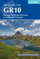
Cover

Guidebook to the GR10, a 955km trek across the French Pyrenees from Hendaye on the Atlantic Coast to the Mediterranean coast at Banyuls-sur-Mer. Described in 55-day stages, the route can be completed in its entirety, or in shorter sections using the bus and rail links found throughout the Pyrenees.

Step by step route descriptions are accompanied by 1:100,000 mapping and gradient profiles. Useful practical information is also included such as when to go, getting there and back, camping, accessing fuel and water, plus handy equipment tips and more.

The easiest, oldest and most popular of the three long-distance routes that traverse the mountain range, the GR10 is well waymarked and follows good mountain paths. For many walkers, the highlight of the route is the magnificent wildflowers and associated butterflies. For others, it’s the spectacular mountain terrain, while those keen on bird watching will delight in scanning the sky for the many varieties of birds of prey that can be seen in the region, from the massive Griffon vulture to the distinctly coloured Egyptian vulture. 

Kartenausschnitt

Kartenbeispiel

The GR10 Trail - Coast to Coast through the French Pyrenees - Wanderführer - Cicerone (englisch)
EAN / ISBN: 9781786311160
Preis: EUR 28.90

Bestellartikel: versandfertig in ca. 3-7 Tagen. Dieser Artikel wird speziell für Sie bestellt. Keine Rücknahme!
Produkt EUR Anzahl Bestellen
The GR10 Trail - Coast to Coast through the French Pyrenees - Wanderführer - Cicerone (englisch) 28.90
Versandkostenfrei in Deutschland ab 30,- Bestellwert

incl. MwSt.

Stichworte, die bei der Suche nützlich sein könnten:
French Pyrenees - GR10 Trail - Pyrenäen - GR10 Fernwanderweg - Cicerone - Cicerone Radwanderführer - Cicerone Wanderführer - Großbritannien Radwanderführer - Großbritannien Wanderführer - Cicerone Großbritannien - Pyrenäen - Pyrenäen Wanderführer - Pyrenäen

Zuletzt angesehene Artikel:

CoverThe GR10 Trail - Coast to Coast through the French Pyrenees - Wanderführer - Cicerone (englisch)

CoverLëtzebuergesch, AusspracheTrainer (Audio-CD) Kauderwelsch AusspracheTrainer auf CD Reise-Know-How Verlag

CoverAlbania Travel Guide Reiseführer (englisch) Bradt Publications

CoverJacoline`s small hotels in Greece (engl.) Terrain - Griechenland

CoverParque Natural Cañón del Río Lobos (CRL) Wanderkarte 1:25.000 - Editorial Piolet - Spanien

CoverIrland Straßenkarte 1:400.000 (Blatt 712) Michelin

CoverTamil - Wort für Wort Kauderwelsch-Sprachführer (Band 039) Reise-Know-How Verlag

CoverHamburg Poster 70 x 100 cm - von Nina Simone Wilsmann - Vianina

CoverCosenza Stadtplan 1:6.000
Cosenza - Pianta della Citta L.A.C. GlobalMap Italien

CoverSchwarzwald - Bodensee 1:200.000 Straßenkarte Kümmerly + Frey

Noch kein Cover vorhanden2542OT CAMARES - AVENE GPS Topographische Wanderkarte Frankreich 1:25.000 TOP 25 IGN - (GPS)

CoverTop End and Gulf 1:1.65 Mio. - Regionale Straßenkarte Australien - HEMA Maps

CoverKyrgyztan Guide Reiseführer (englisch) Bradt Publications

CoverStockholm CityTrip - von Lars Dörenmeier & Stefan Krull - Reise Know-How Verlag

CoverAlessandria Stadtplan 1:10.000
Alessandria - Pianta della Citta L.A.C. GlobalMap Italien

CoverDiscover The Orkney Islands - Visitor Map and Guide 1:100.000 (wasserfest) Footprint Maps - Stirling Surveys

CoverKambodscha - Angkor 1:1.5 Mio. Nelles-Map
Cambodia Angkor Nelles-Verlag

CoverParis Plan Poche Taschen-Stadtplan 1:20.000 (Blatt 050) Michelin

Noch kein Cover vorhanden2313OT FORETS DE MONTMORENCY Topographische Wanderkarte Frankreich 1:25.000 TOP 25 IGN - (GPS)

CoverDUMONT direkt Korfu von Bötig, Klaus