Willkommen bei MapFox
Wurde Ihre Bestellung bestätigt? Wenn nicht - gab es evtl. ein SERVER-Problem! Bitte kontaktieren Sie uns! +++ Buchhändler-Anfragen erwünscht +++
Warenkorb
Artikel: 0 - € 0.00
Zur Kasse
Impressum Kontakt Versandkosten AGB
Historic Walks in North Yorkshire A collection of 20 scenic walks - Wanderführer - Cicerone Großbritannien (englisch)
<< Großbritannien: Wanderführer + Kletterführer
<< Cicerone
 
Cover

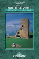
Historic Walks in North Yorkshire attempts to reveal some of the splendours of this land of the ?broad acres’. Accompanied by OS mapping and illustrated with colour photographs, the series of walks combine landscape with architecture, natural beauty with history, and our heritage with our diverse and complex culture.

By approaching these historic sites on foot, a greater appreciation of their being, purpose and geographical setting are gained, along with the satisfaction of reaching the place under your own steam, watching its contours and outline unfold, as well as sharing an experience common to the ancient and ancestral people who once developed, built and inhabited them.

The book describes 20, mostly circular, walks. They have both a scenic and historical appeal, taking you from open moorland and exposed sections of hillside and cliff to the more sheltered dales and the streets of York.

Kartenausschnitt

Historic Walks in North Yorkshire A collection of 20 scenic walks - Wanderführer - Cicerone Großbritannien (englisch)
EAN / ISBN: 9781852843892
Preis: EUR 19.90

Bestellartikel: versandfertig in ca. 3-7 Tagen. Dieser Artikel wird speziell für Sie bestellt. Keine Rücknahme!
Produkt EUR Anzahl Bestellen
Historic Walks in North Yorkshire A collection of 20 scenic walks - Wanderführer - Cicerone Großbritannien (englisch) 19.90
Versandkostenfrei in Deutschland ab 30,- Bestellwert

incl. MwSt.

Stichworte, die bei der Suche nützlich sein könnten:
Yorkshire and the Humber - North Yorkshire - Yorkshire - Cicerone - Cicerone Radwanderführer - Cicerone Wanderführer - Großbritannien Radwanderführer - Großbritannien Wanderführer - Cicerone Großbritannien - Großbritannien - Großbritannien Wanderführer - Großbritannien Trekkingführer - Großbritannien Klettern - Großbritannien Kletterführer

Zuletzt angesehene Artikel:

CoverHistoric Walks in North Yorkshire A collection of 20 scenic walks - Wanderführer - Cicerone Großbritannien (englisch)

Cover2021 Burg (Dithmarschen) Topographische Landkarte 1:25.000 Landesvermessungsamt Schleswig-Holstein

Cover13 Selenge Aimag 1:500.000 Touristische Landkarte
Selenge Aymag - Сэлэнгэ Аймаг - газрын зураг - Монсудар Monsudar - Mongolei

Noch kein Cover vorhanden2654 Altdamm Topographische Karte 1:25.000 Messtischblatt des Deutschen Reiches - Preußische Landesaufnahme / Reichsamt für Landesaufnahme - Faksimile ProjektNord

Cover2: Ostflandern und Hennegau Wanderkarte 1:85.000
GR Oost-Vlaanderen & Henegouwen wandelkaart Alta Via - Belgien

Cover16 S-Gravenhage (Den Haag) *** SCHNÄPPCHEN *** Topographische Karte der Niederlande 1:100.000 (Plotausgabe) kadaster - Topografische Dienst / ProjektNord

Noch kein Cover vorhanden242.24 Amtliche topographische Karte 1:25.000 Polen

CoverMallorca - Tramuntana Nord E25 1:25.000
Mallorca - Tramuntana Norte Wanderkarte - ALPINA

Cover1/4 Frankreich Nordwest (Blatt 706) 1:500.000 Straßen- und Tourismuskarte Frankreich - Michelin

Noch kein Cover vorhanden2522SB COSNE - COURS-SUR-LOIRE - DONZY GPS Amtliche Topographische Wanderkarte Frankreich 1:25.000 - série bleue (IGN)

Noch kein Cover vorhanden2820SB Tonnerre - Ancy-le-Franc GPS Amtliche Topographische Wanderkarte Frankreich 1:25.000 - série bleue (IGN)

Cover198 Topographische Landkarte Wanderkarte und Fahrradkarte Portugal 1:25.000
198 Mapa topográfico - Mapa de caminhadas - Portugal 1:25.000 ProjektNord

Cover5820 Langenselbold Topographische Landkarte Hessen 1:25.000 - ProjektNord (geplottete Ausgabe)

CoverGalicica - Baba 1:25.000 Wanderkarte
Galičica - Baba Balkan Hiking Adventure

Cover175 Reading & Windsor - Henley-on-Thames & Bracknell - Wanderkarte Großbritannien 1:50.000 LANDRANGER MAP - Ordnance Survey

CoverHügelland von Gödöllö Topographische Wanderkarte 1:50.000 *** SCHNÄPPCHEN *** Touristische topographische Karte
Gödöllői-dombság - Tápio-mente - Pesti-síkság, Gödöllői várostérkép Szarvas - Dimap - Faragó - Ungarn

Cover1131 03 KETTELI Topographische Karte 1:20.000 (Maastokartta / Peruskartta / Grundkarta) Maanmittauslaitos / Lantmäteriverket Finnland - ProjektNord

Cover1937 Hanstorf Amtliche Topographische Karte 1:25.000 Landesvermessungsamt Mecklenburg-Vorpommern

Cover2122 08 Vatula Topographische Karte 1:20.000 (Maastokartta / Peruskartta / Grundkarta) Maanmittauslaitos / Lantmäteriverket Finnland - ProjektNord

Noch kein Cover vorhandenNL 33-02-28 Ost (4228-Ost) Gratwein Österreichische Karte 1:25.000 mit Wegmarkierungen (topographische Wanderkarte - UTM) - BEV - Österreich - Vergrößerung (ÖK25V)