Willkommen bei MapFox
Wurde Ihre Bestellung bestätigt? Wenn nicht - gab es evtl. ein SERVER-Problem! Bitte kontaktieren Sie uns! +++ Buchhändler-Anfragen erwünscht +++
Warenkorb
Artikel: 0 - € 0.00
Zur Kasse
Widerruf Impressum Kontakt Versandkosten AGB
The Hillwalker`s Guide to Mountaineering Essential Skills for Britain`s classic routes - Cicerone (englisch)
<< Großbritannien: Wanderführer + Kletterführer
<< Cicerone
 
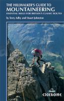
Cover

There was a time when climbing and walking were completely distinct activities. But as the number of people getting out to enjoy the wonders and challenges of Britain`s mountains has grown, the definition of a mountain `walk` has changed. The Hillwalker`s Guide to Mountaineering features the techniques, gear and approaches that the active and ambitious hillwalker needs to be equipped with to competently tackle Britainís classic mountaineering challenges, from the tricky step of Broad Stand on the traverse from Scafell Pike to Sca Fell, to the mighty Tower Ridge on Ben Nevis. The Hillwalker`s Guide to Mountaineering guides the hillwalker through technical terrain where the unaware can all too easily fall off - awkward grade 1-3 scrambling territory. Use of the rope to abseil, belay and protect ascents and descents on steep ground, the placement of protection, gear selection, navigation, survival, scrambling and first aid skills are all dealt with in a highly practical manner, as are the basic skills required for safe travel by the winter hillwalker. The guide goes on to feature a dozen great British mountaineering routes, such as the spectacular objectives of the Aonach Eagach in Glen Coe, Pinnacle Ridge in the Lake District, the Cneifion Arete in Snowdonia, and a big day out on Skye`s wonderful Cuillin Ridge. The routes are often characterised by an increasing level of difficulty. Here the practical skills focused on may, in the context of a thorough and systematic mountaineering apprenticeship, be successfully applied when (but not before) the techniques, abilities and confidence, essential to tackle each route safely, have been acquired and practised.

The Hillwalker`s Guide to Mountaineering Essential Skills for Britain`s classic routes - Cicerone (englisch)
EAN / ISBN: 9781852843939
Preis: EUR 21.90

Bestellartikel: versandfertig in ca. 3-7 Tagen. Dieser Artikel wird speziell für Sie bestellt. Keine Rücknahme!
Produkt EUR Anzahl Bestellen
The Hillwalker`s Guide to Mountaineering Essential Skills for Britain`s classic routes - Cicerone (englisch) 21.90
Versandkostenfrei in Deutschland ab 30,- Bestellwert

incl. MwSt.

Stichworte, die bei der Suche nützlich sein könnten:
Mountaineering - Hillwalker - Cicerone - Cicerone Radwanderführer - Cicerone Wanderführer - Großbritannien Radwanderführer - Großbritannien Wanderführer - Cicerone Großbritannien - Großbritannien - Großbritannien Wanderführer - Großbritannien Trekkingführer - Großbritannien Klettern - Großbritannien Kletterführer

Zuletzt angesehene Artikel:

CoverThe Hillwalker`s Guide to Mountaineering Essential Skills for Britain`s classic routes - Cicerone (englisch)

Noch kein Cover vorhanden3746-SO Topographische Karte 1:10.000 - Landesvermessungsamt Brandenburg

CoverMooré für Burkina Faso - Wort für Wort Kauderwelsch-Sprachführer (Band 196) Reise-Know-How Verlag

Noch kein Cover vorhanden2844-SO Topographische Karte 1:10.000 - Landesvermessungsamt Brandenburg

Noch kein Cover vorhanden4344-NW Topographische Karte 1:10.000 - Landesvermessungsamt Brandenburg

CoverPanama The premier guidebook for Business Globetrotters (englisch)
Nigeria eBiz Guides

Cover060 Islay - Wanderkarte Großbritannien 1:50.000 Active Laminiert LANDRANGER MAP - Ordnance Survey

CoverSerra de Montsià - Serra de Godall (SMG) Wanderkarte 1:20.000 - Editorial Piolet - Spanien

CoverOstsauerland - Marsberg - Aabachtalsperre Topographische Wanderkarte mit Wanderwegen 1:25.000 - ProjektNord

CoverEntdeckertouren mit dem Wohnmobil Südwestfrankreich - Dordogne, Lot und südliche Atlantikküste - WOMO-Verlag

Noch kein Cover vorhanden3142-SO Topographische Karte 1:10.000 - Landesvermessungsamt Brandenburg

Noch kein Cover vorhanden3743-NO Topographische Karte 1:10.000 - Landesvermessungsamt Brandenburg

Noch kein Cover vorhanden2841-NW Topographische Karte 1:10.000 - Landesvermessungsamt Brandenburg

Cover48 Oddi Topographische Karte Island 1:100.000 - Ferdakort
48 ODDI - Atlaskort - Ferðakort

CoverPI10 Manihiki (Cookinseln) Topographische Landkarte 1:25.000 - Land Information New Zealand

CoverHautes-Alpes: 92 itinéraires VTT MTB-Führer (französisch) Guide VTOPO Frankreich

CoverSandomir und Umgebung - Wanderkarte 1:50.000 WZKART (Polen)
Sandomierz i okolice

CoverC3938 Belzig Topographische Karte 1:100.000 (Regelblattschnitt) Landesvermessungsamt Brandenburg

Cover14 MARCO POLO Freizeitkarte Hannover, Südheide 1:100.000 wasserfest, reißfest

Noch kein Cover vorhandenGebiet Talas - Landkarte 1:400.000
Talas oblast 1:400 000 - Kirgisistan