Willkommen bei MapFox
Wurde Ihre Bestellung bestätigt? Wenn nicht - gab es evtl. ein SERVER-Problem! Bitte kontaktieren Sie uns! +++ Buchhändler-Anfragen erwünscht +++
Warenkorb
Artikel: 0 - € 0.00
Zur Kasse
Widerruf Impressum Kontakt Versandkosten AGB
Walking in Bulgaria`s National Parks - Pirin, Rila and Central Balkan National Parks - Wanderführer - Cicerone (englisch)
<< Bulgarien
<< Cicerone
 
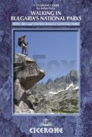
Cover

For walkers and naturalists, Bulgaria is a paradise. There is an amazing variety of landscapes and a rich biodiversity, yet mountains dominate much of the country. The treks in this guidebook are based in the Pirin, Rila and Central Balkan national parks which cover the three wildest and most majestic mountain regions of Bulgaria.

This guidebook contains route descriptions for 12 two to four-day treks, including one single day trek, that cover spectacular scenery and offer an unrivalled opportunity to encounter some of Europe’s rarest plants and animals. Each walk is broken down into day stages with each stage finishing at either a mountain hut or another suitable source of accommodation. The distance of each trek varies from 7 to 61km in length and covers a variety of terrain including panoramic ridges over Musala and Vihren, the two highest peaks in the country.

The walks in this guidebook are challenging and are aimed at fit, experienced mountain walkers. The trails are often physically demanding, with long steep ascents and descents, often over rocks and boulders. Furthermore, most of the ridge walks require a good head for heights - especially the exposed scramble along the Koncheto crest (Walk 12). Be sure to read the route description carefully before setting out.

As well as providing detailed route descriptions for many of the most outstanding walks offered by these three national parks, it also contains a great deal of background information about the history and geography of places passed along the trails, along with comprehensive details of the wildlife likely to be seen.

Kartenausschnitt

Walking in Bulgaria`s National Parks - Pirin, Rila and Central Balkan National Parks - Wanderführer - Cicerone (englisch)
EAN / ISBN: 9781852845742
Preis: EUR 22.90

Dieser Titel ist momentan nicht lieferbar.
Produkt EUR Anzahl Bestellen
Walking in Bulgaria`s National Parks - Pirin, Rila and Central Balkan National Parks - Wanderführer - Cicerone (englisch) 22.90
Versandkostenfrei in Deutschland ab 30,- Bestellwert

incl. MwSt.

Stichworte, die bei der Suche nützlich sein könnten:
Bulgaria - Balkangebirge - Rila - Rila Gebirhe - Pirin - Pirin Gebirge - Bulgarien National Park - Balkan - Bulgarien - Cicerone - Cicerone Radwanderführer - Cicerone Wanderführer - Großbritannien Radwanderführer - Großbritannien Wanderführer - Cicerone Großbritannien - Bulgarien Landkarten - Bulgarien Reiseführer - Bulgarien Stadtpläne - Bulgarien Wanderkarten

Zuletzt angesehene Artikel:

CoverWalking in Bulgaria`s National Parks - Pirin, Rila and Central Balkan National Parks - Wanderführer - Cicerone (englisch)

CoverShetland 40 Coast and Country Walks Wanderführer Paul and Helen Webster - POCKET MOUNTAINS LTD

CoverSpanisch für Bolivien - Wort für Wort Kauderwelsch-Sprachführer (Band 198) Reise-Know-How Verlag

Noch kein Cover vorhandenLawrence County County-Straßenkarte 1:63.000 (Ohio - USA)
Lawrence County county map GIS / Cartography & Publishing Services / GM Johnson

Noch kein Cover vorhanden441.4 Szprotawa Amtliche topographische Karte 1:50.000 Polen

CoverNRW: Jakobsweg Schloss Corvey - Aachen - von Martin Simon - Conrad-Stein-Verlag

Cover1265 LES MOSSES 1:25.000 Topographische Landeskarte der Schweiz - swisstopo

CoverL1526 Laboe Topographische Landkarte 1:50.000 Landesvermessungsamt Schleswig-Holstein

CoverCher - Indre Straßenkarte 1:150.000 Frankreich (Blatt 323) Michelin Départements

CoverDUMONT Reise-Taschenbuch Bretagne von Görgens, Manfred

CoverZu Fuß durch die Pyrenäen Teil 1: Der Westen von François Meienberg - Rotpunktverlag

CoverFernwanderweg 66-Seen-Wanderweg - Wanderführer und Karte 1:50.000 Hikeline Esterbauer

Noch kein Cover vorhanden2811SB Asfeld GPS Amtliche Topographische Wanderkarte Frankreich 1:25.000 - série bleue (IGN)

Noch kein Cover vorhandenMinneapolis - St. Paul - MN regional map Regionale Straßenkarte - Rand McNally - USA

CoverKongo (Demokratische Republik Kongo und Republik Kongo) Reiseführer (englisch) Bradt Publications
Congo - PR and DRC Travel Guide

CoverCC 3102 Emden Geologische Übersichtskarte 1:200.000 - Bundesanstalt für Geowissenschaften und Rohstoffe (BGR)

Cover389 Forfar - Brechin & Edzell - Wanderkarte Großbritannien 1:25.000 EXPLORER MAP - Active Map LAMINIERT - Ordnance Survey

Noch kein Cover vorhanden3446-NO Topographische Karte 1:10.000 - Landesvermessungsamt Brandenburg

CoverWyoming 1:700.000 - Straßenkarte USA
Wyoming State Map GM Johnson

CoverMitteleuropa 1:1.2 Mio. - Landkarte - ITMB International Travel Reference Maps (engl.)
Central Europe Travel Reference Map ITMB - International Travel Maps