Willkommen bei MapFox
Wurde Ihre Bestellung bestätigt? Wenn nicht - gab es evtl. ein SERVER-Problem! Bitte kontaktieren Sie uns! +++ Buchhändler-Anfragen erwünscht +++
Warenkorb
Artikel: 0 - € 0.00
Zur Kasse
Widerruf Impressum Kontakt Versandkosten AGB
Great Mountain Days in Snowdonia - 40 classic routes exploring Snowdonia - Wanderführer - Cicerone Großbritannien (englisch)
<< Großbritannien: Wanderführer + Kletterführer
<< Cicerone
 
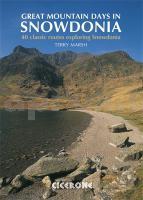
Cover

This inspirational guidebook describes 40 superb routes among the valleys and heights of the Snowdonia National Park, inviting walkers to explore the less well-known regions of Snowdonia as much as those that are eternally popular. These walks have been chosen to encourage experienced walkers and mountaineers to try something new in this much-loved region, while at the same time offering clear descriptions of classic routes for those new to Snowdonia.

All the routes in Great Mountain Days in Snowdonia are day walks - graded from moderate to arduous to help you choose the right route - and all of them make for a great day out in Snowdonia, whether in the ice and snow covered winter or during long summer days, the walks in this guide can be enjoyed all year round.

  • 40 graded walks throughout the Snowdonia National Park area
  • routes illustrated with Harvey maps and pictorial route diagrams by artist and outdoor writer, Mark Richards
  • some routes include mild scrambling or long days in rugged country
  • Kartenausschnitt

    Great Mountain Days in Snowdonia - 40 classic routes exploring Snowdonia - Wanderführer - Cicerone Großbritannien (englisch)
    EAN / ISBN: 9781852845810
    Preis: EUR 28.90

Bestellartikel: versandfertig in ca. 3-7 Tagen. Dieser Artikel wird speziell für Sie bestellt. Keine Rücknahme!
Produkt EUR Anzahl Bestellen
Great Mountain Days in Snowdonia - 40 classic routes exploring Snowdonia - Wanderführer - Cicerone Großbritannien (englisch) 28.90
Versandkostenfrei in Deutschland ab 30,- Bestellwert

incl. MwSt.

Stichworte, die bei der Suche nützlich sein könnten:
Wales Wanderführer - Snowdownia National Park - Snowdonia - Snowdonia Wanderführer - Cicerone - Cicerone Radwanderführer - Cicerone Wanderführer - Großbritannien Radwanderführer - Großbritannien Wanderführer - Cicerone Großbritannien - Großbritannien - Großbritannien Wanderführer - Großbritannien Trekkingführer - Großbritannien Klettern - Großbritannien Kletterführer

Zuletzt angesehene Artikel:

CoverGreat Mountain Days in Snowdonia - 40 classic routes exploring Snowdonia - Wanderführer - Cicerone Großbritannien (englisch)

Cover0719SB PLOUAY - LE FAOUËT GPS Amtliche Topographische Wanderkarte Frankreich 1:25.000 - série bleue (IGN)

Cover57/1-2 SIVRY - RANCE NGI 1:25.000 Topographische Landkarte Belgien

CoverWingst Topographische Wanderkarte mit Wanderwegen und Radwegen 1:25.000 Niedersachsen - ProjektNord

CoverRandonnées en boucle dans les Parcs naturels de Wallonie - 18 randos vertes Topo-Guide du Sentier de Grande Randonnée - Belgien (französisch) GRSentiers - Grote Routepaden

CoverFernwanderweg E1: Deutschland Nord - von Flensburg bis Hameln - Rother Wanderführer - Bergverlag Rother

Cover68/5-6 TINTIGNY - ETALLE NGI 1:25.000 Topographische Landkarte Belgien

CoverDuMont Reise-Taschenbuch Leipzig von Buhl, Susann u. Gohlis, Tobias

CoverWandern rund um Göteborg Wanderführer schwedisch
Vandra kring Göteborg Calazo Förlag Schweden

Noch kein Cover vorhanden4546-NO Topographische Karte 1:10.000 - Landesvermessungsamt Brandenburg

Cover4645 Riesa Sonderausgabe mit Wanderwegen - Topographische Wanderkarte Brandenburg 1:25.000 ProjektNord

CoverAfrika und die Welt - Schüler-Landkarte 1:10 Mio. und 1:50 Mio.
Africa & The World Pack Student Map MapStudio

Cover10040 Geilo Topographische Landkarte 1:50.000 Norge-serien - Nordeca Norwegen

Cover2786 05B Jiri Bazaar (40) 1:25.000 Rolwalin trek, Jiri to Pike Peak Trek FINN MAPS - HMG Nepal

Noch kein Cover vorhanden3334OT MASSIF DE LA CHARTREUSE SUD Topographische Wanderkarte Frankreich 1:25.000 TOP 25 IGN - (GPS)

CoverPistes du Maroc - De l`oued Draa à la Seguiet el Hamra Guide J. Gandini - Serre Editeur

CoverChichewa für Malawi - Wort für Wort Kauderwelsch-Sprachführer (Band 210) Malawi - Reise-Know-How Verlag

Cover20 Vértes - Topografische Wanderkarte Ungarn 1:40.000
A Vértes - Cartographia

CoverEuropa per Rad - Das Reisehandbuch für alle Radlar durch ganz Europa Reiseführer Reise-Know-How Verlag

Noch kein Cover vorhanden5033 Weimar Topographische Karte Thüringen 1:25.000 Landesvermessungsamt Thüringen