Willkommen bei MapFox
+++ Buchhändleranfragen willkommen! Tel. 0431-666 75 99 +++
Warenkorb
Artikel: 0 - € 0.00
Zur Kasse
Impressum Kontakt Versandkosten AGB
Mountain Walking in Southern Catalunya - The Mountains of Tarragona - Wanderführer - Cicerone (englisch)
<< Spanien: Wanderführer, Radwanderführer und Reiseführer
<< Cicerone
 
Cover

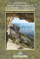
A dramatic coastal mountain region of remarkable natural beauty and diversity, Southern Catalunya is mysteriously unknown outside of Spain. In the mountains, limestone crags with well-established paths overlook the orange and olive groves perfect for day walks with a long-distance path that runs along the coast for those wanting to walk a little further. The walks all vary in difficulty, from coastal trails to hands-on scrambles, but all are clearly marked at the start of each route for route finding, scrambling and exposure.

The region has not been greatly visited by walkers from the UK, as it is not obvious from the general tourist maps that it even has mountains yet with its benign winter climate it is ideal for walkers from October through to May. These day walks boast spectacular scenery including salt and freshwater lagoons surrounded by wildlife, high mountainous regions as well as stunning coastal trails.


  • 30 route descriptions, illustrated with colour maps and photography
  • all routes graded for difficulty and route-finding
  • thorough information about the history, culture, amenities, wildlife, climate as well as other practicalities
  • Kartenausschnitt

    Mountain Walking in Southern Catalunya - The Mountains of Tarragona - Wanderführer - Cicerone (englisch)
    EAN / ISBN: 9781852845827
    Preis: EUR 19.90

Bestellartikel: versandfertig in ca. 3-7 Tagen. Dieser Artikel wird speziell für Sie bestellt. Keine Rücknahme!
Produkt EUR Anzahl Bestellen
Mountain Walking in Southern Catalunya - The Mountains of Tarragona - Wanderführer - Cicerone (englisch) 19.90
Versandkostenfrei in Deutschland ab 30,- Bestellwert

incl. MwSt.

Stichworte, die bei der Suche nützlich sein könnten:
Katalonien - Tarragona - Catalunya - Southern Catalunya - Cicerone - Cicerone Radwanderführer - Cicerone Wanderführer - Großbritannien Radwanderführer - Großbritannien Wanderführer - Cicerone Großbritannien - Spanien Wanderführer - Spanien Radwanderführer - Spanien Fahrradführer - Spanien Reiseführer

Zuletzt angesehene Artikel:

CoverMountain Walking in Southern Catalunya - The Mountains of Tarragona - Wanderführer - Cicerone (englisch)

Noch kein Cover vorhandenCampbell River - TOPO (Blatt VIBC40) Topographische Landkarte 1:60.000 - Backroad Topo Map Kanada

CoverDublin & Irland 1:10.000 / 1:500.000 - Landkarte - ITMB International Travel Reference Maps (engl.)
Dublin & Ireland

CoverTsum Valley 1:100.000 Trekking-Karte trekking map SHANGRI-LA MAPS Nepal

CoverWassersportatlas Pfalz - CD-ROM Nr. 1 Sport- und Freizeitatlas Rheinland-Pfalz - Landesvermessungsamt Rheinland-Pfalz

CoverAzilal - Mgoun 1:160.000 (engl./frz.)
Azilal, Mgoun (Morocco) topographical map / carte topographique Marokko - EWP - WEST COL PRODUCTIONS

Cover236 LACHEN 1:50.000 Topographische Landeskarte der Schweiz - swisstopo

CoverSüdtirol Ost - Schneeschuhführer Eisacktal - Pustertal - Dolomiten. 60 Schneeschuhtouren. Mit GPS-Daten - von Evamaria Wecker - Bergverlag Rother

CoverWilde Wege Schwäbische Alb 47 Touren mit GPS-Tracks - von Forst, Bettina - Rother Bergverlag

Cover6921 Großbottwar Topographische Landkarte 1:25.000 - Landesvermessungsamt Baden-Württemberg

CoverAlbsteig HW 1 - Nordrandweg von Donauwörth bis Tuttlingen. 27 Etappen. Mit GPS-Daten - von Renate Florl - Bergverlag Rother

Cover1118 Neukirchen Topographische Landkarte 1:25.000 Landesvermessungsamt Schleswig-Holstein

CoverHunsrück mit Koblenz und Trier Reiseführer für individuelles Entdecken - von Katja Nolles - Reise Know-How

Cover084 Dumfries & Castle Douglas - Wanderkarte Großbritannien 1:50.000 LANDRANGER MAP - Ordnance Survey

Noch kein Cover vorhandenL-34-32-B Pocsaj Amtliche Topographische Karte Ungarn 1:50.000

CoverOdenwald - Spessart 1:75.000 (Blatt RK-HES08) bikeline-Radkarte Deutschland Esterbauer

CoverUpernavik (Blatt 14) 1:250.000 Topographische Landkarte Westgrönland Saga Maps

CoverTürkei Landkarte 1:1.2 Mio. (Blatt 3018) AdventureMap wasserfest
Turkey National Geographic

CoverLettland 32 Entdeckertouren zu Fuß, mit dem Fahrrad und dem Kanu - Naturzeit Reiseverlag

CoverSowetsk (Tilsit) Stadtplan 1:20.000 - Russland
Советск Roskartografia