Willkommen bei MapFox
Wurde Ihre Bestellung bestätigt? Wenn nicht - gab es evtl. ein SERVER-Problem! Bitte kontaktieren Sie uns! +++ Buchhändler-Anfragen erwünscht +++
Warenkorb
Artikel: 0 - € 0.00
Zur Kasse
Impressum Kontakt Versandkosten AGB
South Downs Nationalpark Wanderführer (englisch) Kev Reynolds - 139 Seiten
Walking in the South Downs National Park - 40 Coast, Downs and Countryside Walks - A Cicerone Guide by Kev Reynolds Cicerone Großbritannien
<< Großbritannien: Wanderführer + Kletterführer
<< Cicerone
 
Cover

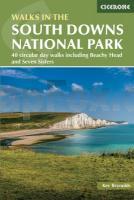
Handy guidebook describing 40 circular walks in the South Downs National Park. The walks range from just under 5 miles to 11 miles in length, visiting the iconic Beachy Head, Seven Sisters, Ditchling Beacon and Cissbury Ring. The South Downs are accessible all year round, with spring and early summer best for seeing the wild flowers and wildlife.
The South Downs stretch in a 100-mile arc between Eastbourne in East Sussex and Winchester in Hampshire. With some of the most iconic landscapes in southern England, including the white chalk cliffs of Beachy Head and the Seven Sisters, walking in the South Down National Park proves a delightful experience mile after mile.

The challenge for the author, Kev Reynolds was choosing just 40 routes to represent the essential beauty of the South Downs, such is the quality of walking to be had here on England`s south coast. Each walk is circular, and where possible beginning and ending at a place accessible by public transport.

  • 40 walks suitable for all ages and abilities
  • romantic villages and prehistoric sites provide plenty to fire the imagination and captivate the interest
  • the South Downs are easily reached from London and the south coast
  • Kartenausschnitt

    South Downs Nationalpark Wanderführer (englisch) Kev Reynolds - 139 Seiten
    Walking in the South Downs National Park - 40 Coast, Downs and Countryside Walks - A Cicerone Guide by Kev Reynolds Cicerone Großbritannien
    EAN / ISBN: 9781786312259
    Preis: EUR 22.90

Bestellartikel: versandfertig in ca. 3-7 Tagen. Dieser Artikel wird speziell für Sie bestellt. Keine Rücknahme!
Produkt EUR Anzahl Bestellen
South Downs Nationalpark Wanderführer (englisch) Kev Reynolds - 139 Seiten
Walking in the South Downs National Park - 40 Coast, Downs and Countryside Walks - A Cicerone Guide by Kev Reynolds Cicerone Großbritannien
22.90
Versandkostenfrei in Deutschland ab 30,- Bestellwert

incl. MwSt.

Stichworte, die bei der Suche nützlich sein könnten:
South Downs Nationalpark (Großbritannien) Wanderführer - South Downs National Park (Great Britain) Hiking Guide - Cicerone - Cicerone Radwanderführer - Cicerone Wanderführer - Großbritannien Radwanderführer - Großbritannien Wanderführer - Cicerone Großbritannien - Großbritannien - Großbritannien Wanderführer - Großbritannien Trekkingführer - Großbritannien Klettern - Großbritannien Kletterführer

Zuletzt angesehene Artikel:

CoverSouth Downs Nationalpark Wanderführer (englisch) Kev Reynolds - 139 Seiten
Walking in the South Downs National Park - 40 Coast, Downs and Countryside Walks - A Cicerone Guide by Kev Reynolds Cicerone Großbritannien

CoverSkitourengehen Ausrüstung - Technik - Sicherheit - von Markus Stadler - Bergverlag Rother

CoverSkåneleden SL 3: Ås till åsleden Wanderkarte 1:50.000 wasserfest
Skåneleden 3 Ås till åsleden Region Skåne - Schweden

CoverNorth Dakota - South Dakota State Maps Landkarte / Straßenkarte USA Rand McNally

CoverSaudi-Arabien 1:2 Mio. Auto- + Freizeitkarte
Saoedi-Arabie - Saudi-Arabia - Arabie saoudite - Arabia Saudita freytag & berndt

Noch kein Cover vorhandenSzymki Topographische Karte 1:25.000 Messtischblatt des Deutschen Reiches - Preußische Landesaufnahme / Reichsamt für Landesaufnahme - Faksimile ProjektNord

Noch kein Cover vorhanden3833 Seehausen Topographische Karte 1:25.000 Landesamt für Vermessung und Geoinformation Sachsen-Anhalt (Landesvermessungsamt)

Noch kein Cover vorhandenN-34-75-A/B Sztum Amtliche topographische Landkarte Polen 1:50.000
N-34-75-A/B Sztum - Mapa Topograficzna Polski Glowny Geodeta Kraju

Noch kein Cover vorhandenNordkapp - Lille-Tamsøya - Sværholt - Seekarte Norwegische Küste 1:50.000 - (Blatt 104) Den Norske Kyst
Sjøkart - Hovedkart (sjø) Statens Kartverk Sjø - Norwegen

CoverSüdafrika: Drakensberge OutdoorHandbuch - Der Weg ist das Ziel (Band 54) - Stockmann Conrad-Stein-Verlag

CoverSchwerin - Stadtplan 1:20.000 (Nr. 192) Mit allen Stadtteilen, mit neuen Straßennamen, mit Postleitzahlen, mit Innenstadtkarte, mit Umgebungskarte, Maßstab: 1:20000 Dr. Barthel Verlag

CoverSportklettern I - von Kristof Kontermann - Stein, Conrad, Verlag

Noch kein Cover vorhandenErläuterungen zur Geologischen Karte 4950 Stolpen (68) - Ausgabe 1890 Sächsisches Landesamt für Umwelt, Landwirtschaft und Geologie

CoverSchweiz Generalkarte 1:300.000 Topografische Landeskarte der Schweiz - swisstopo

CoverSouthern African Wildlife Reiseführer (englisch) Bradt Publications

CoverSardinien 1:220.000 Landkarte (Blatt 3309) AdventureMap
Sardinia National Geographic

CoverSkofja Loka 1:10.000 Taschen-Stadtplan
Škofja Loka Kartografija - Slowenien

CoverNL 33-02-08 West (4208-West) Spital am Pyhrn Österreichische Karte 1:25.000 mit Wegmarkierungen (topographische Wanderkarte - UTM) - BEV - Österreich - Vergrößerung (ÖK25V)

Cover3824 Elze Amtliche topographische Karte 1:25.000 Landesvermessungsamt Niedersachsen

CoverSuwalszczyzna Touristische Wanderkarte/Radwanderkarte Polen 1:75.000 (GPS) Compass - Polen