Willkommen bei MapFox
Wurde Ihre Bestellung bestätigt? Wenn nicht - gab es evtl. ein SERVER-Problem! Bitte kontaktieren Sie uns! +++ Buchhändler-Anfragen erwünscht +++
Warenkorb
Artikel: 0 - € 0.00
Zur Kasse
Widerruf Impressum Kontakt Versandkosten AGB
Ayrshire & Arran Coastal Paths Wanderführer
The Ayrshire and Arran Coastal Paths Cicerone Großbritannien
<< Schottland
<< Großbritannien: Wanderführer + Kletterführer
<< Cicerone
 
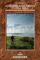
Cover

A guide to walking or backpacking along the Ayrshire and Arran Coastal Paths, which stretch for over 150 miles along the stunning west coast of Scotland, within easy reach of Glasgow. Described in 11 day stages, passing through Girvan, Ayr and Ardrossan, good public transport means walkers can tackle it as day walks or weekend trips. Featuring 11 day stages across a 150-mile coastline full of beautiful sandy beaches and secluded coves, this guide to the Ayrshire and Arran Coastal Paths is a wonderful showcase of long-distance coastal walking at its finest.

Historic sites including many castles passed along the way show the area’s rich past, and there are obvious links here to significant Scottish figures including Robert the Bruce and Robert Burns.

  • seven days on the Ayrshire mainland and a four-day tour round Arran
  • fantastic photography throughout fully illustrates the area’s exceptional views and scenic beauty
  • detailed information on public transport and accommodation
  • Kartenausschnitt

    Kartenbeispiel

    Ayrshire & Arran Coastal Paths Wanderführer
    The Ayrshire and Arran Coastal Paths Cicerone Großbritannien
    EAN / ISBN: 9781852846329
    Preis: EUR 19.90

Dieser Titel ist momentan nicht lieferbar.
Produkt EUR Anzahl Bestellen
Ayrshire & Arran Coastal Paths Wanderführer
The Ayrshire and Arran Coastal Paths Cicerone Großbritannien
19.90
Versandkostenfrei in Deutschland ab 30,- Bestellwert

incl. MwSt.

Stichworte, die bei der Suche nützlich sein könnten:
Arran Wanderführer - Ayrshire - Schottland Wanderführer - Arran - Ayrshire - Arran - Ayrshire Wanderführer - Cicerone - Cicerone Radwanderführer - Cicerone Wanderführer - Großbritannien Radwanderführer - Großbritannien Wanderführer - Cicerone Großbritannien - Großbritannien - Großbritannien Wanderführer - Großbritannien Trekkingführer - Großbritannien Klettern - Großbritannien Kletterführer - Schottland - Schottland Landkartenverkauf - Schottland Atlanten - Schottland Kartographie - Schottland Wanderkarten - Schottland Radwanderkarten - Schottland Kartografie - Schottland Fahrradkarten - Schottland Reiseführer - Schottland Radwanderführer - Schottlandkarten - Schottland Landkarten - Schottland Karten - Schottland Straßenkarten

Zuletzt angesehene Artikel:

CoverAyrshire & Arran Coastal Paths Wanderführer
The Ayrshire and Arran Coastal Paths Cicerone Großbritannien

Noch kein Cover vorhandenBW22 Topographische Landkarte Neuseeland 1:50.000 Land Information New Zealand

Cover200 Wohnmobil Ziele in Deutschland TVV Touristik-Verlag GmbH

CoverL3322 Rethem Amtliche topographische Karte 1:50.000 Landesvermessungsamt Niedersachsen

CoverL5128 Eisenach Ost Topographische Karte Thüringen 1:50.000 Landesvermessungsamt Thüringen

CoverValencia - Murcia Straßenkarte 1:400.000 (Blatt 577)
Valenciana Communidad - Murcia Michelin Regional

Cover2412-III Topographische Karte Dänemark 1:50.000 - Kort & Matrikelstyrelsen ProjektNord

CoverTrillemarka-Rollagsfjell Wanderkarte Norwegen 1:50.000 (Blatt 2824) - Nordeca / UGLAND / Statens Kartverk Norwegen

Cover10078 Sunndalsøra Topographische Landkarte 1:50.000 Norge-serien - Nordeca Norwegen

Cover1263 EVIAN LES BAINS 1:25.000 Topographische Landeskarte der Schweiz - swisstopo

CoverBritish Columbia 1:1.428 Mio. Touristische Landkarte
Easy to read provincial map GM Johnson

Cover23 EUSKADI (Baskenland) 1:150.000 Touristische Landkarte Spanien - Geo / Estel

Cover300 Howardian Hills & Malton - Wanderkarte Großbritannien 1:25.000 EXPLORER MAP - Ordnance Survey

CoverL5140 Altenburg Topographische Karte Thüringen 1:50.000 Landesvermessungsamt Thüringen

CoverNiedersachsen - Verwaltungskarte 1:500.000 Landesvermessungsamt Niedersachsen

Noch kein Cover vorhanden1933SB Thiviers - Saint-Pardoux-la-Rivière GPS Amtliche Topographische Wanderkarte Frankreich 1:25.000 - série bleue (IGN)

CoverÎle-de-France Reiseführer Rund um Paris. Mit Versailles, Saint-Denis, Chartres, Giverny, Fontainebleau, Sceaux, Provins und Rambouillet - von Bentheimer, Heike - TRESCHER

Noch kein Cover vorhandenPuszcza Solska - Wanderkarte 1:50.000
Puszcza Solska WZKART (Polen)

Noch kein Cover vorhandenL-34-19-D Hajduszoboszlo Amtliche Topographische Karte Ungarn 1:50.000

CoverLausitz Unterwegs zwischen Spreewald und Zittauer Gebirge - Micklitza, Kerstin - Micklitza, Andre Trescher Verlag