Willkommen bei MapFox
Wurde Ihre Bestellung bestätigt? Wenn nicht - gab es evtl. ein SERVER-Problem! Bitte kontaktieren Sie uns! +++ Buchhändler-Anfragen erwünscht +++
Warenkorb
Artikel: 0 - € 0.00
Zur Kasse
Widerruf Impressum Kontakt Versandkosten AGB
Walking in Derbyshire - 60 circular walks across the county Wanderführer Großbritannien - Cicerone (englisch)
<< Großbritannien: Wanderführer + Kletterführer
<< Cicerone
 
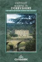
Cover

Without doubt Derbyshire is one of the most picturesque counties in England, renowned for its varied scenic beauty ranging from wild sombre moorland in the north to sparkling rivers laced with delightful deep dales in the central area and gentle rolling countryside further south.

The uniquely contrasting and beautiful Derbyshire landscape is steeped in history. Specially selected for their historical interest, the walks in this guide lead readers through the country’s past, from the remnants of ancient civilisations to today’s fine market towns and picturesque villages. Along the way, the routes explore castles, grand country houses and parklands galore, and reveal Derbyshire’s industrial heritage and transport history.

All the walks in this guide are easy to moderate in terms of the difficulty of the terrain and length as this guidebook avoids the more challenging geography of the Dark Peak moorlands. They range in distance from 4km (2.5 miles) to 15.5km (9.5 miles) and are suitable for both individuals and families. Each route is linked to a main historical theme, and the walks have been arranged in a rough chronological order according to the selected theme, so that you are literally walking through layers of history and treading in the footsteps of past generations.

Information on the theme of the walk, distance, terrain and other points of interest precedes the route instructions for each trail. Where appropriate, telephone numbers are provided for the tourist attractions so you can check opening times, ticket prices and so on.

Walking in Derbyshire - 60 circular walks across the county Wanderführer Großbritannien - Cicerone (englisch)
EAN / ISBN: 9781852846336
Preis: EUR 22.90

Bestellartikel: versandfertig in ca. 3-7 Tagen. Dieser Artikel wird speziell für Sie bestellt. Keine Rücknahme!
Produkt EUR Anzahl Bestellen
Walking in Derbyshire - 60 circular walks across the county Wanderführer Großbritannien - Cicerone (englisch) 22.90
Versandkostenfrei in Deutschland ab 30,- Bestellwert

incl. MwSt.

Stichworte, die bei der Suche nützlich sein könnten:
Derbyshire - Derbyshire Wanderführer - Cicerone - Cicerone Radwanderführer - Cicerone Wanderführer - Großbritannien Radwanderführer - Großbritannien Wanderführer - Cicerone Großbritannien - Großbritannien - Großbritannien Wanderführer - Großbritannien Trekkingführer - Großbritannien Klettern - Großbritannien Kletterführer

Zuletzt angesehene Artikel:

CoverWalking in Derbyshire - 60 circular walks across the county Wanderführer Großbritannien - Cicerone (englisch)

Cover32 MARCO POLO Freizeitkarte Odenwald - Rhein 1:100.000 wasserfest, reißfest

Cover5708 Kaisersesch Topographische Karte 1:25.000 - Landesamt für Vermessung und Geobasisinformation Rheinland-Pfalz

CoverNorwegen Mitte Zwischen Ålesund, Femunden und Børgefjell. 52 Touren. Mit GPS-Daten - von Bernhard Pollmann - Bergverlag Rother

CoverL4740 Leipzig 1:50.000 Amtliche Topografische Landkarte - Landesvermessungsamt Sachsen

Noch kein Cover vorhanden3342-NO Topographische Karte 1:10.000 - Landesvermessungsamt Brandenburg

Noch kein Cover vorhanden2347OT QUILLAN - ALET-LES-BAINS Topographische Wanderkarte Frankreich 1:25.000 TOP 25 IGN - (GPS)

Noch kein Cover vorhanden2746-SO Topographische Karte 1:10.000 - Landesvermessungsamt Brandenburg

Noch kein Cover vorhandenIndiana Atlas & Gazetteer - Topographischer Straßenatlas Delorme Publishing Company DELORME MAPPING USA

Cover252 Lago d`Iseo 1:25.000 - Rad- und Wanderkarte Italien - 4land
Carta escursionistica e per cicloturismo del Lago d`Iseo e dintorni

CoverLand of the High Flags - Afghanistan - Reiseführer (englisch) When the Going Was Good ODYSSEY

Noch kein Cover vorhanden2743-SO Topographische Karte 1:10.000 - Landesvermessungsamt Brandenburg

Noch kein Cover vorhandenCE15 Topographische Landkarte Neuseeland 1:50.000 Land Information New Zealand

CoverDUMONT Reise-Taschenbuch Ostseeküste Schleswig-Holstein von Adams, Nicoletta

Cover12/7-8 GISTEL - ZEDELGEM NGI 1:25.000 Topographische Landkarte Belgien

Noch kein Cover vorhanden2746-NO Topographische Karte 1:10.000 - Landesvermessungsamt Brandenburg

CoverL6504 Merzig (TK50) Amtliche topographische Landkarte 1:50.000 - Landesamt für Vermessung und Geobasisinformation Rheinland-Pfalz

Cover1241 MARCHAIRUZ 1:25.000 Topographische Landeskarte der Schweiz - swisstopo

Cover073 Peebles - Galashiels & Selkirk - Tweed Valley - Wanderkarte Großbritannien 1:50.000 LANDRANGER MAP - Ordnance Survey

Cover116 Lyme Regis & Bridport - Wanderkarte Großbritannien 1:25.000 EXPLORER MAP - Ordnance Survey