Willkommen bei MapFox
+++ Buchhändleranfragen willkommen! Tel. 0431-666 75 99 +++
Warenkorb
Artikel: 0 - € 0.00
Zur Kasse
Impressum Kontakt Versandkosten AGB
Walking the Corbetts Vol. 2 North of the Great Glen Wanderführer (englisch) Cicerone Großbritannien
<< Schottland
<< Cicerone
 
Cover

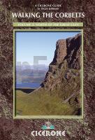
The Corbetts - Scotland’s mountains between 2500 and 2999ft in height - are less visited but in most cases more accessible than the ever-popular Munros, and frequently offer better views when the 3000ers are shrouded in cloud. Their lower altitude also means the walks tend to be shorter meaning they can be tackled easily between breakfast and dinner and during the short daylight hours in winter.

However, many of the Corbetts are very remote from road access and will still give a demanding hike. What is more, between many of the peaks listed as Munros, there is little drop, so you can often climb several in one day. By contrast, the requirement for a 500ft drop on all sides between listed Corbetts means that there are few occasions where Corbetts can be linked together. Subsidiary summits of Munros and Corbetts between 2500 and 2999ft high with a drop of at least 30m on all sides are known as Corbett Tops.

Also mentioned in the route descriptions are Grahams, which are mountains between 2000 and 2499ft, and Donalds, which are hills over 2000ft in Southern Scotland. The routes described here are not necessarily for the peak bagger who just wants the shortest and easiest way up the mountain; they’re for the walker who wants the best, most interesting route up the wildest glen or along the most dramatic ridges.

When climbing the scottish Corbetts you will frequently find the only paths are sheep or deer tracks. There are usually good tracks in the glens, maintained by the owners of the shooting estates, but higher up it is only on the most popular Corbetts that you will find well-maintained paths. Deep heather or boggy grass can make for hard walking on the approach to the mountain and steep rocky slopes protect many of the ridges. Unless there are lots of crags, the going is usually relatively easy on the ridges although on some peaks you will have to cope with peat hags or boulderfields.

Kartenausschnitt

Walking the Corbetts Vol. 2 North of the Great Glen Wanderführer (englisch) Cicerone Großbritannien
EAN / ISBN: 9781852846534
Preis: EUR 25.90

Bestellartikel: versandfertig in ca. 3-7 Tagen. Dieser Artikel wird speziell für Sie bestellt. Keine Rücknahme!
Produkt EUR Anzahl Bestellen
Walking the Corbetts Vol. 2 North of the Great Glen Wanderführer (englisch) Cicerone Großbritannien 25.90
Versandkostenfrei in Deutschland ab 30,- Bestellwert

incl. MwSt.

Stichworte, die bei der Suche nützlich sein könnten:
Great Glen - Great Glen Way - the Corbetts - Cicerone - Cicerone Radwanderführer - Cicerone Wanderführer - Großbritannien Radwanderführer - Großbritannien Wanderführer - Cicerone Großbritannien - Schottland - Schottland Landkartenverkauf - Schottland Atlanten - Schottland Kartographie - Schottland Wanderkarten - Schottland Radwanderkarten - Schottland Kartografie - Schottland Fahrradkarten - Schottland Reiseführer - Schottland Radwanderführer - Schottlandkarten - Schottland Landkarten - Schottland Karten - Schottland Straßenkarten

Zuletzt angesehene Artikel:

CoverWalking the Corbetts Vol. 2 North of the Great Glen Wanderführer (englisch) Cicerone Großbritannien

Noch kein Cover vorhanden7317 Neuweiler Topographische Landkarte 1:25.000 - Landesvermessungsamt Baden-Württemberg

Noch kein Cover vorhanden7219 Weil der Stadt Topographische Landkarte 1:25.000 - Landesvermessungsamt Baden-Württemberg

CoverKiel CityTrip Reiseführer mit Faltplan - Mit Gratis-App für Smartphone, Tablet und PC - von Hans-Jürgen Fründt - Reise Know-How

CoverTschechien und Slowakei - Straßenkarte 1:500.000
Czechy i Słowacja - mapa samochodowa Compass - Polen

CoverFriuli - Venezia - Giulia 1:150.000 wasserfest Topographische Straßenkarte - Casa Editrice Tabacco - Italien

Cover2849 Warnitz Topographische Karte 1:25.000 Landesvermessungsamt Brandenburg (gefaltet)

CoverL4326 Osterode Amtliche topographische Karte 1:50.000 Landesvermessungsamt Niedersachsen

Cover444 Helmsdale & Strath of Kildonan - Wanderkarte Großbritannien 1:25.000 EXPLORER MAP - Ordnance Survey

Cover125 Romney Marsh - Rye & Winchelsea - Tenterden & New Romney - Wanderkarte Großbritannien 1:25.000 EXPLORER MAP - Active Map LAMINIERT - Ordnance Survey

CoverStadtgeschichte im Kartenbild - Frankfurt (Oder) von 1700 bis heute 1:8.000 - BLOCHPLAN

CoverWyoming topographische Freizeitkarte 1:792.000
Recreational Map of Wyoming GTR MAP PUBLISHERS

CoverEuropa - Naher Osten - Zentralasien politisch 1:5.5 Mio. Magnetmarkiertafel freytag & berndt

Cover443 Ben Klibreck & Ben Armine - laminierte Wanderkarte Großbritannien 1:25.000 EXPLORER MAP - Ordnance Survey

Cover4920 Armsfeld Topographische Landkarte Hessen 1:25.000 - ProjektNord (geplottete Ausgabe)

CoverEdmonton / St. Albert / Sherwood Park / Red Deer, Alberta Street Stadtplan 1:31.25 (Kanada) GM Johnson

CoverBreslau Stadtplan 1:22.000 Stadtplan/Landkarte
Wrocław PLAN Galileos - Polen

Cover4930 Gräfentonna Topographische Karte Thüringen 1:25.000 Landesvermessungsamt Thüringen

CoverBT501 Jhomolhari Trek 1:200.000 *** SCHNÄPPCHEN *** - Trekking Map - Himalayan MapHouse - Bhutan

Cover143 Warminster & Trowbridge - Westbury & Mere - Wanderkarte Großbritannien 1:25.000 EXPLORER MAP - Ordnance Survey